Hidden away in remote Northern California, Lassen Volcanic National Park is one of the great gems of the United States and home to some of the most unique and diverse landscapes you’ll ever explore, not to mention stunning vistas that will blow you away. Whether you’re looking for thrilling adventures or a quieter experience getting back to nature, there is something for you here. Get to know Lassen Volcanic through our ultimate guide below which outlines everything you need to know to plan your trip from exploring, hiking, and camping through to accommodation and the endless possibilities for adventure in the park.
Editor’s Note: This article is in partnership with Visit California, all opinions are our own.
Table of Contents
Why should you visit Lassen Volcanic National Park?
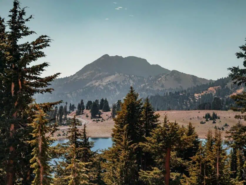
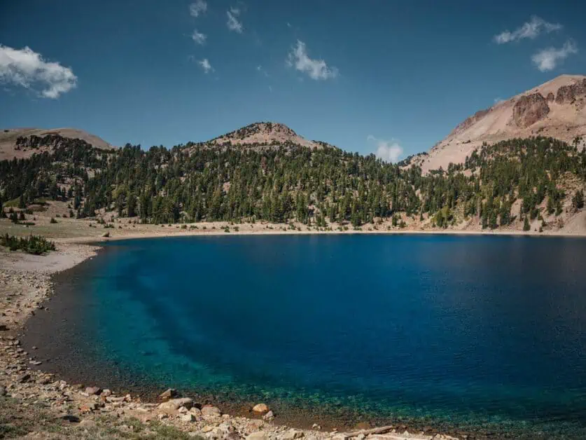
Quite simply, Lassen Volcanic National Park is one of the most unique places in the United States. The fact that it is off the beaten path means that it receives far less visitors than some of the other major National Parks and in fact, Lassen Volcanic has been tipped as one of America’s least visited National Parks. This may well appeal to you if you like a quieter experience. There is also a significant amount of the National Park that is considered wilderness, whilst also having a whole assortment of well-maintained and trafficked trails, so it’s easy to find something that will appeal to all tastes. What’s more, you’ll be overwhelmed by the scenery, which you likely won’t be expecting either – it’s extremely diverse. Think of high-altitude volcanoes towering above the park, unusual geothermic activity combined with pristine alpine lakes and endless views of the cascade mountains. Think low lying meadows with endless streams and sprawling forests. It really is an oasis that you won’t find anywhere else!
The Unique Wonders of Lassen Volcanic National Park
Lassen Volcanic is a gem that many people don’t even know is there, which is a great shame considering its unique proposition. Here are some of the key things that make Lassen Volcanic what it is:
The park's dramatic volcanic history and geothermal features
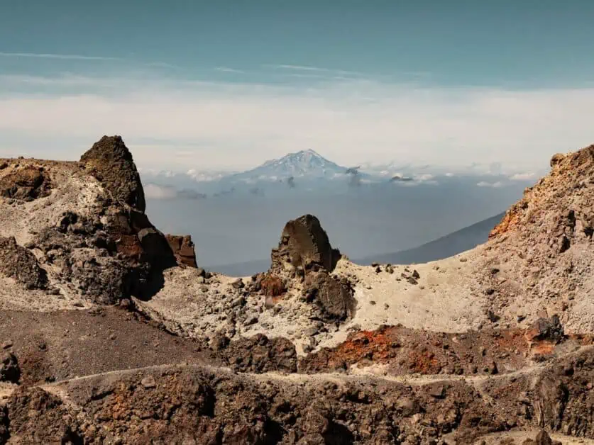
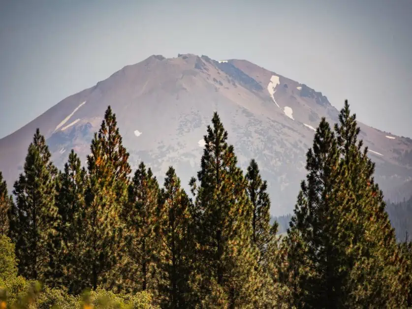
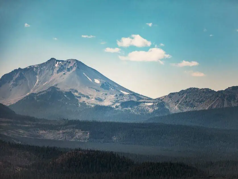
There are few places on earth that can rival Lassen Volcanic National Park’s rich natural history. It’s utterly fascinating and the park is well known for its volcanic activity that has shaped the landscape we see today in the area. In fact, the National Park contains all of the four types of volcano you can hope to see – Cinder Cone, Plug Dome/Lava Dome, Composite and Shield. Lassen Peak, which sits proudly in the landscape as you drive the main scenic road (Highway 89) through the park, is actually the largest Plug Dome volcano in the world (10,440 ft / 3,180 m) – and you can hike right to the top of it! There are also some fascinating geothermal areas within the park, which can be accessed either a short distance from exhibit parking areas or by hiking. These include boiling pools, steaming ground, mud pots and fumaroles – you’ll be well aware of the smell of sulphur as you visit too.
Diverse ecosystems, from mountainous terrains to lush meadows
In Lassen Volcanic you’ll experience some of the most diverse environments in a relatively small area. This is in part due to the significant snowfall that covers the park from November through to July. Spend any amount of time exploring the park, and you’ll be amazed with how quickly the landscape changes. For example, you can be next to Lassen Peak in a stark but beautiful high altitude volcanic landscape and then very quickly at Kings Creek witnessing wildflowers in sprawling meadows. The water that enters the park plays a big part in the geological areas you see, such as Bumpass Hell, Boiling Springs Lake and Devils Kitchen and the great thing is that all this variety makes for an incredibly memorable experience. Whilst hiking and exploring, you’re likely to encounter so much it almost feels microcosmic.
Flora, fauna, and spectacular vistas
Because of its rich diversity, the National Park is home to over 300 species of vertebrates, including mammals, reptiles, birds, amphibians and fish. When you step into the wilderness around the park, this grows even more. In terms of plant life, the park supports a whole variety of flora from lower meadows to high altitude, harsher landscapes and fir and pine forests. The ecosystems as well as the fauna in the area shape the landscape to create the incredible vistas you’ll get to experience. Wildlife watching is a key activity here, so be sure to bring your binoculars.
The Park in Motion
Bring the park to life and watch how we experienced Lassen Volcanic:
The Best Time to Visit
Due to its relatively high altitude, Lassen Volcanic National Park has a fairly short summer season. Winter weather conditions exist in the National Park from around November to May. Wintery conditions (including potential heavy snowfall) are likely to persist well into June at the higher elevations you’ll find along the main park highway (Highway 89) around places like Lassen Peak for example. It’s also worth noting that most of the park’s roads are closed to vehicular traffic in the winter months due to snowfall, but it’s still possible to access some backcountry and snowshoeing routes, as well as the Kohm Yah-mah-nee Visitor Center. June through to October is summer season and is the parks peak time to visit, where you will find everything open (in early season it’s best to check up to date information on the National Park’s website to see if snowfall may curtail your plans). You will find shoulder seasons in Lassen Volcanic National Park in Spring and Fall/Autumn, but these can change quickly. That said, there are benefits to visiting in both peak and off-peak times (Summer or Winter).
Summer Season (peak season)
Pros: All hiking routes and exhibits will be open, as well as front country campsites, backcountry campsites and auto tour routes. Temperatures are up to a reasonable 25 degrees Celsius. There is more opportunity to see the rich, diverse flora, fauna and geothermic activity in the summer season – you’ll really get to see the park in ‘full force’ and get to appreciate it for all it is.
Cons: Whilst the park doesn’t get a large amount of visitors due to its tucked away location, it is the busier time. You will need to consider accommodation in the area further in advance (as there isn’t a huge amount on offer), especially in more popular campsites like Manzanita Lake Campground. Whilst it’s also warm, there is very little shade, which can make things hot in the daytime and very cool at night.
Winter Season (off peak season)
Pros: Less people visiting, so fewer people in the area, stunning views of contrasting landscapes where snow meets volcanic. Areas that are open are open to snowshoeing and backcountry exploration – you’ll get to see the park in a new light.
Cons: The main highway (89) through the National Park is generally closed to vehicles at this time, so you will be very limited in where you can go. Because most of the routes open at this time are in the backcountry, you will need experience of winter backcountry travel, such as knowing and accessing avalanche risk, knowing how to self-arrest etc. Many outdoor retailers offer outdoor skills courses such as this one by REI which are well worth it if you plan to explore more in winter.
Where is Lassen?
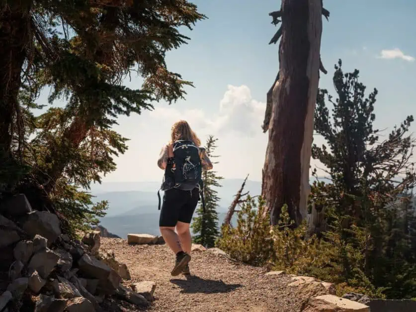
Lassen Volcanic National Park is located in Northern California, and is roughly 50 miles/80km from the city of Redding, toward the end of the Sacramento Valley. Whilst the National Park is more tucked away than some of the other parks California has to offer, it is still easily accessible from a number of bigger hubs (but you might like to plan to stay for longer if you’re travelling further) and smaller, more local cities and towns.
How to get to Lassen
From San Francisco, California: The journey from San Francisco and the Bay Area to Lassen Volcanic is roughly 250 miles/402km and takes approximately 4 hours 30 minutes – very doable in a day. If you’re travelling internationally to reach Lassen Volcanic, San Francisco is a great base to arrive in as it has a major airport which serves the majority of the world (and you should certainly allow yourself some time to visit San Francisco, Oakland etc too). It’s also easy to pick up rental cars of all classes here. It also makes a great hub to fly into if you’re coming from somewhere you’d rather not drive all the way from.
From Redding, California: The journey is roughly 47 miles from Redding, taking around an hour to reach the Southwest entrance of Lassen.
Other areas such as Chester, Susanville and Burney are all within an hour’s drive to the National Park with Chester being the closest (it’s also worth checking out Lake Almanor if you pass through). Of course, keep in mind that there are various entrances to the National Park, and where you plan to go that day may be a further drive from the entrance. It’s always a good idea to plan this out accordingly in advance.
Lassen National Park Visitor Center
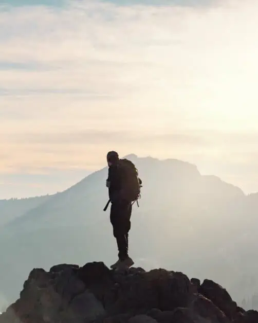
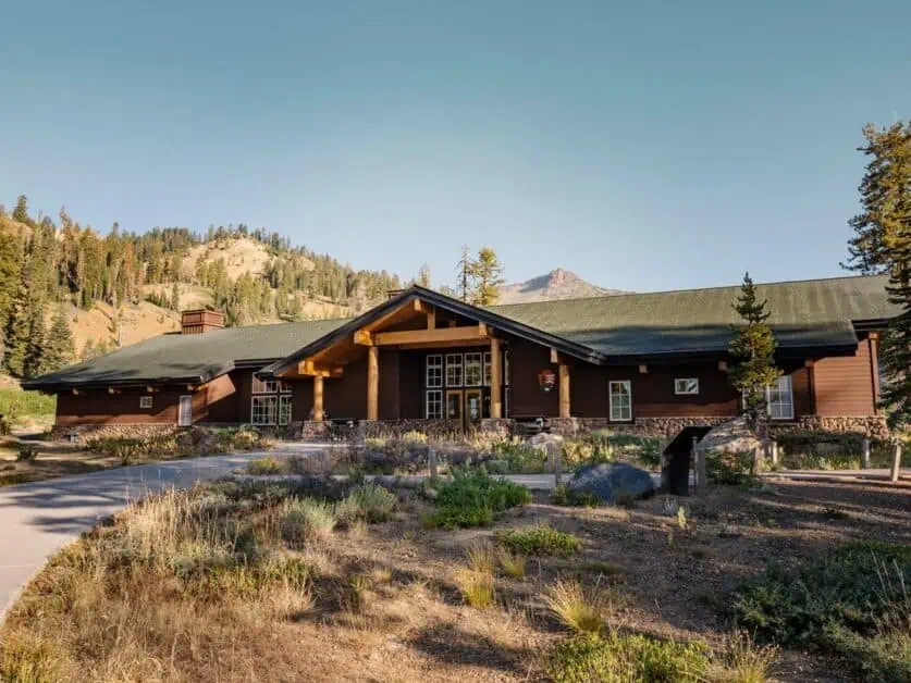
The Kohm Yah-mah-nee Visitor Center, is the main visitor center for Lassen Volcanic National Park. It’s located just one mile outside the park from the Southwest entrance, is open all year and well worth a visit. There’s a very good chance that you’ll pass it when you enter the park to pay your entry fee. If you’re looking for further information on trails and park conditions, the information desk is a great place to start. There’s also a café and dining area as well as a gift shop and exhibits which contain a wealth of information about the area. It’s free to visit, provided you’ve paid your entry fee to the park. It’s open 9am to 5pm daily from May 1st to October 31st and on Wednesday to Sunday from November 1st until April 30th. The visitor center is located at Lassen National Park Highway, Mineral, CA 96063.
At the time of publishing, entry to Lassen Volcanic National park is $30 for a private vehicle between April 15th and December 1st and $10 between Dec 1st and April 15th. These fees are both valid for 7 days from purchase and first entry to the park. You can pay upon entry. Please check the National Park’s website for info on fees before visiting. If you’re planning to visit more than one National Park or payable National Forest area within your visit and over the coming year, an interagency pass may be more suitable. We’d recommend the America the Beautiful Pass which you can buy in advance here. It’s currently $80 and is your ticket to over 2,000 federal recreation areas across the United States.
Loomis Museum
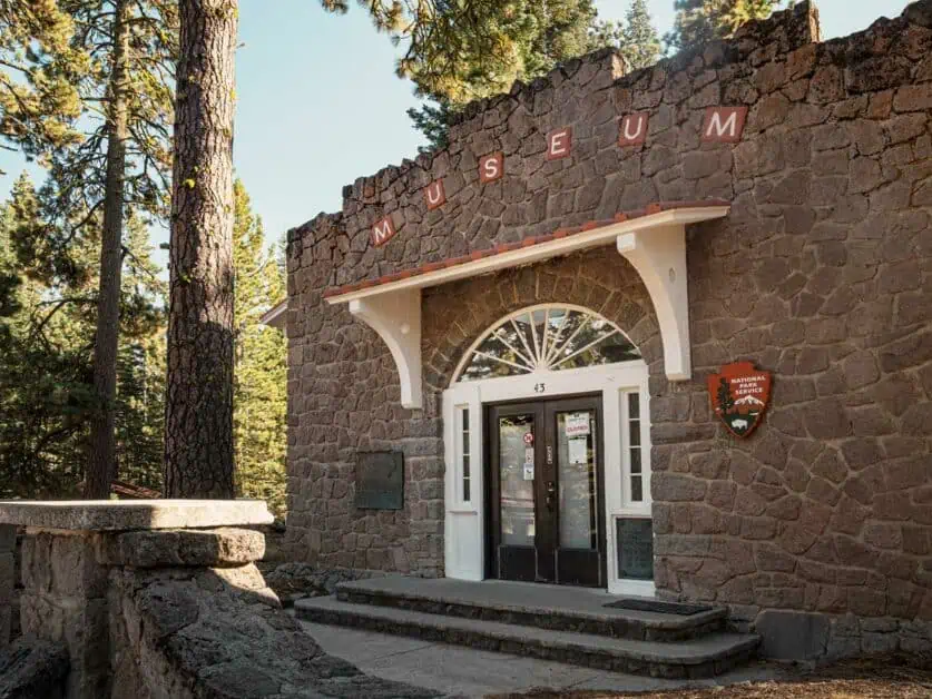
As you drive the National Park highway that takes you through the park, near Manzanita Lake Campground and facilities, you’ll find the Loomis Museum, also known as the Loomis Visitor Center. This museum is of particular importance to the area and is named after Benjamin Franklin Loomis. It’s acknowledged that Loomis’ fascinating photographs of the area and the volcanic activity he captured were instrumental in gathering attention and understanding of the area leading to it becoming a National Park. It’s well worth taking a look and really allows you to get a sense of the history in the area and the incredible, unique land you’re stood on. If you visit, you can also still see Loomis’ images that have been on display since the building was constructed in 1927. It’s also close to numerous trails in the park so easy to combine with other activities. The Loomis Museum is free to visit (within your entrance fee price to the National Park) and is open from 9am – 5pm daily from May 1st until October 31st and Wednesday to Sunday from November 1st to April 30th.
Lassen National Park Map
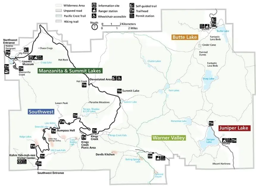
When you enter the Lassen Volcanic during staffed hours at the entry gates, you’ll be given a leaflet containing a map of the main areas of the National Park and the scenic drive through. However, it’s worth familiarising yourself with this beforehand and planning where you’ll go. As you’ll see from the map below, the Lassen Volcanic can be accessed from five different entry points, with some of them being more developed than others. You’ll see that the majority of the park is connected by Highway 89 which runs through, but there are areas such as Butte Lake and Juniper Lake that you’ll access via separate roads outside the National Park. This map gives a good overview of how Lassen Volcanic is laid out:
Hiking Mt Lassen's Trails: Tips for Beginners and Pros
Be prepared: Because of Lassen Volcanic National Park’s relative high altitude and changing weather conditions, be prepared for the temperature to drop as you climb higher or increase as you lose height. Bring layers, plenty of water, sunscreen and a hat to protect you from the sun – a lot of trails (especially Lassen Peak) are exposed to the elements. Hiking poles are also a great addition for steeper hikes, which the park certainly has its share of!
Stick to trails: Whilst sticking to the trails is one of the main ways we can maintain natural areas for years to come and those who visit after us, it’s more important than ever in Lassen Volcanic due to the geothermal activity that is so evident in the park. Whilst the park is incredibly safe to visit if you stick to the trails, there have been accidents when people have stepped into geothermal areas, needing serious medical attention for burns caused by extremely hot underground and close to the surface activity.
Download your maps and plan your route: The National Park has very little cell service other than in select areas, so if using phone navigation, always download your map beforehand and plan your route to and from. This is especially important in the backcountry, where trails may be less obvious or lightly trafficked. It’s always a good idea to bring a paper map and compass, and know how to use them, too.
Leave pets at home: Unfortunately, pets are not allowed on the trails in the National Park, so to avoid disappointment, it’s a good idea to make other arrangements for your furry travel companions.
Hiking essentials: gear recommendations, maps, and safety precautions
There are a number of essentials that will make your time exploring in Lassen Volcanic more enjoyable, here are our top suggestions:
- Layers: Think lightweight layers that you can take off or put on as you need them – it can get cold at night and hot in the day, so go prepared.
- A hat and sunscreen: As you get to higher altitudes, you need to be considering factor 30 and above (50+ is our preference).
- Solid footwear: As there are many loose rocks and hard surfaces on the trails of the park, a good pair of well-worn in, comfortable hiking boots or shoes is a must.
- Plenty of water: consider 2 – 3 litres (0.4-0.6 gallons) per person – we find this is best carried in a water bladder in your backpack like this one from Osprey.
- Hiking poles: we consider these an essential for hiking now, as they really take the pressure off your knees and can help with inclines and declines. Especially on uneven terrain like you’ll experience if you plan on hiking Lassen Peak. You can find more information on what to look for in trekking poles in our guide here.
- Maps: As much of the park is without cell service, you’ll want to make sure you download your offline maps for any trails you decide to do beforehand and make sure you have plenty of charge in your device. It’s also a good idea to have a map and compass and know how to use them before you go. If you’re unfamiliar with compasses, be sure to check out our guide to the best hiking compasses and spend some time practising before you head off.
- Wildlife: There are black bears in Lassen Volcanic and you’ll need a bear can if you’re going into the backcountry to store all your scented items. However, bear mace is not accepted in the park. Be sure to familiarise yourself with the official advice of the NPS on bears in advance.
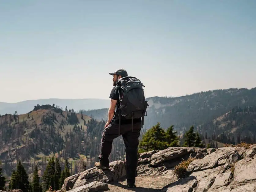
Spotlight on popular trails: difficulty, distance, and distinct attractions
Below is a brief outline on some of the most popular hiking trails in Lassen Volcanic National Park:
- Lassen Peak: 5 miles/7.9km, difficult, the National Park’s namesake peak and tallest volcano. Expect other worldly landscapes and breath-taking views.
- Bumpass Hell: 3 miles/4.8km, easy to moderate. Expect unique geothermal activity and wonderful mountain views along the trail.
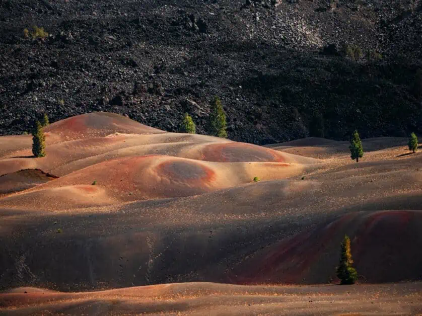
- Cinder Cone Trail and Painted Dunes: 4.7 miles/7.6km, moderate to difficult, exceptional volcanic landscape and colors in a more remote area of the National Park.
- Manzanita Lake Loop: 9 miles/3.1km, easy, with stunning views of the pristine Manzanita Lake and Mt. Lassen.
- Brokeoff Mountain: 8 miles/11.1km, difficult, experience unique views from the summit of this iconic peak.
- Crags Lake: 4 miles / 6.4km, moderate, the Chaos Crags area is fascinating and genuinely unique to the area and it’s forming of the landscape, this hike allows you to experience it up close.
Wildlife watching and photography tips
If you’re into wildlife watching, then you should absolutely bring a set of binoculars to Lassen Volcanic. Given that the park houses over 300 different species of vertebrates, you’ll be amazed by what you see. There are certain areas within the park that you’re likely to see wildlife in the summer, such as Manzanita Lake which is home to nighthawks, mule deer and bufflehead ducks to name a few. In other areas of the park, you’ll be lucky to sight the likes of pika and golden mantled ground squirrel. The Warner Valley Wildlife Area, which has significant wetlands, wet meadows and forest habitat is home to beavers and many others.
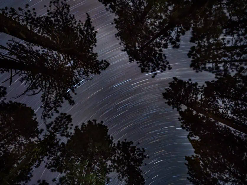
There is so much to take in whilst you’re visiting Lassen Volcanic National Park that you’re going to want to bring a camera. Whether you’re a beginner or more advanced, you’ll want to bring longer and shorter lenses. We are very keen on using longer lenses for landscape photography as well as more traditional shorter lenses, as they allow you to pick out mountain scenes and points of interest in more detail. They’re also great for wildlife shots. Because of the lack of light pollution in the area, Lassen Volcanic National Park is also a great area for star gazing and Astro photography. You’ll see some of the clearest night skies you can imagine here and night photography is a real treat of an activity to indulge in here. Be sure to bring (or invest in) a sturdy tripod to help get those all-important long lens shots – see our lightweight tripod recommendations here.

Best Hikes in Lassen National Park
Use the map below to see starting locations for each of the hikes listed in proximity to each other in order to plan your journey. The locations are numbered in reference to the hikes outlined below:
1. Lassen Peak
Difficulty: High level of exposure with full sun, steep uneven trail, at altitude with a light scramble at the peak classes this trail as difficult.
Distance: 5 miles/7.9km
Elevation: 1889ft/576m ascent, 1912ft/583m descent
When to do it: Due to limited access in the winter, this trail is best completed between July and the end of September.
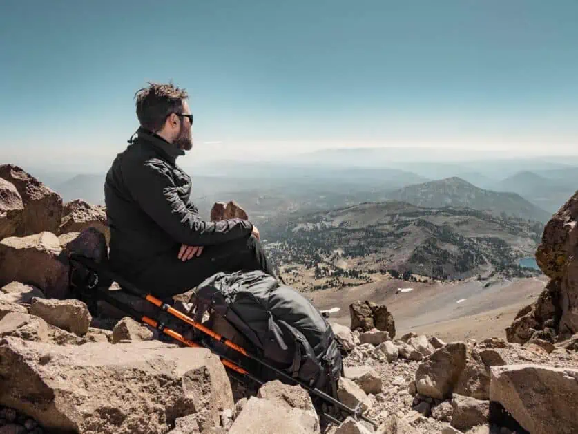
Mt. Lassen or Lassen Peak is the National Park’s namesake trail – and it’s worth making the effort to hike it and Lassen Peak is actually the biggest Plug Dome volcano in the world at 10,440 ft/3,180 m. Aside from its obvious appeal, the views from the hike are simply spectacular, with far reaching vistas across Brokeoff Mountain and the surrounding cascades, even over to Mt. Shasta on a clear day. This trail can be steep in places with uneven ground, and is at altitude, so take it at a slower pace, especially to start. That said, the trail is well trafficked so it’s very straight forward to follow.
There is a light scramble toward the end to reach the peak where you may need to get your hands involved, but this is relatively short. Be sure to bring a hat, lots of sunscreen, plenty of water and food for this trail – there is no tree cover at all on this hike and the trail is very exposed so you will feel the heat. It’s advised to start early in the day for this reason. Likewise, due to its elevation it can get windy and cooler at the top so be sure to bring layers. The parking lot for this hike is large and you should have no problem parking.
About our free downloadable trail maps: We use Outdooractive maps for our hiking guides to give you a live map you can see and save offline for your hike, which is a must as reception can’t be relied on!
2. Cinder Cone and Painted Dunes
Difficulty: Loose scree on the cinder cone, steep and exposed path and elevation gain at altitude class this trail as difficult. If you decide to hike to the Cinder Cone to see the Fantastic Lava Beds and the Painted Dunes, this hike would instead be classed as moderate.
Distance: 4.5miles/7.3km
Elevation: 1013ft/309m ascent and descent
When to do it: Due to its more remote location and inaccessibility in winter, this trail is best enjoyed between July and October.
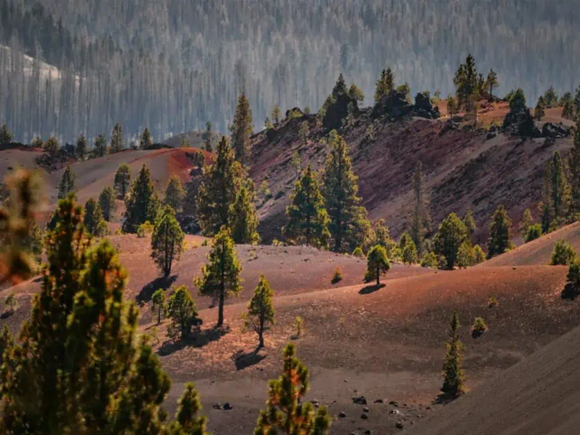
This is one of the most iconic hikes in the Butte Lake area of the National Park, which you access separately to the main park highway. Even just spending time at Butte Lake is a spectacle in its own right, but the Cinder Cone is a special trail. The trail starts out through forest past Fantastic Lava Beds on your left and as you climb up, the views start to open out and you’ll get your first glimpses of the Cinder Cone and the Painted Desert. Like with many mountain peaks, the views from the top are only part of the experience and the Painted Desert is truly magical – taking in the colors will take your breath away, alongside the peaks you’ll see around you.
As you reach the foot of the Cinder Cone, this is where things start to become steep – it’s a slog to the top, the ground is loose and steep, so hiking poles are very helpful here. That said, the ascent to the top is short and as you come back down you’ll have continued great views. It’s also still a great hike if you head up to the base of the Cinder Cone and turn round there, as you’ll get to take in some of the best views on this hike in this section alone. Bring sunscreen, a hat and plenty of water as your only cover is within the first section and it soon becomes very exposed.
3. Bumpass Hell
Difficulty: Easy to moderate
Distance: 2.8miles/4.6km
Elevation: 511ft/156m ascent and descent
When to do it: This hike is best completed between late June/July and mid-October
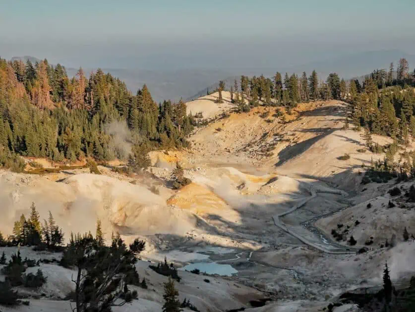
The fantastically named Bumpass Hell is one of the must do hikes in the National Park and can be completed as an easy add on to other activities (it can be done within two hours). Whilst this hike is all about the viewpoints of the fantastic geothermal activity at the end point, don’t forget to look out at the scenery. Along the trail from the large parking lot you’ll be treated to wonderful mountains in the background and rocky foregrounds. The views are simply spectacular, and we’d say they’re every bit as incredible as the geothermal areas themselves – and most people seem to just pass them by without a glance in favor of their destination! If you don’t fancy the hike down into the crater at the end, you can take in the views from the viewpoint (which are every bit as good). This is a fantastic, interactive hike and if you have children, it’ll keep them thoroughly entertained.
4. Manzanita Lake and Reflection Lake Loop
Difficulty: Minimal elevation gain and even paths mark this route as easy
Distance: 2.67miles/4.3km
Elevation: 91ft/28m ascent and descent
When to do it: This trail can be accessed all year, summer trail conditions will exist from June to October with snow conditions expected from November to April. If completing in the winter, you’ll likely need to ski or snowshoe in.
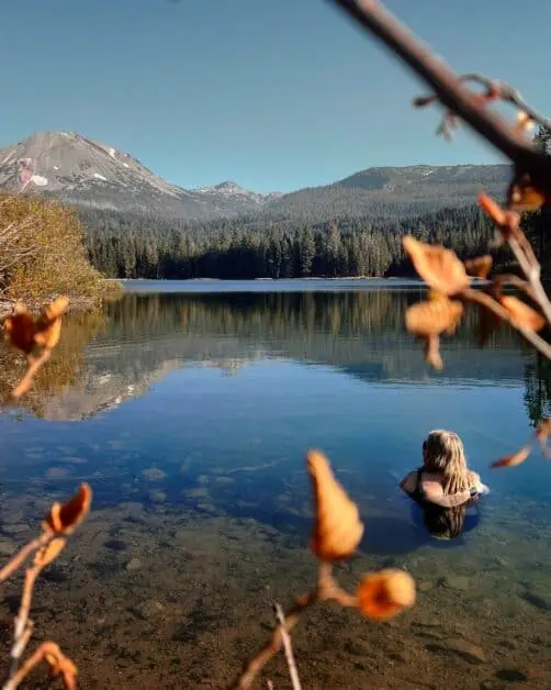
This trail is a really great, more accessible way to experience far reaching views of places like Mt. Lassen and Chaos Crags. The trail is mostly even and if you’re staying at Manzanita Lake Campground, this would be a great one to hike either first thing or at the end of the day (wear bug spray if hiking later in the day). The typical route takes a loop of Manzanita Lake alone but adding in Reflection Lake is a worthy addition if you’ve got the time and inclination. Both are also equally great to take in on their own. If you’re into lake swimming, be sure to bring your swimwear for a dip in the cool, crystal clear waters of Manzanita Lake – there are plenty of spots along the shore that are great to take a dip. You could very easily make a day of it here, bringing a picnic and hiking from swimming spot to swimming spot.
5. Brokeoff Mountain
Difficulty: Combining length, altitude and height gain, this hike is classed as difficult
Distance: 6.89miles/11.1km
Elevation: 2513ft/766m ascent and descent
When to do it: This trail is best completed between July and early October
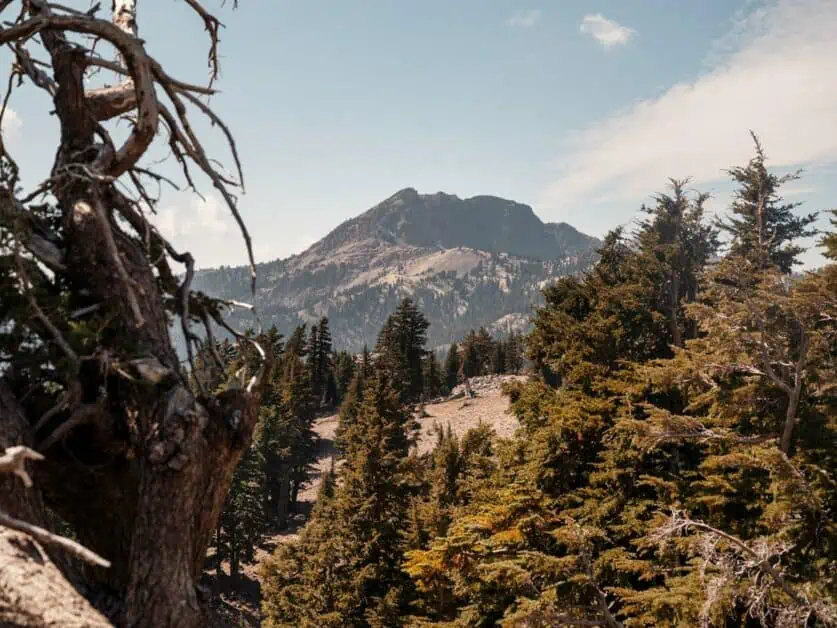
Brokeoff Mountain is one of the iconic trails in Lassen Volcanic National Park because of the unique views that you’re awarded of Lassen Peak, Mt. Shasta and the surrounding mountains such as Chaos Crags. It’s also one of the toughest in the park. The trail climbs up through meadows and forest vegetation for the first section until you reach above the tree line and the views really start to open up. You’ll also get to take in the view of the Brokeoff caldera from the summit. Due to its elevation and position, there may still be snow on the trail until August. Be sure to bring layers as it can get chilly on this hike, especially as you climb. It’s well worth the effort!
6. Chaos Crags and Crags Lake
Difficulty: Some steep sections with moderate ascent and descent, this trail is classed as moderate to moderately difficult.
Distance: 4.2miles/6.9km
Elevation: 918ft/280m ascent and descent
When to do it: It is possible to use some of this trail year-round, with the right experience, but you may need to ski or snowshoe in, depending on snow levels and seasonal road closures which can add significantly to your journey. Otherwise, this trail is best enjoyed between early July and October.
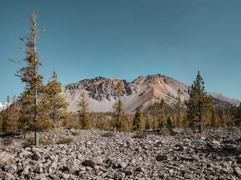
Chaos Crags is an incredibly interesting area and is responsible for the formation of much of the environment you’ll see around you on this hike, due to a landslide and volcanic activity from the dome. You’ll start in a forested area as you ascend. Earlier in the season, you’re more likely to see water in the lake, but later, it is likely to be dried up, so keep that in mind if you were expecting a swim or to relax by the lake. The final descent down to the lake itself is steep, so if you wanted to leave this off and the ascent back out, you can stop at the view of the lake from above. You’ve got far reaching alpine views on this trail and whilst it is near the popular area of Manzanita Lake, you’ll generally get a good sense of solitude on the trail.
7. Mill Creek Falls
Difficulty: This trail is classed as moderate
Distance: 3.3miles/5.4km
Elevation: 767ft/234m ascent and descent
When to do it: The best time to complete this trail is between June and October
Whilst the Dixie Fire of 2021 has had a significant impact on this trail, it is none the less beautiful, and it’s a fantastic chance to see how the landscape is starting the regenerate – as you’ll see new growth and wildflowers. Be sure to bring sunscreen, a hat and water as there is limited shade on this trail. You’ll view the waterfall from a viewpoint as the trail down to it is currently closed due to fire damage, but once it’s regenerated, you could easily relax and enjoy a picnic or a few hours there. The trail is rocky and sandy in parts, so be sure to wear good hiking shoes.
8. Lake Eiler and Thousand Lakes Wilderness
Difficulty: Moderate
Distance: 5miles/8km
Elevation: 600ft/183m ascent and descent
When to do it: This trail is best completed from July to early October
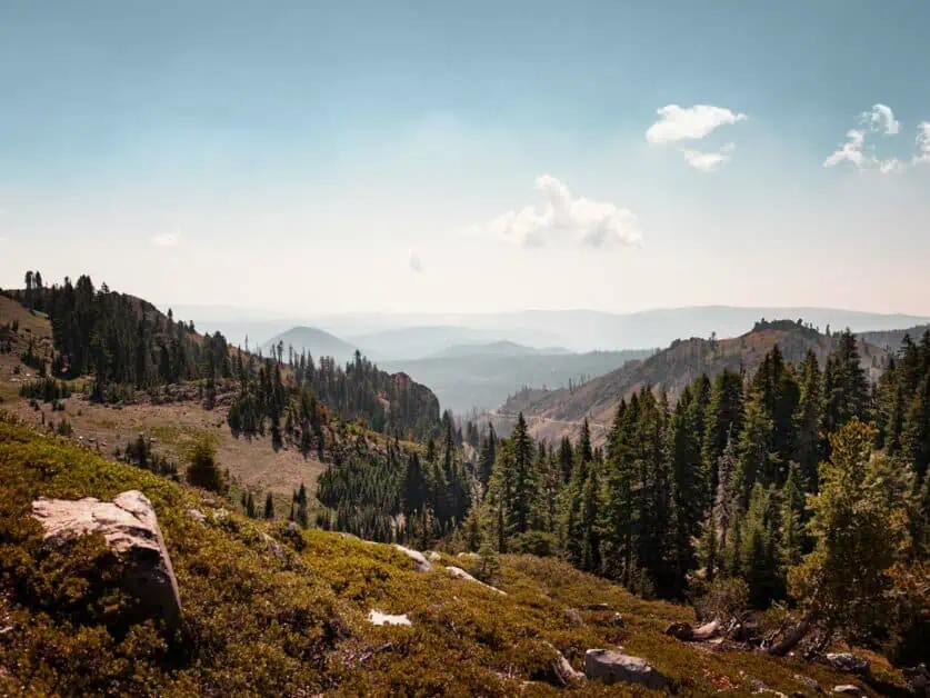
This hike is technically not in Lassen Volcanic National Park, but just outside, and is well worth exploring. The area named the Thousand Lakes Wilderness is an area next to Lassen National Forest and is easily reachable from just outside the National Park boundary. If you like your solitude, then this hike is for you, as you’re likely to see very few people on it, even on weekends. The views of the whole area and around Lake Eiler are truly stunning, and it’s a great area to spend a night or two backpacking and taking things at a slower pace (you also do not need a permit to camp here, as it isn’t within the National Park boundary). You could easily set up near the lake (there is a recognised area for this as you’ll see marked on the map) and you could use this as a base to explore over several days the variety of trails around. It’s worth carrying some cash (up to $20) with you for developed camping areas that do require a fee. The ascent and descent on this hike is very gradual and it’s advised to bring bug spray and sunscreen as well as a hat.
9. Butte Lake and Bathtub Lake
Difficulty: This trail is rated as easy to moderate
Distance: 2.17miles/3.5km
Elevation: 314ft/96m ascent and descent
When to do it: This trail is accessible from July to early October, depending on snowfall.
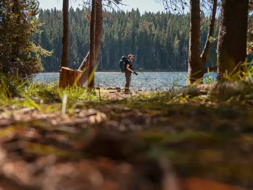
Butte Lake is an incredible sight to see – the fact that this whole lava field is piled up so high with endless rock and pristine turquoise water is breath-taking as a juxtaposition. What we love about this area as well is that it’s much less trafficked than some of the other areas in the park so you’re more likely to have it to yourself. It’s also a great hike to do if you’re staying at Butte Lake campground and is particularly nice first thing in the morning. If you’re into lake swimming, be sure to bring your swimwear for a dip in the cold waters of Butte Lake – there are plenty of spots, especially near the large parking lot for a swim. Bathtub Lake is also interesting, and the scenery you’ll take in along this hike is unusual and incredibly memorable!
10. Terrace, Shadow and Cliff Lakes
Difficulty: This trail is classed as moderate
Distance: 3.3miles/5.4km
Elevation: 695ft/212m ascent and descent
When to do it: This trail is accessible between mid July and late September
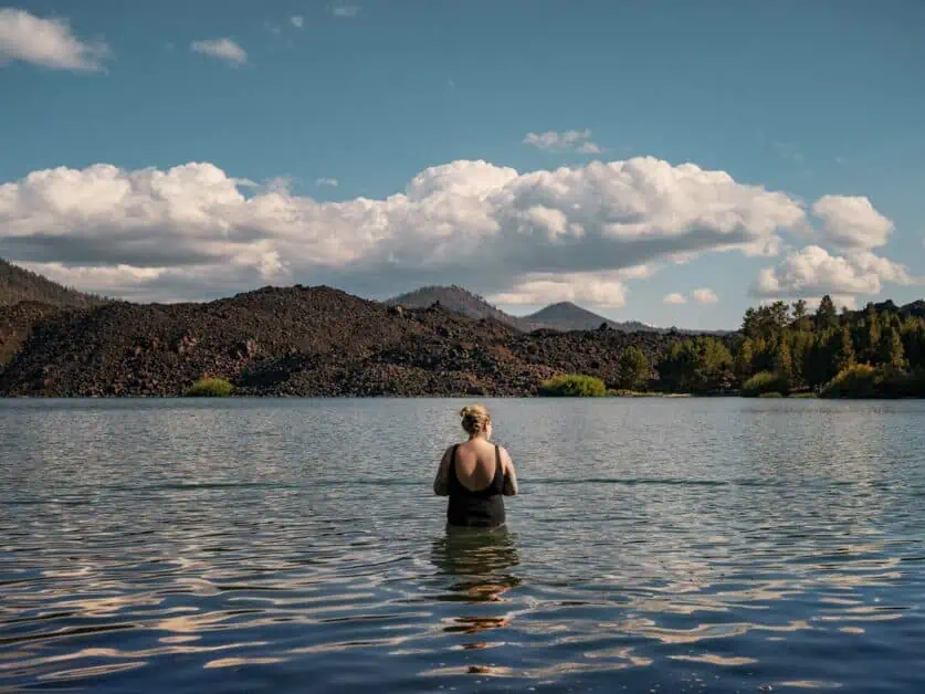
This is a stunning trail which, even though it’s within the National Park doesn’t feel overrun and you’re likely to get a great sense of solitude on this hike if that’s something you enjoy. The trail is downhill most of the way which means you’ve got a steady uphill most of the way back, but the views make it worth it and lakes you’ll get to take in are stunning. The trail is in good condition, and easy to follow meaning you can take in the views and the pristine blues of the lakes. Be sure to bring bug spray, plenty of water and a hat! There may still be snow on the trail well into July so be sure to check trail conditions in advance at the National Park Visitor Center.
Camping in Lassen Volcanic National Park
Camping is a great way to access the Lassen Volcanic, and if you’re looking to stay right in the thick of it within the park boundary, it is actually your only option as there are very few hotels and similar lodging options directly in Lassen itself, except for Drakesbad Guest Ranch. Whilst many of the lodging options in the area are a pretty quick drive from the park, there is something to be said for getting back into nature and starting out fresh on the trail or with your activities that day.
Choosing a Campground
There are several front country campsites available within the National Park boundary, some require more effort to secure a spot than others, due to their location and popularity. However, the National Park itself and access to the activities within are not on a huge scale, so even if you use a front country campsite that isn’t your first choice for location, it shouldn’t curtail your trip at all. Here are some of the most popular/well used front country campsites in Lassen Volcanic National Park:
Manzanita Lake Campground
A well maintained, well trafficked campsite. This is one is one of the more popular, due to its location close to the lake itself and is the largest in the park. The campground has rustic cabins available as well as group campsites.
Location: Manzanita Lake Campground, Lassen Volcanic National Park, Mineral, CA 96063, USA
Facilities: Camp store, toilets and showers, trash and recycling collection, no internet or phone service, potable water, laundry.
Accessibility: Car/drive up
Ideal for: Families, RV’s and trailers
Reservation tips/How to book: You can only reserve Manzanita Campground online, and because it is the most popular, it is advised to book as soon as you can. You can reserve your spot and pay through Recreation.gov.
Butte Lake Campground
Great location and base if you’re wanting to check out trails such as Butte Lake and the Cinder Cone and Painted Dunes. Much quieter and more remote feel.
Location: Butte Lake Campground, Old Station, CA 96071
Facilities: Trash and recycling, food storage lockers, no camp store, no laundry, vault toilets, no showers.
Accessibility: Drive up campsite suitable for tents, trailers and RV’s but no specific RV sites.
Ideal for: Limited development, so those who want to get back to nature.
Reservation tips: Whilst it is much quieter, it’s worth booking in advance to avoid disappointment, and this is certainly required for groups. You can book Butte Lake Campground through Recreation.gov.
Summit Lake Campground
The campground has a North and South section, and both have access to the lakeshore.
Location: Summit Lake North Campground, Lassen Peak Highway, Mineral, CA 96063
Facilities: No camp store, cell phone or internet reception, seasonal; trash and recycling collection, food storage lockers flush toilets and vault toilets, seasonal potable water.
Accessibility: Drive up campsite.
Ideal for: Families and groups, limited development so those who want to get back to nature.
Reservation tips: If you’re planning to swim, try to book the North section, as this area is better. You can book through Recreation.gov.
Other Campgrounds
There are various other campgrounds that can be booked such as Southwest Campground, Warner Valley Campground and Juniper Lake which were all closed in 2023 due to Dixie fire recovery, however, it’s worthwhile keeping an eye on the Recreation.gov website and the National Park’s website to see when these will reopen.
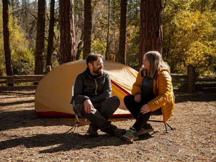
Backcountry Camping Adventures
There are many opportunities to explore the National Park, National Forest and Wilderness areas that surround Lassen by backcountry camping. This is a great opportunity to combine longer trails into multi day adventures and really get away from it all and feel that sense of peace. In fact, Lassen Volcanic has some of the best backpacking trails we’ve experienced. We’d recommend combining a backcountry adventure with checking out some of the other hikes in the park to really get an overall, unique feel of what this truly breath-taking area has to offer. It’s worthwhile familiarising yourself with the park regulations on backcountry camping before you go. There are a number of things you need to consider before you go, which we’ve outlined below.
Acquiring necessary permits
Depending on where you plan to go backpacking in and around Lassen Volcanic National Park, you may need a permit for your overnights. Various areas have different regulations around this, so you’ll need to check in advance and organise permits. Generally, a wilderness permit is needed to camp within the National Park boundary (this isn’t needed for front country campgrounds). You’ll need to source your permit from Recreation.gov. There are no designated backcountry campsites within the park, and fee permits range between $5 and $6. You’ll need as much information as you can about your trip, including your contact information and vehicle registration. Generally, if you’re going to be in the backcountry outside of the National Park, you don’t need to have a wilderness permit. Though it’s wise to bring some cash (depending on your trip length between $12 and $50) to pay the fee needed for dispersed and walk in campsites which are dotted around.
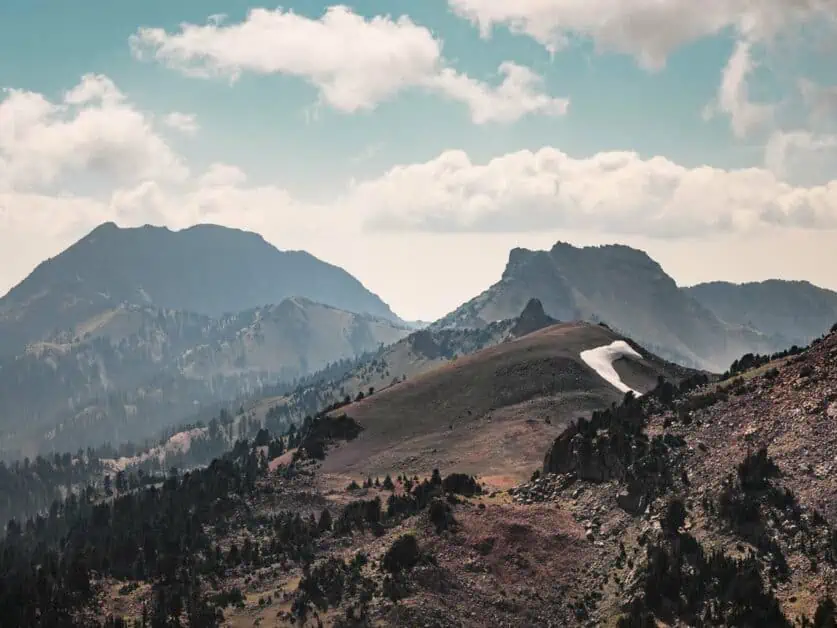
Recommended routes and safety precautions
There are of course numerous starting points for backpacking and backcountry camping ideas within the National Park, some of which you can find here. However, there is also a lot more to explore in the wilderness areas around the National Park too. When we visited, we enjoyed a couple of days on the Lassen Backcountry Discovery Trail; a 4×4 route which allows you to take in some of the most incredible landscapes, forests, volcanic views and pristine lakes.
You can combine driving the 4×4 route (which in most places is not technical and just requires some experience of off road driving) with day hikes and hiking to see various areas along the way. For example, you can set up camp and spend days hiking into the Thousand Lakes Wilderness (which was our itinerary). Within this, you’ll get a real sense of solitude. The trail in total is 187 miles/300km and runs through some of most impressive scenery in the region. However, it’s possible to do shorter sections over a period of days as there are many entry and exit points near more major roads in the area. This also gives you an opportunity to top up on gas (it’s advised to enter the trail with a full tank).
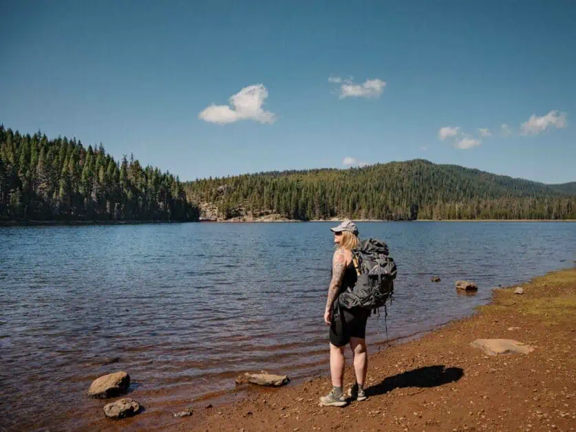
This adventure gives you a great opportunity to plan something special and get away from it for a while. To plan, you’ll need to know how much food to bring – essentially, you’ll want to plan for a backpacking trip and everything you bring that is scented will need to go into a bear can. This is why it is a good idea to look at dehydrating your food (we have a whole series of articles on dehydrated meals for backpackers). You’ll also want to plan out bear safe campsites, by keeping your food/bear can 100m from your tent and your cooking area. If you plan to use a stove, you’ll need a permit, which can be obtained here.
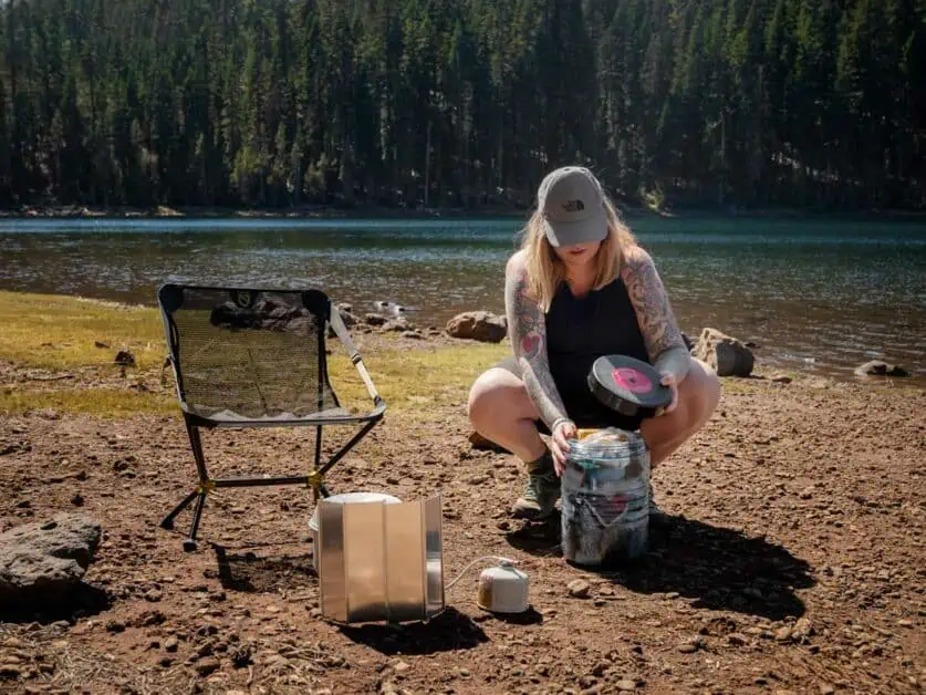
We’ve included the section of the route we completed that we’d highly recommend. This took us two days to complete with two nights camping. You do not need a wilderness permit to camp on this trail, but it is advised to use the dispersed campsites (which are payable, and you should bring between $12 and $50 in total to pay for them) along the route.
Leave No Trace principles to uphold
It’s of course important to uphold Leave No Trace principles when hiking but also camping too. Here are several things you can do to minimise your footprint when backpacking, and to keep things looking great for years to come:
Pack it in and out: Take anything with you that you bring in, this includes any litter.
Inspect the area: Before you leave your camping spot, check for any trash or spilt foods, and take them with you. Pack out toilet paper.
Deposits: Where possible make use of toilet facilities, but when this isn’t possible deposit solid human waste in a cat hole which is 6 to 8 inches deep and 200 feet/100 meters from water.
Schedule: Avoid high use time and ‘honeypot sites’, travel in small groups.
Footprint: Don’t create any landmarks or changes to the trail, camp on durable surfaces. Use a lightweight stove to cook with and where a campfire is permitted, use established rungs. Put out any fires completely.
Respect: Be respecting of wildlife and never feed animals. Leave what you find, where it is.
Accommodation and Lodging: Where to Stay Nearby
There are several areas fairly close to Lassen Volcanic that have options for accomodation such as Burney, Mineral and Mill Creek, Chester, Susanville and a little further afield in Redding (but still very doable). Here are our top recommendations:
- The Village at Highlands Ranch: 41500 CA-36, Mill Creek, CA 96061, United States
9 miles / 13 minute drive from Lassen Volcanic National Park Southwest entrance and a great base for exploring the main park highway, Lassen Peak etc.Highlands Ranch includes the Village Inn, a small motel with refrigerator and microwave facilities, also offers RV camping. It has a restaurant on site (Frank’s) which does great burgers and burritos. It also has a grocery shop on site.
- Green Gables Motel & Suites: 37371 CA-299, Burney, CA 96013, United States
39 miles/43 minutes drive from Lassen Volcanic National Park Northwest entrance. A great base for exploring around Manzanita Lake, Lake Eiler and Chaos Crags.
Each room has a microwave and refrigerator as well as air conditioning and is close to the various restaurants on offer in the area.
Other options include:
- Best Western Rose Quartz Inn, 306 Main St, Chester, CA 96020, various distances to the National Park depending on the entrance.
- Shasta Pines Motel & Suites, 37386 CA-299 E, Burney, CA 96013, 39 miles/43 minutes drive from Lassen Volcanic National Park Northwest entrance.
- Surestay Plus Hotel by Best Western, 2785 Main St, Susanville, CA 96130, varying distances depending on the entrance to the park. Has a pool.
Food: Where to Eat in Lassen Volcanic National Park and Nearby
Whilst there aren’t really any restaurant options within the National Park itself, there are various options around for dining near Lassen Volcanic, though the visitor center does have a café. Depending on your plans for the day, we’d advise getting something for lunch to bring with you – there are a number of supermarkets in nearby places such as Holiday Market in Chester, Mineral Grocery in Mineral and Safeway in Burney to name a few.
Here are some of the best places to eat whilst you’re in the area:
Frank’s: 41500 Hwy 36E The Village at Highlands Ranch, Mill Creek, CA 96061. Serving burgers, fried fish and burritos as well as craft beer with a comfortable and friendly atmosphere. Has vegan and vegetarian options. Roughly 12 minutes from the National Park.
Highlands Ranch Restaurant and Bar: 41500 Hwy 36E The Village at Highlands Ranch, Mill Creek, CA 96061. Just across the road from Frank’s is Highlands Ranch Restaurant serving upmarket fair and contemporary dishes. Roughly 12 minutes from the National Park.
Lassen Ale Works Boardroom: 702-000 Johnstonville Rd, Susanville, CA 96130. Serving pizzas, salads and craft beers with a relaxed atmosphere. Also has at least one vegetarian pizza option. Varying distances from the park depending on entrance.
Blackberry Patch Restaurant: 37453 CA-299, Burney, CA 96013. Serving American fair like soups, salads, sandwhiches, breakfasts and waffles. Roughly 50 minutes from the park.
Things to do in Mount Lassen National Park
Of course, there are lots of other activities to enjoy in the National Park other than hiking and backpacking alone, and there’s something to keep everyone’s interests happy.
- Swimming and water sports: Whether swimming or paddle boarding is your thing, the lakes in Lassen Volcanic are pristine and beautiful. You can swim in any of the lakes in Lassen, unless local signage says otherwise. What better way to end a hike or day taking in the sights. Be mindful that the lakes do stay cold all year round, so it’s best advised to be acclimated to cold water swimming, and always stay within your limits.
- Guided tours and educational programs: The National Park run a number of ranger led programs, both as tours and educational programs suitable for both adults and children each year. These have natural focuses on geology and ecology. For more information about events, check out the National Park’s website.
- Stargazing: Due to the remote location of Lassen Volcanic National Park, you’ll be treated to some seriously dark skies and that means taking in the stars at their best and pondering the Milky Way. The National Park also runs the Lassen Dark Sky Festival which can be a great way to get kids involved and interested in celestial observation.
- Festivals and seasonal events: There are numerous events happening throughout the year in and around the National Park, such as Hike and Bike the Highway and Discover Lassen Weekend, with something sure to keep everyone in your group entertained. For more information, check out the National Parks website here for up-to-date events.
Planning and Preparing for Your Trip
Due to its slightly more remote location, it’s worth planning in advance as much as possible for your trip, here are a few important areas to consider before visiting Lassen Volcanic National Park:
- Navigating to and within the park: The best transportation options to get to Lassen is by car. Once you’re on the park highway, you should be able to navigate fairly easily, but be mindful that there is little cell service in the area, so it’s wise to plan your route to your activity in advance. It’s also worth noting that there aren’t that many gas and refuelling stations along the way. Always check where your nearest station is, and if possible, fuel up before the day ahead.
- Park fees, regulations, and essential contacts: At the time of publishing, entry to Lassen Volcanic National Park is $30 for a private vehicle between April 15th and December 1st and $10 between Dec 1st and April 15th. This will allow you entry for 7 days. However, if you’re going to be visiting more than once or plan to visit other federal recreation lands across the United States within a year, an American the Beautiful Pass is a good option. You can buy in advance here, and it currently costs $80. It’s a good idea to check out the park’s website in advance for up to date prices, but also to familiarise yourself with park regulations (such as on animals, bear cans, camping and more).
- Packing essentials: This will be very dependent on your itinerary but be sure to familiarize yourself with park conditions before your visit and pack accordingly. For example, if you’re going to be camping, it can get cold at night, so you’ll want to bring plenty of layers. If you’re planning to hike some of the taller peaks, be sure to bring layers and consider trekking poles. A camera is also an essential, as is sun cream and a hat as many of the trails in the park can be exposed to the sun constantly.
FAQs
Will I see a bear in Lassen Volcanic National Park?
There are estimated to be 50 black bears in Lassen Volcanic National Park and seeing them is a rare thing, but not impossible. It’s important to familiarise yourself with localized bear safety, included how to store your scented items and the use of bear spray is not permitted.
How hard is the Lassen Peak hike?
Due to its altitude and steep climb to the summit and light scramble near the top, the Lassen Peak hike is classed as hard. That said, if you’re used to hiking at this altitude, you may find this easier. It is a well-marked and graded trail pretty much the entire way to the top and is certainly an achievable day hike. It takes roughly 3 to 5 hours to complete.
What are the park hours?
The National Park is open 24 hours a day, all year round. Though access in the winter and early spring is more limited because of snow. So, depending on where you plan to visit, you may need to be prepared to snowshoe or ski in.
Where can I bring my pet?
You can’t bring pets on trails, but they’re allowed in developed areas such as picnic areas, campgrounds, paved roads and other parking areas. They must be on a lead at all times.
What is the weather like in Lassen Volcanic?
Visitors should be prepared for any type of weather, and it can change extremely quickly. That said, the summer sees reliable conditions. The daytime is warm and dry with blue skies and cooler nights. In Winter, you can expect snow on most trails from October through to July. In some areas, snow can persist all year round.
Conclusion
Lassen Volcanic National Park really does have it all. From towering volcanoes to geothermal areas, lush pastures all the way through to pristine mountain lakes and dark skies there really is something for everyone. Appreciating natural wonders is easy here as every moment there is yet another breath taking and unusual view to be drawn in by and when you consider the park’s history and important activity, you’re sure to make memories here that will last a lifetime. Whilst this guide aims to give you everything you need to plan a trip to Lassen Volcanic National Park; we also hope this gives you the inspiration to explore off the beaten path and make your own adventure whilst exploring responsibly and keeping the park beautiful for years to come! Bottom of Form
Disclaimer: This article contains Affiliate Links. You won’t pay any more for buying through these links, but we may receive a commission from any purchases made through them. As an Amazon Associate, I earn from qualifying purchases. If you choose to support us by buying through our links, we thank you as it helps us to continue providing the resources we do to help you enjoy the outdoors more!
