
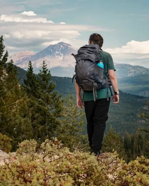
It’s fair to say that many people visiting California will focus their visit around a major city or one of the ‘big hitter’ National Parks. However, California is a vast and immensely varied area and, at the far north of the State, amidst a seemingly infinite pine forest, you’ll find the Southern end of the Cascade Mountain Range, which stretches down from Canada through Washington and Oregon. Towering above it all is Mt. Shasta. For those who think they know what California is all about, the Shasta Cascade region will present something new and very exciting.
Editor’s Note: This article is in partnership with Visit California, all opinions are our own.
Table of Contents
Why should you visit Shasta Cascade?
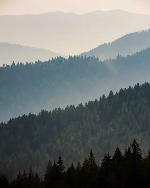
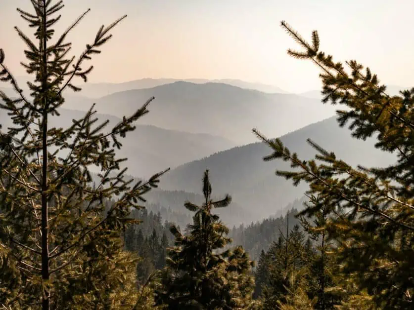
The Shasta Cascade is definitely off the beaten track in terms of destinations in California – it’s certainly nowhere near as busy or even as well-known as some of the State’s National Parks. The Shasta Cascade is vast and alpine, comprising dense forest punctuated with dizzying and spectacular mountain peaks, crystal clear streams and lakes. The Shasta Trinity National Forest takes up an astonishing 89000 hectares or 2.2 million acres with substantial wilderness areas – it’s easy to find true solitude here. In Summer, temperatures are warm, but come winter, the area receives heavy snow fall and is completely transformed. If your idea of California is the desert, beaches and bustling cities, then the Shasta Cascade presents a whole new experience of California, something which many visitors may not even know exists. This area presents many fantastic hiking routes, scenic drives and opportunities for open water swimming, mountain biking and off-road driving too.
The Shasta Cascade in Motion
Bring this vast area to life and watch how we experienced the Shasta Cascade:
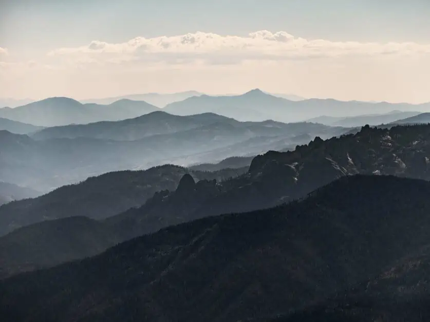
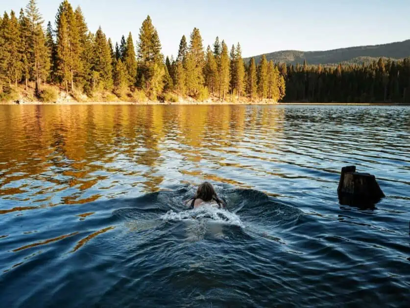
Capturing the essence of Shasta Cascade's wild beauty
Aside from the Shasta Trinity National Forest, there are also several adjoining wilderness areas including the Marble Mountain Wilderness, Trinity Alps and Russian Wilderness. This is a largely evergreen forest that’s sparsely intersected by main roads (though there is also a network of less developed forestry roads, many of which are perfectly suited for regular road cars) and there are no roads at all in the designated wilderness areas. In Spring and Summertime, the weather is generally temperate to good, but heavy snowfall comes in winter and many roads are seasonally close for this very reason. This is a landscape the invites exploration an in which you can easily find true solitude!
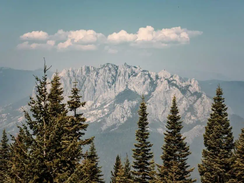
Geographic wonders: from majestic peaks to serene lakes
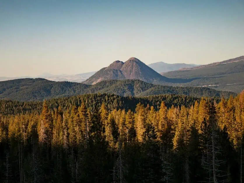
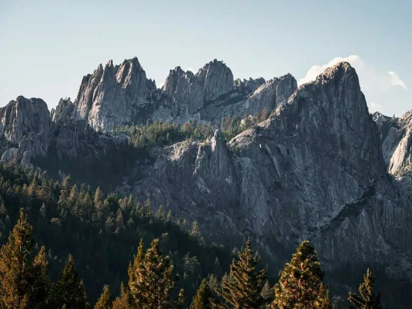
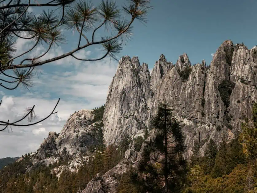
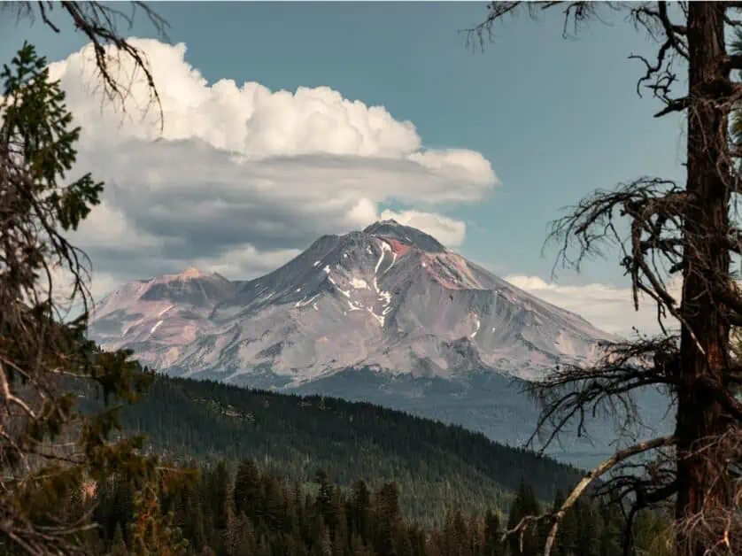
The forest is punctuated by mountains and spectacular rock formations – there’s the southern end of the Cascade Range including Mt. Shasta, which dominates so many views in the area, and there’s also the Klamath Mountains which include the jaw-dropping Castle Crags. Moving into wilderness areas, there’s also the marble Mountains and Trinity Alps. The mountain peaks are contrasted by an abundance of alpine lakes and streams. Fed by glacial streams, many of the lakes here are clear and cold and they are home to the famous Shasta Trout (the area is very popular with anglers).
Brief history of exploration and adventure in the area
Europeans – and Americans of European origin – first reached the Shasta Cascade in the 1820s and 30s. At first, these were fur trappers and prospectors, and their numbers were small, but the discovery of gold brought an influx of settlers from 1849 onwards. In 1874, John Muir, who’s writing did much to bring America’s natural beauty into mainstream public awareness, climbed Mt. Shasta in a snowstorm. His subsequent account of this – published in Harper’s New Monthly Magazine in September 1877 – cemented the reputation of the aera.
Of course, the area has been populated for far longer than this and several Native American Tribal Groups including the current day Redding Rancheria, Hoopa Valley, Pit River, Quartz Valley, Karuk and Klamath Tribes have long called the area their home. The landscape and nature in the area factors large in their legends and customs. The historic treatment of these Native American groups has been appalling and is, rightly so, a source of shame for many Americans. To start to address this, the US Forestry Service has worked closely with a number of tribal groups since the 1970s (those mentioned previously, plus another seven non-Federally recognized Tribes) to help preserve Native American cultural sites and practices within the National Forest areas.
The region's significance for adventurers and nature lovers
This vast area gives visitors a glimpse of how America perhaps looked before European settlers arrived. The sheer scale of the forests here is dizzying and it can be difficult to comprehend. For sure, the area is far from untouched, but the untouched areas are still enormous, and it would certainly be possible to spend a long time in the woods without encountering any signs of the modern world. This holds a true appeal to many who are interested in nature, adventure and the outdoors.
How to get to Shasta Cascade
The Shasta Cascade is situated in North East California. It’s not close to the two largest cities in the State, being over 4hrs drive (442km/275miles) from San Francisco and over 9hrs drive (970km/603miles) from Downtown Los Angeles. If you are arriving internationally – or even from another major city in the US, then there’s a good chance your first stop in California will be one of these two cities. If this is the case, and you can choose, San Francisco is the obvious point to start a journey to the Shasta Cascade. San Francisco is a fantastic city in its own right and if you are starting your journey to Shasta there, it’s well worth taking time to explore the city and some of what it has to offer.
The time and effort taken to get to the Shasta Cascade means that it’s better suited to a trip lasting several days in the region rather than a single day trip. None the less, the area is still certainly accessible, and a trip to the Shasta Cascade can easily be worked into a wider trip to California.
Air travel: nearest airports and connections
Most international visitors and a fair number travelling within the United States heading to the Shasta Cascade will likely arrive at either Los Angeles (LAX) or San Francisco (SFO). However, both of these airports are still a good distance from the Shasta Cascade. Redding Regional Airport (RDD) is much closer – Roughly 1:15hrs drive (109km/68miles) from Mt. Shasta City and can be reached by a short connecting flight from either Los Angeles (around 1:45hrs) or San Francisco (just over an hour). Redding Reginal Airport has car hire facilities, and we think that a car is the best way to get about once you’ve arrived in Shasta.
Road trips: best routes, scenic drives, and tips for the journey
We think that for most visitors, driving is the best option for reaching the Shasta Cascade. From San Francisco, the most direct route follows Highway 5 North. This route rapidly enters California’s agricultural heartland and gets progressively wilder the further north you journey. The route is mostly on high speed-limit roads and can easily be completed in half a day allowing for rest stops.
From Los Angeles, the most direct route also follows Highway 5 all the way and it would be possible to complete this in one long day or driving. However, if you wanted to break the journey up, it’s possible to follow State Route 1 – the iconic Pacific Coast Highway (PCH) – to San Francisco before completing the rest of the journey on the 5. Alternatively, you could follow the 395 through the Sierra Nevada before either cutting west at Yosemite National Park or Lake Tahoe. These options, taking in the Sierra Nevada or PCH, would turn the journey into a multi-day trip, but also add the possibility to see some truly spectacular scenery on the way.
Public transportation: buses, trains, and other options
The Amtrak Coast Starlight is a train service that connects Seattle and Los Angeles. It’s widely regarded as one of the most spectacular train routes in the world. Amongst others, the service has stops in Oakland (in the San Francisco Bay area) and in Dunsmuir, right in the heart of the Shasta Cascade. Los Angeles to Dunsmuir takes roughly 19hrs and Oakland to Dunsmuir takes roughly 7:40hrs. These are long journeys and sleeper cabins are available. Outwardly, the train may seem like a poor alternative to driving: It will certainly take longer plus it can get quite expensive – especially if you want a private cabin – and you’ll likely still want to hire a car at the destination. However, for some, the experience of riding a train through some of California’s most breath-taking scenery will more than compensate for this.
It’s also possible to travel from Los Angeles to Weed or San Francisco to Redding on the iconic Greyhound buses. Both Weed and Redding are close to, though not in the Shasta Trinity area.
Public transport is very limited on the ground around Shasta Cascade and, given the sheer scale of the area, if you want to hike, you will certainly need a car to reach many of the trailheads.
The Best Time to Visit Shasta Cascade
Shasta Cascade may be visited all year round. The major seasonal consideration to bear in mind is the weather as some of this area receives substantial snow fall which can limit certain activities at higher elevations and lead to road closures. If you’re interested in hiking at higher elevation, the best time to visit is generally from April to October when there’s no or minimal snow on the ground – of course, this can vary from year to year, so it’s worth checking in advance. If you are planning to summit Mt. Shasta itself, the optimum window is generally mid-May to mid-July when there is still snow cover over the extensive scree fields on the upper slopes.
Of course, the area doesn’t completely shut down in Winter and many of the hiking routes in this article can be adapted for snowshoeing. There are also several ski resorts in the area including the Mt. Shasta Ski Park, with a number of alpine ski runs and the Mt. Shasta Nordic Centre, which, as the name suggests, specialises in Nordic/cross country skiing. If visiting in Winter and driving, bear in mind that snow chains may be required on some roads.
The lower elevations of the Shasta Cascade region also provide hiking options available year-around. The Sacramento River National Recreation Trail is a great example, starting at the Sundial Bridge at Turtle Bay Exploration Park in Redding, meandering 17.4 miles along the Sacramento River, ending picturesque views of Shasta Lake and Mt. Shasta from the Shasta Dam.
Hiking Shasta Cascade’s Trails: Tips for Beginners and Pros
- Whilst the area is not as arid as southern California, it does get hot and dry in Summer, so be sure to carry plenty of water, snacks and sunblock.
- Insects can be a problem during the warmer months too – so be sure to carry repellent or bug spray.
- Be sure to have your route mapped out and available offline – either through a mapping app or via a hard copy map. Cellular service can be sporadic, and you can’t rely on online mapping.
- Some areas or activities require permits. The US forest Service publishes an overview of what’s required in the area. Additional permits are required to summit Mt. Shasta and in common with most of California, a California Campfire permit – available free of charge after taking a short quiz online – is required if you plan to light a fire or use a camping stove.
- Many camp sites are not staffed and require payment in cash to be left in deposit boxes. Costs vary per site (typically $12-20 per pitch per night) and it’s wise to carry multiple small bills if you plan to camp.
- Black Bears are active around Shasta Cascade and, whilst the odds are that you probably won’t encounter one, it’s good to be aware of how to stay safe if you do.
- If you plan to camp on your hike in the Shasta Trinity National Forest, a Bear Cannister for storing scented goods and food is mandatory. These are readily available either through Amazon or outdoor retailers such as REI.
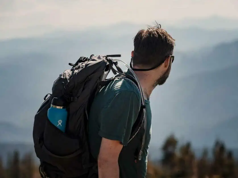
Hiking essentials: gear recommendations, maps, and safety precautions
We’d recommend the follow items to get the most out of you hiking in Shasta Cascade:
- Layers and weather appropriate hiking clothes
- Comfortable, broken in hiking footwear
- Water bottles or hydration pack
- Head torch
- Sunblock
- Insect repellent
- First aid kit
- Some way to navigate – either an offline mapping app or device or a hard copy map and compass. For multi-day hikes, both are advised.
If you are planning to summit Mt. Shasta, the following mountaineering equipment is recommended in addition to the above:
- Waterproof clothing suitable for 0C/32F or lower
- Rigid mountaineering boots
- Crampons
- Ice axe (and know how to self-arrest!)
- Helmet
Spotlight on popular trails: difficulty, distance, and distinct attractions
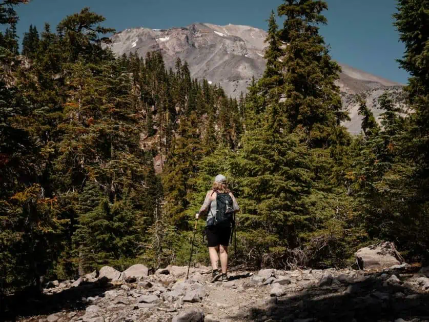
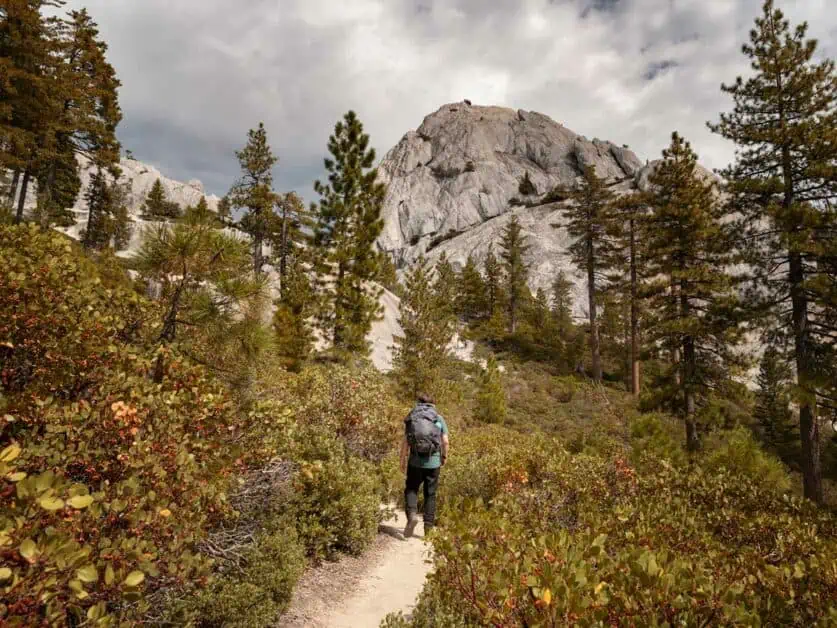
There’s easily a lifetime worth of trails in the Shasta Cascade area, but none the less, certain areas standout. Mt. Shasta itself is a great place to hike. Whilst summiting the mountain itself is a very demanding hike that many more casual hikers and walkers may not feel confident to attempt, the lower slopes of the mountain offer plenty of spectacular hiking opportunities. Castle Crag State Park is situated nearby and is home to several spectacular trails of varying lengths – many of which also offer spectacular views of Mt. Shasta.
Wildlife watching and photography tips
The Shasta Cascade has an abundant ecosystem and it’s a great place to spot wildlife. Aside from a wealth of bird and insect life, several larger species including Mule Deer, Black Bears and Even Mountain Lions and Bobcats call the forest home. The odds of running into a large predator are slim, but it’s worth being aware of how to handle an encounter safely (read here for bears and here for big cats). It’s also well worth looking into the crystal-clear streams and lakes that punctuate the landscape as there’s plenty of aquatic life to spot (including the famous Shasta Trout). Patience and persistence are key to good wildlife photography, so if your goal is to get great images of animals, then be prepared to spend a lot of time staking out locations – this will certainly take priority over other activities. However, if you’re happy to be more opportunistic, then bringing along a long zoom lens for your camera – or simply some binoculars – is also a great option.
Planning Multi-Day Hikes and Routes
The Shasta Cascade region contains vast areas of wilderness – so it’s a great place to get a true experience of solitude and lends itself well to multi-day hikes and backpacking adventures. The iconic long-distance Pacific Crest Trail or PCT passes through the area and hiking a section of this would provide a great way to see the area over a few days. There are numerous camping sites in the Shasta Trinity National Forest – with varying degrees of development in terms of amenities – and it’s easy to plan a multi-day adventure around these sites. The US Forest Service has an interactive map that shows camp sites in the area. The US Forest service state that ‘Dispersed Camping’ (which is the same as ‘backcountry’ or ‘wild’ camping – essentially not camping in a developed camp site) is generally permitted in Shasta Trinity National Forest with a few exceptions and conditions – there’s more information on this here. Water sources can be found through the region, and most developed camp sites will have a source of drinking water. However, visiting water sources should always be planned – don’t just assume you will encounter them.
Essential Backpacking Tips for the Region
When planning a multi-day hike or backpacking trip in the Shasta Cascade, remember that permits may be required in some areas and that bear cannisters are mandatory for storing food and scented items if camping. Most of the towns in the Shasta Cascade have a general store and these can make handy resupply points on longer backpacking trips. With any multi day trip, navigation is important, especially if crossing large wilderness areas, so be sure to have a mapping solution – whether that’s an app, a printed map and compass or ideally, both – and know how to read it and also let someone know where you’re going and agree check-in points. It’s also vital to practice Leave No Trace Principles and pack out anything you pack in on multi-day hikes.
Best Hikes in Shasta Cascade
Use this map to find the starting points of the hiking routes listed below – the numbers on the map correspond to the numbers next to each hike.
1. Mt Shasta Summit Via Avalanche Gulch
Difficulty: Extremely hard
Distance: 17km/10.5mi there and back
Elevation: 2193m/7194ft ascent
When to do it: Mid-May to mid-July, dependant on weather
Summiting Mt. Shasta is considered a challenging mountaineering route: there are no formal trails to the summit as the upper slopes of the peak are comprised of loose scree. This route via Avalanche Gulch on the south face is arguably the most popular route to the top and mid-May to mid-July is generally recommended as the ideal summit window as snow cover over the scree will make the ascent easier. Crampons, ice axes and helmets are considered essential equipment for this ascent. The north face of Mt. Shasta offers an even more technical ascent via the glaciers. The USDA publish an excellent guide that’s essential reading for anyone wishing to summit Mt. Shasta. As well as outlining the key routes, it also details the permits that are required to climb above 3300m/10000ft and the contact details of several guiding companies and equipment rental locations. Up to date weather conditions on the mountain can also be found on shastaavalanche.org along with further technical information on this route.
About our free downloadable maps: We use Outdooractive for all our hiking maps. This gives a route map that can be used offline. Remember, you can’t rely on cellular coverage in the outdoors.
2. Castle Dome Via Indian Springs
Difficulty: Moderate to hard
Distance: 9.5km/5.9mi there and back
Elevation: 699m/2293ft ascent
When to do it: Year-round, but snow fall may make the route much tougher in winter.
The actual summit of castle Dome is roughly 100m/300ft higher than the end point of this hike but requires rock climbing to reach. The first half of this route ascends steadily through thick forest before the tree cover thins to reveal spectacular views. The route is consistently steep and requires some scrambling at stages towards the high point. There are some dramatic viewpoints towards Mt Shasta at the top of this hike but be aware that reaching them involves coming close to some very severe drop-offs. A short detour can be made from the main trial to see Indian Springs – a group of natural water springs and small waterfalls – the route to the springs also features some great views of the overhead crags. During the Summer, heat, sun exposure and insects can all be intense on this route. Noe the less, this is a very rewarding hike. This route starts at the same point as the short ‘Vista Point’ trail below. It’s worth considering combining these two routes.
3. Vista Point
Difficulty: Easy and marked as an accessible trail
Distance: 800m/0.5mi there and back
Elevation: 30m/98ft ascent
When to do it: Year-round
Situated in Castle Crags State Park, this short trail starts at the same point as the Castle Dome via Indian Springs route listed above and is well worth adding on if you choose to do that hike. This trail follows a short and wheelchair accessible path through the forest, emerging at a truly spectacular viewpoint, offering some of the best views of both Mt. Shasta and Castle Crags in the whole area. It is a shame that many hikers ascending to Castle Dome seem to either ignore or be unaware of this fantastic ‘extra’! The actual Vista Point is a wide clearing with the views framed by trees. It’s a great spot to have some lunch or just pause to soak in the views.
4. Gray Butte from Lower Panther Meadows
Difficulty: Moderate
Distance: 5.3km/3.3mi there and back
Elevation: 171m/561ft ascent
When to do it: Late June to late October – dependent on snow fall
This trail, starting at the highest campsite on Mt. Shasta, starts by winding through the beautiful Panther Meadows – which offer great views of Mt. Shasta, before weaving into the forest and ascending to the summit of Grey Butte with panoramic views. The total ascent in this hike may not seem like a lot but bear in mind that the trail starts at over 2200m/7200ft and only goes up from there! The air will feel thin so this hike may prove to be more challenging than you may think. The short and relatively flat ‘Upper Panther Meadow’ trail detailed elsewhere in this article is very close to this trail and, if you want to explore the mountain further, these two routes can be combined.
5. Upper Panther Meadow Trail
Difficulty: Easy
Distance: 1.5km/0.9mi there and back
Elevation: 37m/121ft Ascent
When to do it: Late June to late October – dependent on snow fall
This short and relatively flat trail starts high on the slopes of Mt. Shasta – the trailhead is at over 2300m/7545ft, so you may well fell the impact of the thinner air making the trail harder going that you may anticipate. This trail is a good way to explore the varied and spectacular slopes of Mt. Shasta, giving great views in a relatively accessible package. This short hike is situated very close to the ‘Gray Butte from Lower Panther Meadows’ route detailed above. If you’re hiking that route and would like to explore the mountain further, it’s possible to combine the two.
6. Soapstone Trail
Difficulty: Moderate to hard
Distance: 8.1km/5mi there and back
Elevation: 458m/1500ft ascent
When to do it: Year round
The Soapstone Trail lays just outside the bounds of the Castle Crags Wilderness. Originally intended as an exit route for the long-distance Pacific Crest Trail (PCT), this trail is very seldom used and a great opportunity to experience true solitude. This route joins up with the PCT and followS it to a spectacular vista point. The start and finish point of this trail is plotted from the closest you can get to the trailhead in a regular vehicle. If you have a high clearance vehicle, it’s possible to proceed (with caution, of course) to the actual trailhead roughly 1km/0.5mi further along the trail.
7. Flume/PCT/Bob’s Hat Loop (Castle Crags State Park)
Difficulty: Moderate to hard
Distance: 10km/6.2mi circular route
Elevation: 403m/1322ft ascent
When to do it: Year round
This long circular route loops through Castle Crags State Park and is a great way to experience’s the parks views and varied landscapes. It also joins up with the iconic, long-distance Pacific Crest Trail (PCT) for a section. It is possible to reduce the length (and ascent required) in this walk at a few points. There are several intersections and points where you could easily take a wrong turn on this trail, so it’s advised to ensure you have a map, know how to read it, and keep an eye on it whilst hiking. This trial can get very hot in Summer and insects can also be a nuisance – so be prepared.
8. Castle Lake to Heart Lake
Difficulty: Moderate
Distance: 3.9km/2.42mi there and back
Elevation: 229m/750ft ascent
When to do it: Year-round – this is a snowshoe trail in winter
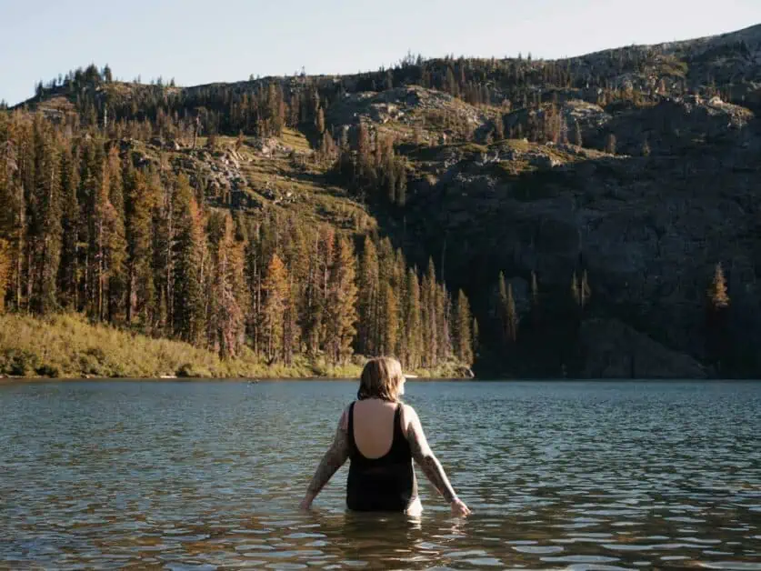
This relatively short but steep trail, climbing from Castle Lake to the much smaller Heart Lake, packs in some of the most spectacular views in the area. In winter, this route is also a relatively accessible snowshoeing route as the access road to the carpark at Heart Lake is regularly ploughed to keep it clear of snow. The views over Castle Lake towards Mt. Shasta in the distance are truly spectacular and make this trail well worthwhile. Castle Lake freezes in winter, but during the warmer months it’s also a great spot for canoeing, paddleboarding and swimming.
9. Girard Lookout Tower and Ridge
Difficulty: Easy to moderate
Distance: 14.2km/8.8mi there and back
Elevation: 194m/636ft ascent
When to do it: Year-round
Starting on forestry roads, the first part of this route takes hikers to the Girard Ridge Lookout Tower – a historic fire lookout tower that offers spectacular views of both Castle Crags and Mt. Shasta (you can also book to stay in the tower if you wish), then, you double back on yourself before following the trial along Girard Ridge – which offers wide panoramic views out over the surrounding landscape. The route shown here is relatively long, but the great thing about this route is that it can easily be shortened or extended to taste. Cutting out the ridge section entirely and simply walking to the lookout tower makes the hike considerably shorter and, arguably, still delivers the best view on the hike.
10. The Horse Camp and Hidden Valley Camp on the slopes of Mt Shasta
Difficulty: Moderate to hard
Distance: 9.2km/5.7mi there and back
Elevation: 695m/2280ft ascent
When to do it: Mid-May to mid-July, dependant on weather
Summiting Mt. Shasta is certainly an achievement many will aspire to, but the reality is that the route is tough, technical, and extremely physically demanding. What’s more, the route is often attempted over two (or even three) days, requiring a major time commitment that may well be at odds with travel plans. This hiking route gives you the opportunity to sample the ascent of Mt Shasta, following the Avalanche gulch route to Sierra Club managed Horse Camp (where you can camp or bivvy for a nominal fee if you wish), before diverting off this route to the Hidden Valley Camp Site. This trail is still recommended for advanced and confident hikers, but it is far less technical than the full Avalanche Gulch ascent, stays clear of the worst of the scree and also tops out at 2805m/9202ft, so the Summit Permit required above 3048m/10000ft on Mt. Shasta is not required.
Camping in Shasta Cascade
There are numerous campsites – run both privately and by the US Forest Service – in the area and the amenities they offer vary tremendously. Some are very basic, offering only minimal pitches, perhaps some picnic benches, a water pump or spigot and vault toilets. Whilst others are more developed and might feature flushing toilets, have on-site shops or small cabins available. Campsites on roads are generally accessible by car and are popular with those using RV’s.
Campsites fees are not standardised and, in many sites, – especially those that are less developed or that work on a first come first served basis – must be paid in cash at fee deposit boxes. These don’t offer change, so if you anticipate using these sites, it’s handy to carry a lot of small denomination bills.
Choosing a Campground or RV Park
The US Forest Service has a helpful interactive map that shows many State and Federally run campsites in the Shasta Cascade area and the recreation.gov website also lists numerous camping options. Whilst many of these sites are vehicle accessible, they may not be suitable for very large RVs and it’s also worth bearing in mind that many of the State and Federally run sites have a limit on many consecutive days you can book to stay for. Additionally, there are numerous private resorts, RV parks and campgrounds in the area. These private sites will often have cabins of various types available ranging from very basic to quite luxurious. It’s well-worth taking a bit of time to research any site you plan to stay in.
It’s always best to reserve camping sites and RV parking in advance. Whilst it is certainly possible to just turn up and pay at some sites, the reality is that many get fully booked well in advance and trying to find a pitch on short notice – especially at weekends – can be a stressful experience that may necessitate you camping far away from the areas you wish to visit.
Lake Siskiyou Camp Resort
Lake Siskiyou Camp Resort sits on the shore of lake Siskiyou with epic views out over the lake to Mt. Shasta. This large resort offers the full range of experiences, from several different types of tent sites (ranging from rustic, through to sites with electric hook-ups); Cabins and RV pitches too. There’s an on-site bar and café and Mt. Shasta City is just a short drive away too. Being on the lake, the resort offers boat moorings, small boat, paddle board and kayak rentals and also has a kid-friendly aquatic play centre.
Castle Lake Campground
Castle Lake Campground is a relatively short distance from Siskiyou Camp Resort, but it couldn’t be further away in terms of experience! Described as a ‘primitive campground’ facilities here are very minimal – there’s no drinking water available, though there are vault toilets. There are no fees to pay, and reservations are not accepted.
Panther Meadows Campground
The excellently named Panther Meadows Campground is the highest campsite on Mt. Shasta, situated at the tree line at 2286m/7500 ft. and offering tremendous views of the peak and surrounding landscape. As with Castle Lake Campground (above), this small site is considered a primative campsite, with minimal facilities. There are vault toilets, picnic benches, fire rings and that’s it. Water is available from a nearby creek, but is not suitable for drinking unless purified. Bookings are not possible at this site and there is no fee to pay. It is open from early July to early November each year and has a three day stay limit.
Girard Ridge Lookout
The Girard Ridge Lookout is a historic fire lookout tower that was originally built in 1931. Modern satellite technology has made these towers obsolete, but many of those that remain are now offered as accommodation and you can book the Girard Ridge Lookout for up to three consecutive nights. This is a basic camping experience – whilst it is covered, there’s no running water or cooking facilities – but it is also certainly very special, with incredible views (as you might expect from a lookout tower!) of both Mt. Shasta and Castle Crags across the valley. If you are looking for something different this could well be it.
Backcountry Camping and Wilderness Areas
If you’re wanting to get further into the outdoors, you can of course backcountry camp too, and in fact, many areas in the Shasta Cascade are suitable for overnight trips, especially in the wilderness. This means you can break up demanding hikes into longer experiences or simply take a few days away from it all. Below we’ve outlined key considerations for backcountry camping in the area.
Acquiring necessary permits
Permits are required for certain activities in the Shasta Cascade, though fortunately, the permitting situation is not as complex here as it is in other parts of the United States. The key permits most visitors may need is a California Campfire Permit. This is necessary if you want to build a campfire, use a barbecue or even use a camping stove outside of a developed camp site or recreation area anywhere in California (and, as such, it may be necessary even if you aren’t camping). These permits are free, and they are issued online after watching a short video and taking a quiz on fire safety at the Ready for Wildfire website.
The other key permit requirements centre on Mt. Shasta itself. Wilderness permits are necessary when entering the Mt Shasta Wilderness area – these can be self-issued without a fee at various trailheads near the bounds of the Wilderness. The only other permit to bear in mind is the Mt Shasta Summit Pass – only necessary if you intend to climb above 3048m/10,000feet. There’s no quota on these, but they do currently cost either $25 per person (valid for three days) or $30 per person (valid for a year) and are available at the Mt. Shasta and McCloud Ranger stations.
Whilst it’s strictly not a permit, there’s a day use fee – currently $8 per vehicle – to entre Castle Crags State Park and you’ll need to pay this if you want to reach the trailhead for the popular Castle Dome or Vista Point hikes.
Recommended routes and safety precautions
There are countless opportunities for overnight hikes and backpacking in and around the Shasta Cascade. Many of the hiking trails we’ve listed above are suitable to be turned into multi day adventures, and you’re also equally able to join together various routes to make something fit for your needs. Castle Lake to Heart Lake is especially picturesque. The Trinity Alps Wilderness is also a wonderful spot for backpacking, especially if you like solitude. As is the Caribou Wilderness. The US Forest Service website has some great resources on areas that are suitable for backpacking.
In terms of camping on the trail, you’ll need to check Recreation.gov, by looking at a map around the area you’re hoping to camp and inputting the name of the area into the website to find out if permits are required for that specific place. This is more of a precaution than anything just to make sure you’re covered. Some backcountry areas already have recognized areas suitable for setting up camp, so it’s worth studying a map in advance.
Safety is, of course a vital consideration on any hike, and especially when backpacking. The following should be considered before heading out in the Shasta Cascade:
- Check the weather and plan accordingly – this means bringing appropriate clothing and equipment. Also be prepared for the weather to change – layers are a great idea!
- Bring sunblock and bug spray – It’s possible to get sunburned even on a cool day and that’s extra relevant at high altitude. Also, be prepared for biting insects in the warmer months!
- Special considerations: Check in advance to see if there are any special considerations you need to know about animals, bear safety and whether you need a permit for your cooking equipment etc. The US Forest Service have resources on this.
- Bring plenty of food and water – This one is essential. Remember to bring extra water in the warmer months too. If you’re going to be backpacking near a lake or source of water, check if you need to treat the water before drinking and check any filtration devices work before you head out.
- Download your map (or bring a hard copy!) – You can’t rely on cellular service in the wilderness, so be sure you have an offline map or a hard copy map and compass and be sure you know how to read it too.
- Tell someone where you’re going – Even the most experienced hikers and backpackers can have accidents, so be sure to tell someone where you’re going and check in with them when you return. That way, there’s someone to raise an alarm should an accident happen.
Recommended spots for solitude seekers and stargazers
The amount of wilderness and uninhabited space around the Shasta Cascade is vast and there’s far less light pollution than you’ll find in the more developed parts of California. All of this makes the Shasta Cascade a great place for those seeking solitude or wanting to look at the stars. The forest around Dunsmuir, Mt. Shasta City and Lake Siskiyou are a great example of where you can readily find solitude and dark night skies, being far from major sources of light pollution and having several undeveloped camp sites.
Activities other than hiking
Hiking is the obvious activity in the Shasta Cascade, but it’s certainly not the only activity the area is well suited for. The area’s vast network of fire roads lend themselves well to mountain and gravel biking and the area is also a great place for nature watching – the birdlife in particular is exceptionally varied and abundant. There’s also plenty of water in the area and boating, canoeing, kayaking, paddle-boarding and open water or wild swimming are all popular in the area. Many of the forestry roads are popular with 4×4 or ATV/OHV and dirt bike owners too. And, of course, the night skies get very dark there too – with less of the sources of light pollution you find elsewhere in California, the area is a great spot for star-gazers and astronomical photography too. In winter, the area receives significant snow fall and winter sports like skiing (both alpine and cross country), snow shoeing and riding ski mobiles are all popular too.
Winter Camping in Shasta Cascade
Winter camping – and specifically camping in the snow – is possible in the Shasta Cascade and whilst it’s not recommended for novice campers, for those with the right experience, it opens up the prospect of some unique adventures including multi-day snow-shoe hikes or cross-country ski tours. Winter camping in the Shasta Cascade can provide an experience of solitude in nature that few people will ever get to have. Fun as they are, deep winter activities come with their own set of risks and it’s especially important to be properly prepared for them.
Leave No Trace principles to uphold
The natural landscape around the Shasta Cascade is stunningly beautiful and it is important that we take every step we can to preserve its splendour, not just for others to appreciate but also so the ecosystem can continue to thrive. Leave No Trace is a set of principles intended to help you do just that. There’s much more in-depth information on the lnt.org website, but the seven key principles are as follows:
- Plan ahead and prepare
- Travel and camp on durable surfaces
- Dispose of waste properly (often associated with the message that you should pack our what you pack in)
- Leave what you find
- Minimize campfire impacts
- Respect Wildlife
- Be considerate of others
By following these guidelines, we can all help do our part to preserve and protect the wild places we visit.
Accommodation and Lodging: Where to Stay Nearby
We’ve concentrated on camping and more outdoor-oriented accommodation options in the Shasta Cascade so far, but there’s so much more available in the area, from hotels to self-catering cabins:
Cave Springs Resort
Cave Springs Resort is located on the outskirts of Dunsmuir and is a great location to explore the area around Mt. Shasta and Castle Crags. This resort has a small hotel and also offers a range of cabins of various sizes plus a number of the iconic aluminum-skinned Airsteam’s serving as smaller cabins. The experience is more design-hotel than rustic camping, but the cabins are well fitted out, there’s some great amenities on site (there’s an outdoor pool and a kids play area), and the location is fantastic – with both Dunsmuir and Mt. Shasta City with all their amenities a very short drive away.
Hotel Dunsmuir
The Hotel Dunsmuir – is a historic hotel right in the centre of Dunsmuir. Originally dating back to the nineteenth century, the hotel’s current art-deco form dates to the 1940s and the owners have kept the rooms and décor as historically accurate as possible. This is quirky and vintage rather than modern and luxurious.
LOGE Mt. Shasta
LOGE Mt. Shasta, located on the edge of Mt. Shasta City is a design-led hotel tailored for those looking to experience the outdoors and, as such they can organise equipment rental for you too should you need any snow, cycle, climbing or water sports gear. Their on-site Finlandia Café does great barista coffee too.

Food: Where to Eat in Shasta Cascade and Nearby
There are countless places to eat around the Shasta Cascade. Mt Shasta City in particular has a buzzing social scene. A few stand-out locations are listed below:
- Pipeline, Mt Shasta City. This gastro pub offers a classy take on American and Mexican classics, with an extensive craft beer and wine menu to boot.
- Yaks on the 5, Dunsmuir. This quirky restaurant offers gourmet burgers and a huge selection of craft beer. Plant based options are a little thin on the ground.
- The Wheelhouse, Dunsmuir. Offers American style food with an extensive sandwich menu and a range of craft beers on draft.
- Yaks Shack, Mt Shasta City. This is not just another branch of Yaks as it has a substantially different menu to Yaks on the 5. This is a great place for plant-based options.
- Mosaic, Redding. This classy restaurant offers pizza alongside modern takes on American classics.
- Berryvale Grocery, Mt. Shasta. Not technically a restaurant, but organic and whole food/natural grocers offering high quality food, sandwich options and many more.
Things to do in Shasta Cascade: Must-Visit Destinations
The Shasta Cascade is a vast area and it’s no exaggeration to say that there’s a lifetime of hiking, exploration, and adventure in this area. If you’re spending a week or even two here, you can only hope to scratch the surface. That said, there are several key places that really stand out and are well worth taking the time to search out on your visit.
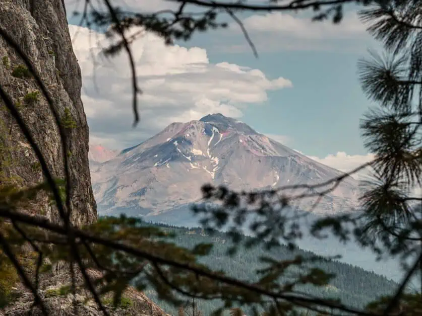
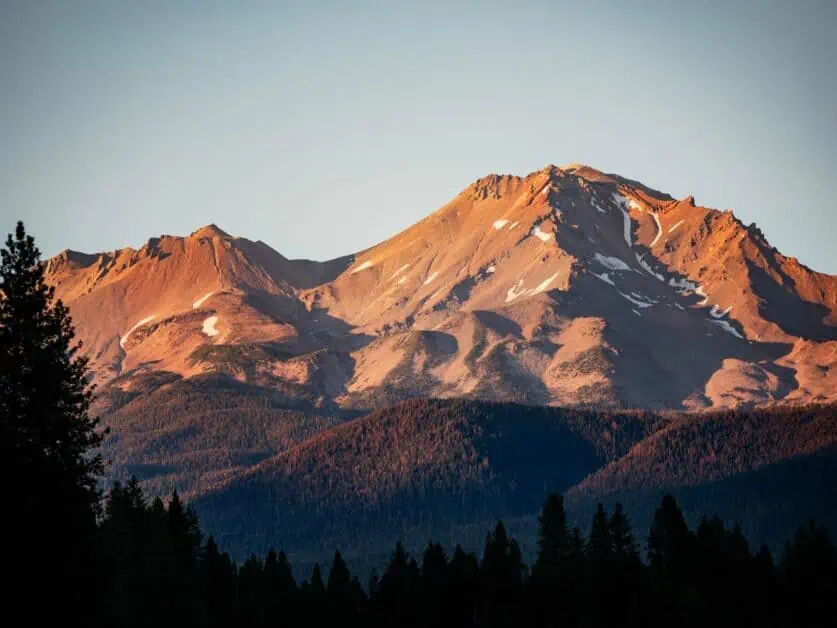
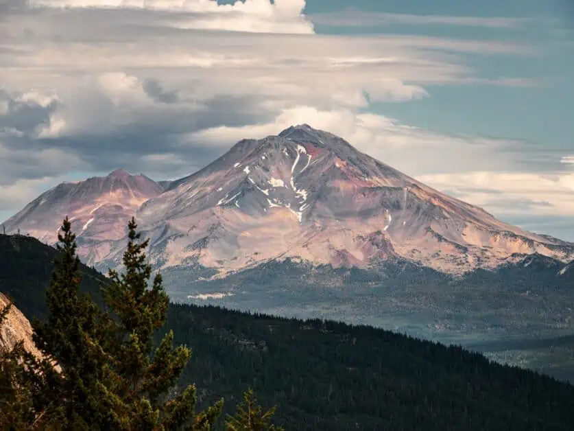
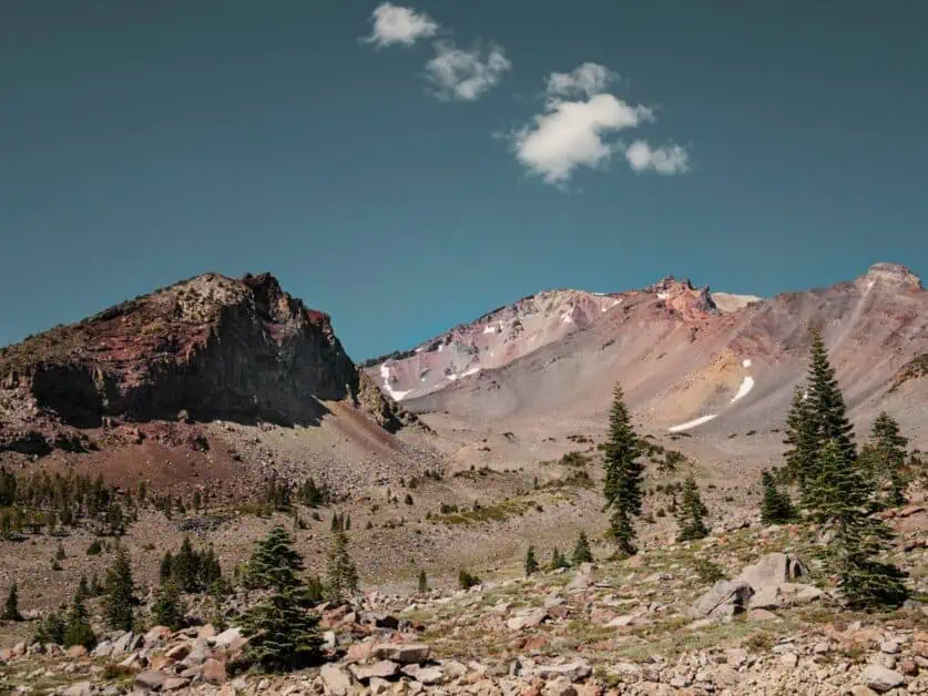
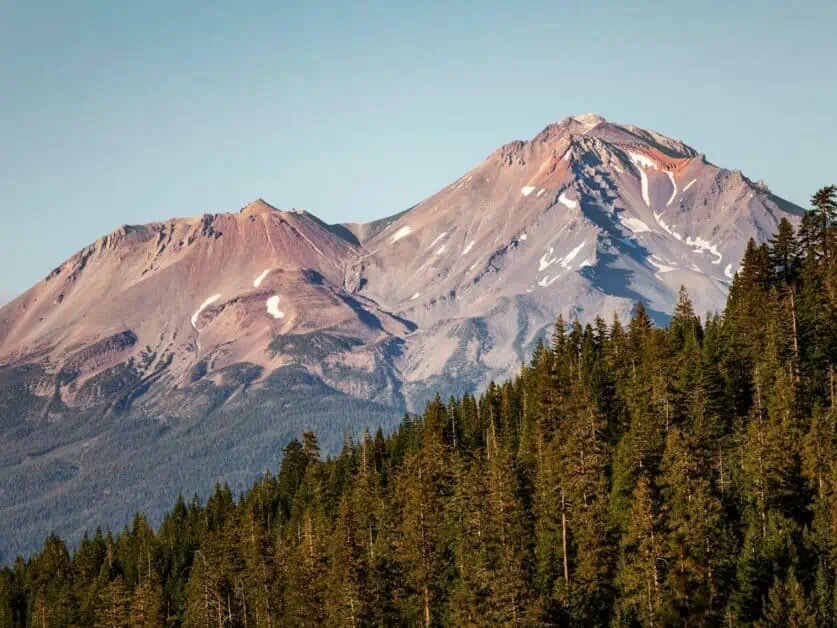
Mount Shasta
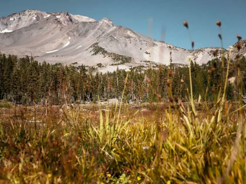
The 4317m/14163 summit of Mt. Shasta dominates the landscape around the Shasta Cascade area and is a presence in many of the area’s most iconic views. Mt. Shasta is a volcano. It’s formally classed as a ‘Stratovolcano’ or ‘Composite Volcano’ – and indeed it may be active. This high mountain – it’s the fourth highest in California and the seventeenth highest in the ‘Lower 48’ – often has snow cover well into the Summer and is home to a number of glaciers. As you might expect, Mt. Shasta is a magnate for mountaineers and hikers, though the fact that it is well away from major cities means it never gets as busy as some of the other well-known peaks in California.
Whilst summiting Mt. Shasta may prove too ambitious for many hikers – it is a demanding mountaineering route over technical terrain, all at considerable altitude – there are still plenty of excellent hiking opportunities on the lower slopes of the mountain, suitable for a much wider range of ability levels. Entry into the Mt. Shasta Wilderness area requires a free wilderness pass available at the Mt. Shasta and McCloud Ranger stations or they can be self-issued at trailheads. Bear in mind that many of the trailheads on Mt. Shasta are still at considerable altitude and thin air can make even a seemingly simple hike seem much tougher.
Mt Shasta’s holds very special significance for several Native American tribes. In Klamath legend, for example, it is the home of the Spirit Chief or Sky God, Skell. Mt. Shasta also features as a refuge in Native American Flood Myths. The Mt. Shasta wilderness is also one of the many claimed homes of the mythical Sasquatch or Bigfoot – itself derived from Native American Myth. In more recent times, the mountain has gained significance in New Age Spirituality, has been linked to numerous UFO sightings and served as a muse for countless artists and writers. What’s clear from all of this is that the mountain holds a grip on the imagination of those who see it – and one has just to look at the beautiful colors it takes on before sunset and the unusual cloud formations that can often be seen around its summit to begin to understand how some of these stories and associations may have taken shape.
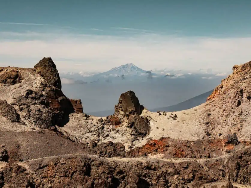
Lassen Volcanic National Park
We can’t talk about the Shasta Cascade without also mentioning the nearby Lassen Volcanic National Park which is roughly two hour’s drive (approximately 160km/100miles) South East from Mt. Shasta City. We have written a dedicated guide to Lassen Volcanic National Park, so be sure to check it out. Comprising a vast area of the Southern Cascade Range of mountains and a surrounding wilderness, the landscape in the park has been shaped by volcanic activity (some as recently as 1917 – that’s no time at all in geological terms) and is home to a range of true natural wonders. Visitors will encounter all four major types of volcano – Plug Dome, Composite, Cinder Cone and Shield – normally not all seen together in the same place, alongside otherworldly, active geothermal vents from which steam, boiling water and scalding mud bubble up form below the earth providing evidence that the volcanic processes that shaped the park are still very much active (though they pose no immediate threat to visitors). This National Park, which, due to its relatively isolated location receives a fraction of the visitors that other National Parks do, hosts some fantastic hiking trails, ranging from shorter family-friendly routes to more advanced, high altitude mountaineering trails. Lassen Volcanic National Park is also home to a wide range of plant and animal species – and indeed the biodiversity will be an attraction in itself for some visitors. Heavy snow closes portions of the park each year, so be sure to check accessibility before you visit.
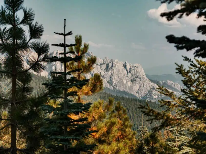
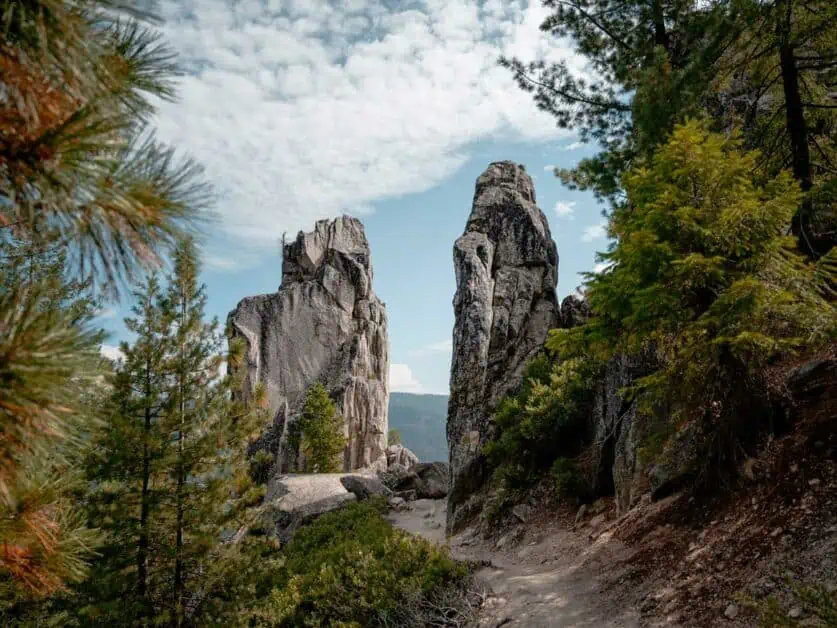
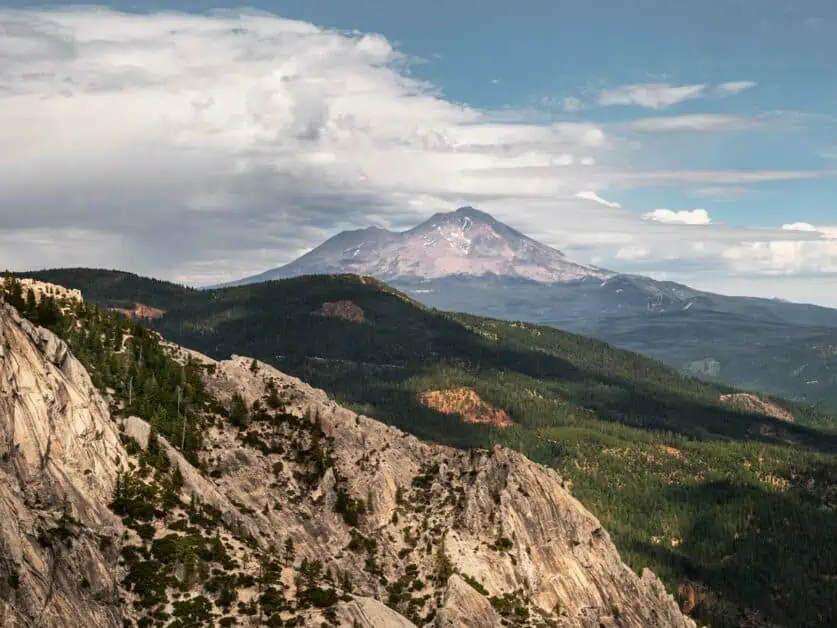
Castle Crags State Park
After Mt. Shasta itself, the spectacular Castle Crags are certainly the second most distinctive landmark in the Shasta Cascade region. If you’re approaching the Shasta Cascade from the South via the 5 Highway, you’ll catch your first glimpse of Castle Crags from the road: An imposing wall of jagged grey rock emerging above the tree line along the path of the Sacramento River. Castle Crags State Park encloses the crags themselves and surrounding forest. The park is absolutely a must-visit in the area and is home to roughly 45km/28miles of hiking trails, ranging from shorter, wheelchair accessible paths to much more technically demanding long-distance routes. Some routes start outside the park, but many are completely within the park’s bounds. The park also has 76 developed campsites (these may be reserved online – and advanced booking is advised) – this means the sites have bear-proof food lockers, picnic tables and facilities such as flush toilets, showers and (of course) drinking water are also available. The State Park is subject to a day use fee which is $8 per vehicle at the time of writing – payable by cash or card and the entry gate. Hiking is, of course, the key activity in the park and the very short (and wheelchair accessible) Vista Point trail is definitely worth walking as it delivers spectacular views of both the Crags and nearby Mt. Shasta. The hike to Castle Dome – the highest point in the park – is also spectacular – but is a much longer and more physically demanding hike. Aside from hiking, the park is a great place to watch wildlife and is popular with anglers wishing to fish on the Sacramento River. The park is also a great spot to stop during the day for a picnic.
Lake Shasta
Lake Shasta – also known as Shasta Lake – is a vast reservoir roughly 90km/56miles and about an hour’s drive south of Mt. Shasta city. The reservoir is fed by the Sacramento River and was formed following completion of the Shasta Dam. Looked at on a map, this reservoir’s shores twist and snake into numerous branches – following the outline of several flooded valleys. The reservoir is beautifully scenic and is deservedly popular for water sports and hiking. There are a number of marinas and recreation areas on the lake shore and these are a great spot to stop for a break on your journey to Mt. Shasta. Camping is also available, though due to fluctuating water levels in the reservoir, it’s advised to check ahead to see if specific campgrounds have bene closed.
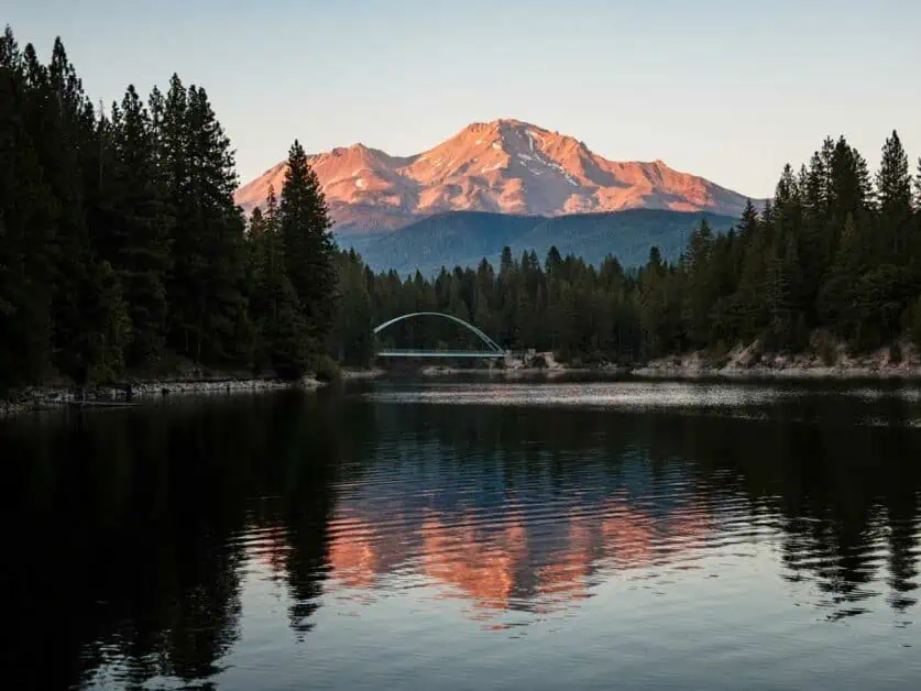
Lake Siskiyou and Castle Lake
Located just outside Mt. Shasta City, Lake Siskiyou is another reservoir formed by a dam on the Sacramento River. Compared to Lake Shasta and Almanor, this lake is far less massive and relatively undeveloped. However, this lake is also spectacularly beautiful and its proximity to Mt. Shasta means you can get some incredible views of the mountain from its shores – especially from the area around Lake Siskiyou beach and near the Wagon Creek Bridge. There’s plenty of hiking opportunities in the surrounding forests along with a more developed resort camp site for accommodation. As you’d expect, the lake is popular with anglers and is a great spot for canoeing, kayaking, and swimming – though bear in mind that as it’s a reservoir, it does get very deep very quickly in places. Castle Lake is a short but scenic drive from Lake Siskiyou – a drive that offers some great viewpoints on Mt. Shasta. Castle lake itself is a much smaller but also wilder alpine lake. This is another great spot for hiking and swimming.
Lake Almanor
Lake Almanor is roughly 225km/139miles (a 2:30hrs drive) from Mt. Shasta City. Whilst it is certainly not in the same neighbourhood, many visiting Mt. Shasta will try to include a visit to this huge and spectacular lake. The lake is well-developed, with extensive marinas, holiday lets and camp sites around Lake Almanor Peninsula and the town of Chester. Those seeking a more absolute experience of solitude and nature might find the lake a bit too developed – and it certainly seems a lot less wild than the areas immediately around Mt. Shasta. However, beyond the developed areas, there are still plenty of wild places around the lake, with a huge network of trails and fire roads extending into the surrounding forest. The lake is also a stunningly beautiful location – great for boating, kayaking and swimming and, as you might expect, it is very popular with fishermen. The wetlands surrounding the lake are a fantastic spot for bird watchers and you’ll also get fantastic views towards Mt. Lassen from here. The proximity of Chester, right on the lake shore, a relatively large community with numerous bars, restaurants and supermarkets will certainly appeal to many too.
Planning and Preparing for Your Trip
There’s a lot to consider before setting out on your trip to the Shasta Cascade. As mentioned throughout this article, it’s a massive area and there may be considerable distance between some of the places you plan to visit – which may not be helped by the fact that there aren’t always direct road links between places. It may be worth basing yourself in a few different places through your stay to minimise the amount of travel time each day – that’s especially so in months when daylight is a premium.
A car is by far the best way to get around the area. The main roads are all the kind of well-maintained highways you’d expect, but if you plan to travel into wilderness areas or off the main roads, it’s worth bearing in mind that sooner or later, you’ll encounter less well-developed, unpaved forestry roads. Many of these are perfectly fine for normal road vehicles, but some are not and are only suitable for high clearance 4×4 vehicles or ATVs. It’s always better to air on the side of caution with rough forestry roads – even if you’re an experienced off-road driver with an appropriate vehicle – as getting stranded on a remote forestry road could be a very serious problem. Despite all the best intentions when planning, it’s not always possible to know the condition of forestry roads in advance, so it’s always good practice to have a backup plan in mind in case you reach a road that makes your original goal unachievable.
Pay particular attention to the weather when packing for your visit – it’s generally very warm in the summer, but as altitude increases, the temperature drops and high on Mt Shasta, for example, things can get very cold, even in the height of summer. That’s also worth bearing in mind if you plan to do any camping as the night can be much colder than the day at altitude.
As always, Forest and Park rangers are a great resource and often have the kind of local knowledge that can really help with your planning. the Mt. Shasta and McCloud Ranger stations and Castle Crags State Park Ranger Station are all well worth contacting if you have specific questions about conditions or outdoor activities in the area.
FAQs
What are the nearest airports in California to the Shasta Cascade?
Redding Regional Airport is the closest large airport – it is regularly serviced by flights from San Francisco and Los Angeles. For those travelling internationally, San Francisco is the closest major airport.
How long does it take to drive to the Shasta Cascade from San Francisco or Los Angeles?
It is a considerable drive from both! It takes roughly 4hrs drive (442km/275miles) from Downtown San Francisco and just over 9hrs drive (970km/603miles) from Downtown Los Angeles to reach Mt. Shasta City. Southern parts of the Shasta Cascade can, of course, be reached in less time.
When is the best time of year to visit the Shasta Cascade?
May to October is really the prime time for hiking (bearing in mind it will get very warm during the peak summer months). The area receives significant snow fall in winter and whilst this does close some roads, it also transforms the landscape and outdoor activities do not stop! Snow shoeing, cross country or Nordic skiing, alpine skiing and hiking are all still possible in the Winter.
What’s the best way to get about in the Shasta Cascade?
We think that a car – or some other motorised vehicle – is by far the best option for getting about in the Shasta Cascade. There are large distances between many of the attractions in the area and public transport and shuttle services are very limited at best.
Is visiting the Shasta Cascade only for advanced hikers?
Not at all! There are plenty of long distance and advanced hiking routes in the area, but that’s far from all there is. There are countless hiking routes suitable for less experienced and intermediate hikers and what’s more, many of the shorter hikes still deliver fantastic views. The area provides fantastic walks and hikes ranging from well under a mile to multi-day backcountry adventures and everything in between.
Is hiking the only thing to do in the Shasta cascade?
There’s much more to the Shasta Cascade then just hiking. There are many large bodies of water and boating, canoeing, paddleboarding and open water swimming are all popular. Mountain and road biking and off-highway driving are all popular activities. Traditionally, the area is also popular with anglers and hunters. Beyond this, many of the towns and cities – especially so Mt. Shasta City – have buzzing social scenes with a wide range of bars and restaurants.
Conclusion
The Shasta Cascade is probably not what most people immediately think of when you mention California. Indeed, it’s fair to say that outside of America, people may not even know it exists! For international visitors, who will likely arrive in California either at Los Angeles or San Francisco, the Shasta Cascade is certainly off the beaten path, but what it offers is unique and a very different experience to what you’ll find elsewhere in California. The scale of the wilderness here is vast and the possibilities to explore and experience something new are enormous. For those who think they know California or want to see a different side to the state, it’s well worth taking the time to discover this wild and beautiful place.
Disclaimer: This article contains Affiliate Links. You won’t pay any more for buying through these links, but we may receive a commission from any purchases made through them. As an Amazon Associate, I earn from qualifying purchases. If you choose to support us by buying through our links, we thank you as it helps us to continue providing the resources we do to help you enjoy the outdoors more!