
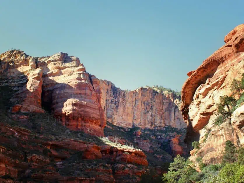
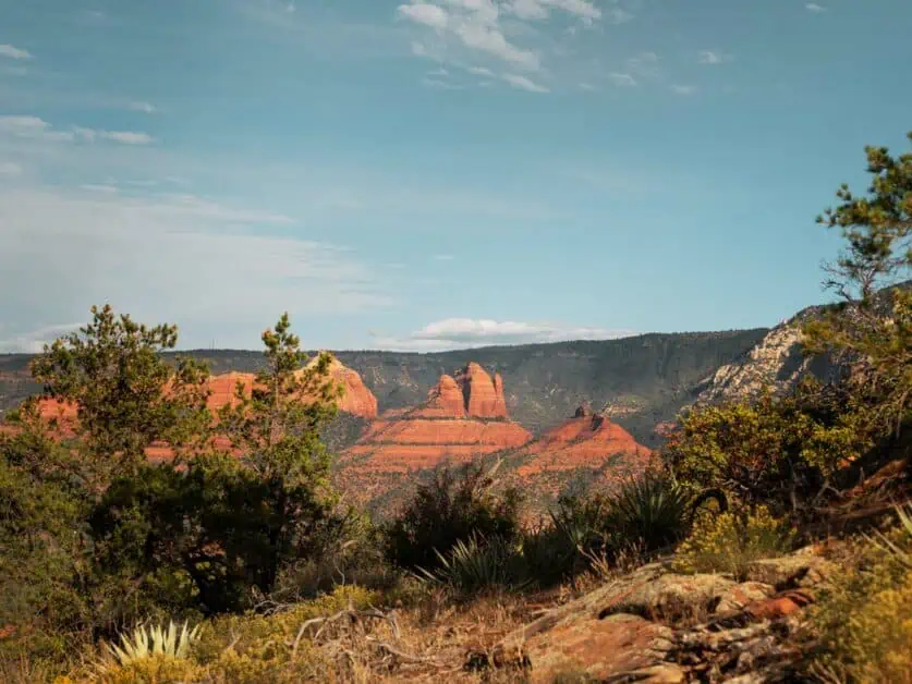
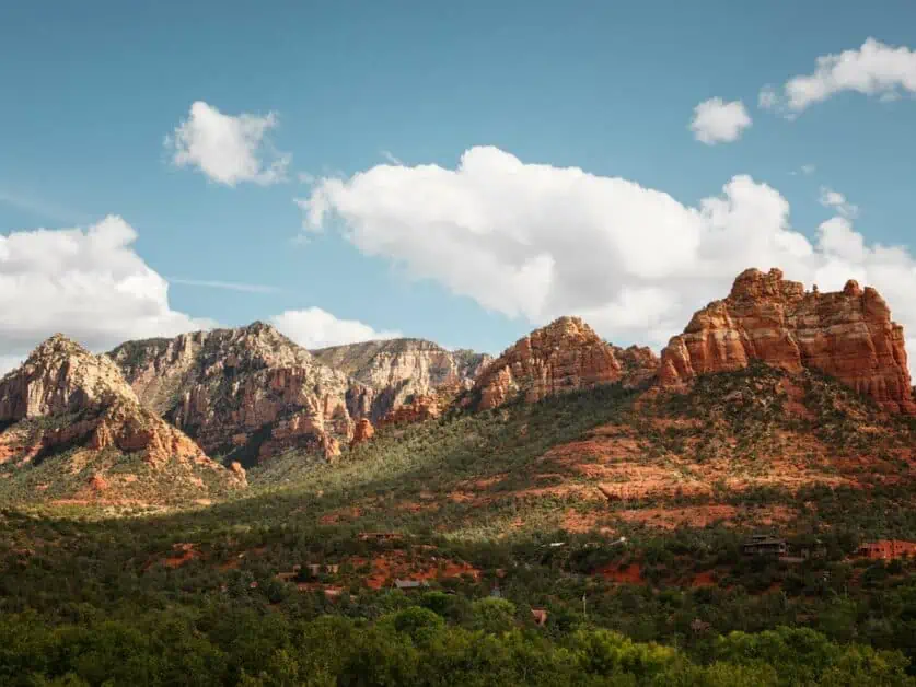
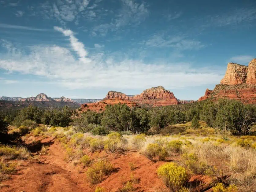
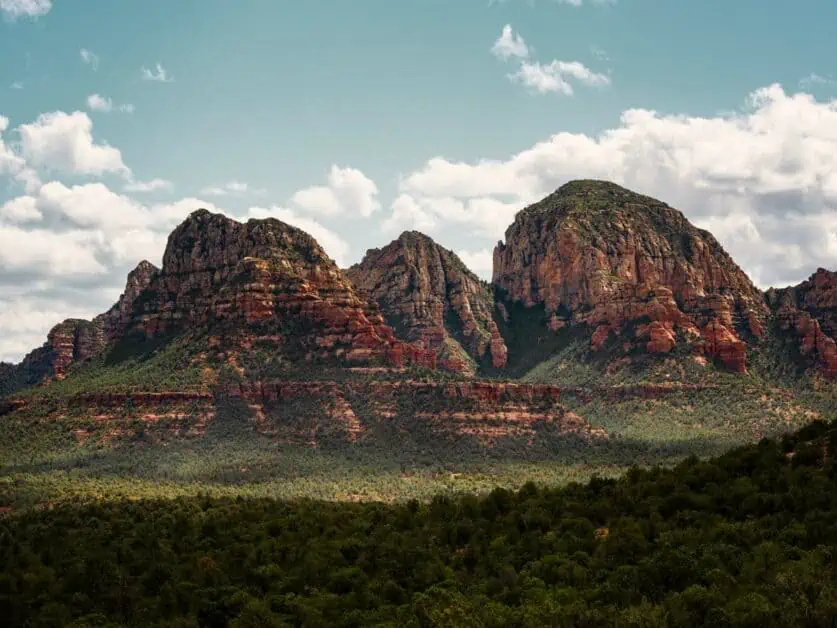
Sedona, Arizona may be one of the best places to go hiking in the world – it has so much to offer and explore and will stay in your memories for a long time! With its iconic red rocks, hidden caves, expansive views, Ponderosa pine forests and vortex sites all near the buzzing city limits that offer plenty of amazing food and drink options, you really can’t go wrong.
What’s more, Sedona offers hiking options all year round. There’s also something for everyone, from shorter trails that boast amazing views to full day adventures that feel wild and rugged. If you’re looking for some inspiration to get your hiking boots on and go explore some of the best hikes in Sedona, you’ll want to read on.
In this guide, we’re sharing 14 of our favorite hikes and covering something for all hikers – from gentler terrain and shorter distances to longer more physically demanding trails. Whether you only have time for one or all fourteen, you won’t be disappointed!
To make things simple, we’ve listed these cool hikes in Sedona from shortest to longest for ease when planning. We’ve also included an overall map of locations, parking and permit information where possible and a downloadable hiking map for each trail we’ve listed to get you on the trail as easily as possible.

Best Hikes in Sedona
Use this map to find hikes near Sedona. The locations are numbered in reference to the hiking trails outlined below.
1. Crescent Moon Ranch
AllTrails map alternative: Crescent Moon Ranch
Difficulty: With little elevation gain over a mainly flat trail with the option to do as much or as little as required, this trail is marked as easy
Distance: 2.4km/1.49 miles
Elevation: 8m/26 ft. ascent and descent
When to do it: This is easy to hike all year round
Parking location: Crescent Moon Ranch – Google Maps location here
Fees: You’ll need a day pass to park here – see info below in hike description
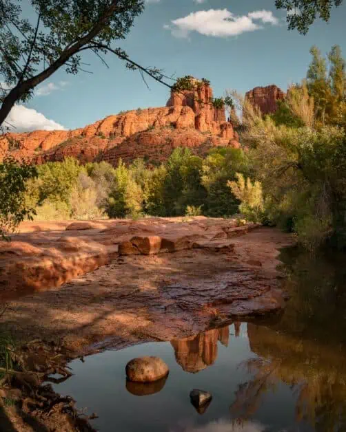
If you’re looking for one of the best vortex hikes in Sedona, AZ, you will want to add the Crescent Moon Ranch trail to your list (and if you don’t know about vortex sites, read our full article on things to do in Sedona to find out more). Aside from that, this trail has some of the best views of Cathedral Rock and if you visit later in the day, you’ll likely see this rock formation reflected in the water holes along the trail. It’s also a one of the best easy hikes in Sedona with water – which can feel very different to a lot of the desert around you.
The great thing about this short trail is you can spend as little or as much time doing it as you wish and it’s also a great place to go swimming in some of the water holes you can see. A great area for this is the large pool shortly after you start the trail from the parking lot. You can also add to this trail to take in more of Oak Creek Canyon and get more of a feel for that true Sedona hiking experience.
You do need to pay for a day use pass when entering from the booth which you can pay with card or contactless and the area is only open at certain times so be sure to plan your visit and hike ahead of time to avoid disappointment. You can find out more about opening times from the US Forest Service website here. You should have no problem finding parking here either as the parking lot is big.
About our free downloadable trail maps: We use Outdooractive maps for all our hiking routes which gives you a live map that you can save offline for your hike. Cell service cannot be relied on around Sedona, so be sure to plan accordingly. We’ve also provided links to AllTrails routes as an alternative where possible.
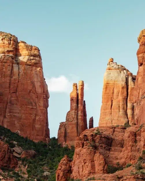
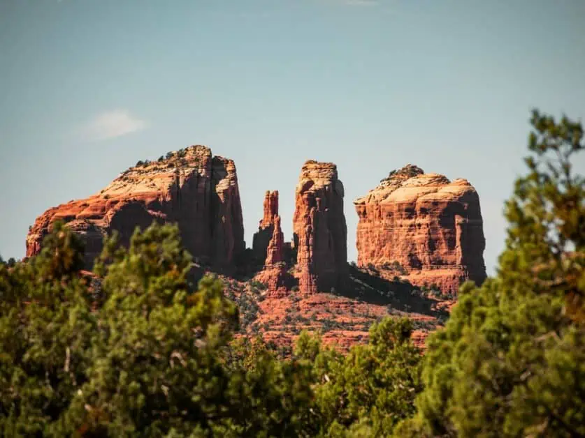
2. Cathedral Rock
AllTrails map alternative: Cathedral Rock Trail
Difficulty: With steep elevation gain over a minimal distance, this is one of the short hikes in Sedona, AZ that is classed as challenging
Distance: 2.8km/1.7 miles
Elevation: 200m/656 ft. ascent and descent
When to do it: You can hike this trail all year
Parking location: Cathedral Rock Trailhead – Google Maps location here. Though there are restrictions, see detailed description below
Fees: As with many of the must do hikes in Sedona, a Red Rock Pass or an America the Beautiful Pass is needed to park here
If you’ve spent any time looking at hikes around Sedona, there is a good chance you’ve heard of Cathedral Rock – it’s a really iconic trail. If you want a quiet trail with peace and solitude, it may be one to avoid, but if you understand it will likely be busy, you will really enjoy what you get to see on this short and sweet hike.
This challenging trail involves scrambling along slick rock (that is so due to heavy footfall) and makes a particularly nice option as one of the best sunset hikes in Sedona – you’ll love this trail!
You can park at the location above, however if you’re going to hike Cathedral Rock from Thursday through Sunday, you’ll need to plan alternatively as you cannot park at the trail. You can use the free shuttle bus in Sedona – from 1294 SR 179 (info on the Sedona shuttle here) and you can park for free at the park and ride. Outside those times, you can also try the Templeton and Baldwin trails as alternate start points, which aren’t always as busy.
3. Birthing Cave Hike
AllTrails map alternative: Birthing Cave
Difficulty: The trail is mostly flat until the cave itself, where the last section to reach the view from the cave becomes a steep, quick climb and scramble. We therefore mark this trail as easy to moderate
Distance: 3km/1.86miles
Elevation: 71m/233ft. ascent and descent
When to do it: Best enjoyed from October to June so is a great Sedona hiking trail in Winter
Parking location: Along Long Canyon Road on the roadside – Google Maps here
Fees: Nothing
You’ll need about one to two hours to hike this trail depending on how fast you go and how many photo stops you make – but in our opinion this is one of the best hikes in Sedona, AZ for the amount of effort put in to rewarding views from the cave itself. When you set off from the parking lot, you’ll find the main section of the trail is pretty flat and on a sandy wash. The climbing for this trail begins just before the cave itself. The last section up to the cave where the incredible views unfold of the surrounding landscape is very steep and can be slightly slippery as there are quite slick rocks in places.
Once in the cave, the walls of it frame the landscape around you and the views are incredibly far reaching. If you want that iconic shot from the Birthing Cave, you’ll need to climb up the back wall slightly and use a wide-angle lens. However, you can also get some great shots just from being in the cave itself. If you want to have the cave to yourself, you’re best visiting earlier in the day. This also helps with parking, as this is just by the side of the road on Long Canyon Road and can get busy as this is the start of a number of other hikes. When you’ve finished taking in the views from the cave, head back down the way you came.
The birthing cave is well known within Native American history in the area – with this cave having been used as a shelter for birthing mothers. It’s really important to stick to the trails as, like many areas in Sedona, cryptobiotic crust is present.
4. Sugar Loaf Loop
AllTrails map alternative: Sugar Loaf
Difficulty: This short Sedona hike is on the easier side, but with some steep sections, we class this trail as easy to moderate
Distance: 3.2km/1.98miles
Elevation: 86m/282ft. ascent and descent
When to do it: This is a great trail to enjoy all year round, but be mindful of heat in the summer months as there is little shade on this trail
Parking location: Sugar Loaf Trailhead – Google Maps location here
Fees: Like many popular hikes in Sedona, you need either a Red Rock Pass or an America the Beautiful Pass to park here
This one of the best hikes in Sedona, Arizona if you’re short on time and want something you can fit in toward the end of a day, as it is perfect toward sunset (and you’ll likely find a spot at the small parking lot at that time). In fact, we’d recommend this trail to anyone as the views from the top of Sugar Loaf are well worth the effort put in. The parking lot does get busy as its quite small and there’s no parking in the area surrounding, so you’re best visiting either earlier in the day or later in the evening. That said, there is usually a flow of traffic so if you come back after exploring somewhere else, you’ll likely get a spot. It’s well worth persevering though as we love this hike.
On the trail, you’ll hike round, and you’ll then come to a hill to head up – this is Sugar Loaf and is where the main uphill section is. Its short and sweet, and well worth the effort. If you wanted to make this trail a little less demanding, you can miss out the summit and follow the loop around alone which will reduce the elevation gain substantially. You’ll love this short hike in Sedona!
5. Fay Canyon
AllTrails map alternative: Fay Canyon
Difficulty: This trail is classed as easy with the moderate section being on the short climb to Fay Canyon Arch that can be avoided if needed
Distance: 4.1km/2.54miles
Elevation: 139m/456 ft. ascent and descent
When to do it: This hike is easily doable all year round
Parking location: Fay Canyon Trailhead – Google Maps location here
Fees: Like many of the best hikes in Sedona, you need either a Red Rock Pass or an America the Beautiful Pass to park here
If you’re looking for one of the best easy hikes in Sedona, AZ, Fay Canyon should make it onto your shortlist. What’s great about Fay Canyon is the trail is pretty much flat, it’s a there and back so you can do as much or as little as you like, and the only ascent is on a section to Fay Canyon Arch which you can avoid if you wish – so you can really make this lovely little trail your own. Oh, and it also offers shade in parts – what more could you want from a couple hours hiking?
In Fay Canyon, you’ll feel surrounded by big nature – you’ll spend time looking at the wonderful and intricate rock formations whilst having the smell of Ponderosa pine trees all around you. Whilst the short uphill section along the trail to Fay Canyon Arch can be avoided if needed, we’d really recommend it as the views from the elevated ground are stunning and well worth the effort.
As with all hikes around Sedona the parking lot can fill up quickly, even though it’s pretty large, so we’d advise going earlier or later in the day. That said, the parking is quite fluid so you should expect to find a parking space without too much trouble.
6. Teacup Trail
AllTrails map alternative: Teacup Trail
Difficulty: This trail is marked as easy
Distance: 4.2km/2.6 miles
Elevation: 108m/354 ft. ascent and descent
When to do it: This trail can be hiked all year
Parking: You can park at the Sugarloaf Trailhead parking – Google maps location here. Please note there is very little parking here, so best to hike earlier or later in the day
Fee: As with many popular hikes in Sedona, you’ll need a Red Rock Pass or an America the Beautiful Pass to park at the trailhead
This is a great, family friendly trail and one that is also fantastic to tack on to the end of a day exploring all the hikes in Sedona. What’s amazing, like many of the easier short Sedona hikes is that you get to see a lot for the effort you put in – think red rock all around and interesting rock formations to explore.
You can hike all the way to Coffee Pot Rock and then turn around, at the base of the mesa. Though this trail is easier, there are loose rocks in places, and you’ll need to keep an eye on your footing. There can also be some slippery rocks too so just be mindful. That said, this is a great trail for beginners or more experienced hikers alike.
Parking is limited at the trailhead, so you’ll want to go earlier or later in the day. It is especially busy at weekends, so make sure you plan in advance and have alternatives. As always, be sure to take sunscreen, a hat and plenty of water as this trail can be very exposed.
7. Airport Mesa/Airport Loop Trail
AllTrails map alternative: Sedona Airport Loop Trail
Difficulty: This hike is classed as easy to moderate – with some steep drop offs to one side on the outbound circuit
Distance: 5.3km/3.3 miles
Elevation: 90m/295 ft. ascent and descent
When to do it: This trail is hike-able all year
Parking: There is a parking lot for this trail – Google Maps location here
Fee: None
This moderately challenging hike will give you some truly stunning views of Sedona – it truly is breathtaking. You may also hear of this hike being called Table Top Mountain too. Either way, you won’t be disappointed that you did it.
The fact that you’re higher up than some of the surroundings means that you get fantastic 360-degree panoramas over the landscape where you can stare out at the red rocks for miles to come.
There’s a steep drop off most of the way around the trail, so if you don’t have a head for heights this may not be the best trail for you, but what that does offer is some pretty impressive photo opportunities and stops along the way. The trail becomes rockier the closer to the top of Table Top Mountain you are and becomes better graded lower down.
The trail is generally one of the quieter ones in Sedona, so it can be a great alternative as a backup plan if one of the other hikes is too busy, and you may find very few people on the trail. If you’re looking for a trail with more solitude, this may well be a great one for you.
8. Courthouse Butte and Bell Rock Trail
AllTrails map alternative: Courthouse Butte Loop
Difficulty: This trail is moderate, especially due to limited shade cover
Distance: 6.1km/3.7 miles loop
Elevation: 117m/383 ft. ascent and descent
When to do it: This is a great trail to hike year round
Parking location: From Bell Rock Trailhead – Google Maps location here
Fees: A Red Rock Pass or an America the Beautiful Pass is needed to park here
If you’re looking for one of best hikes near Sedona, put the Courthouse Butte and Bell Rock trail at the top of your list. You’ll want a half day for this trail – and you’ll forever want to stop to take in the views so plan accordingly. It’s also a well-known as one of the best vortex site hikes in Sedona too.
The trailhead for this hike can get busy, especially so because it’s the starting point of a number of other trails so you’ll want to get there early or later in the day. We find that going around lunch time can be a good moment as a lot of earlier hikers have finished and the afternoon crowds have yet to arrive. That said, shortly after you get onto the loop around Courthouse Butte, you’ll wonder where they’ve all gone because the trail becomes much quieter.
You’ll get to enjoy stunning rock formations on this hike, and you can even take a short and steep climb up Bell Rock to get some amazing sweeping views of the surrounding mesa and red rock the area is well known for.
This hike is exposed so be sure to go with adequate sunscreen, water and a hat and avoid extreme heat.
9. Easy Breezy Trail
AllTrails map alternative: Easy Breezy Trail
Difficulty: This trail is marked as easy to moderate
Distance: 6.27km/3.9 miles
Elevation: 95m/311 ft. ascent and descent
When to do it: Best enjoyed later in the year when it isn’t as hot
Parking: You can park at Cathedral Rock Trailhead – Google Maps location here
Fee: You’ll need a Red Rock Pass or an America the Beautiful Pass to park for this hike
Please note, this trail appears slightly shorter in our Outdooractive Map than it actually is – the distance information above is accurate. The Easy Breezy Trail, kind of gives the name away, but it is essentially a great hike in Sedona where you don’t have to think too much about looking at your trail map so you can focus on enjoying the views all around you. It’s also pretty flat with a few rolling bumps along the way, but nothing too bad and one that you could likely take on if you are slightly more limited in your mobility. You’re basically walking along a wash for most of the hike.
It’s a really lovely trail to enjoy first thing in the morning as the sun is rising or later in the day and in the summer months, it can become extremely hot, so it’s best advised to visit when it’s cooler. You’ll love this trail if you’re looking for something with a sense of solitude and to just relax after a long day. Due to its proximity to Cathedral Rock too, you may want to add this trail to your hike after the busy feel of Cathedral Rock. All in all, this is one of the best Sedona hikes for a low key feel and you won’t want to miss it!
You’ll also need to plan to use the Sedona shuttle if hiking this trail between Thursday and Sunday as there is no parking at the Cathedral Rock trailhead between those times.
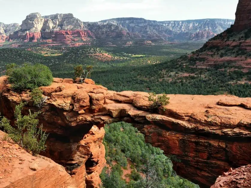
10. Devil’s Bridge
AllTrails map alternative: Devil’s Bridge via Mescal Trailhead
Difficulty: Moderate
Distance: 6.4km/3.97 miles
Elevation: 190m/623 ft. ascent and descent
When to do it: Hike-able all year round
Parking location: Mescal Trailhead – Google Maps location here
Fees: Like many trails in Sedona, AZ, you need either a Red Rock Pass or an America the Beautiful Pass to park here
There are several ways to do this iconic hike in Sedona, and we’ve included information on the quieter version, because even though its longer than the other versions, its much nicer in our opinion. Either way, hiking in Sedona to Devil’s Bridge is iconic!
The main issue for this trail and why there are various options for routes is because of the parking and access to the trail. The trail we love is the hike to Devil’s Bridge from the Mescal Trailhead – where you’ll find signs for Devil’s Bridge to follow. This is much more scenic for most of the way and the parking lot is much less intense, meaning you’re more likely to get a spot. If you’re up for the extra distance, then this variation on the Devil’s Bridge hike is well worth it.
The other two options are to park in the parking lot on Dry Creek Road and head to the trail from there. Though this area fills up early and it can be a nightmare to get a space. With that, you can park along Boynton Pass Road, but walking on the side of the road is fairly unpleasant around there and we don’t advise it as you’ll spend more time breathing in fumes and dust than enjoying the trail.
The other alternative to make the hike even shorter is to take a high clearance 4WD down Dry Creek Road to the small parking lot just under a mile from Devil’s Bridge itself. This is why we recommend the hike from Mescal Trailhead instead.
You’ll follow the trail until you reach the base of the mountain where you’ll head up to Devil’s Bridge itself – there’s rock steps with some scrambling and it is quite steep, but its over quickly and is manageable.
Whilst a lot of the trail done this way will be a bit quieter than some of the shorter trails and alternates you should expect it to become very busy as you reach Devil’s Bridge. Plan enough time if you want photographs of the bridge, as there is usually a line of people waiting for the photograph.
11. Little Horse Trail
AllTrails map alternative: Little Horse via Bell Rock Pathway
Difficulty: This is a great, moderate trail in Sedona
Distance: 6.5km/4 miles
Elevation: 175m/574 ft. ascent and descent
When to do it: Great all year round
Parking: Little Horse Trailhead – Google Maps link here
Fee: As with many hikes near Sedona, you’ll need a Red Rock Pass or an America the Beautiful Pass to park at the trailhead
This trail in Sedona, AZ is a great example of just how varied the landscape can be, even in close proximity to other areas you may already have explored. You’ll start your hike from relatively close to the Courthouse Butte and Bell Rock Trail. In fact, this trail is a great alternative to those ones if they’re busy.
Little Horse Trail is really rewarding – especially the view at Chicken Point and the trail is well graded and looked after – making this trail great for people with slightly more limited mobility or a suggestion as an easy hike in Sedona for elderly visitors.
This trailhead can get busy, and it does have quite a small parking lot, so an alternative is to take the shuttle bus that is provided by Sedona city – this goes from a park and ride located at 1294 SR 179. You can find more details on this here, including up to date times. What’s more, it’s free to travel and you can park for car for free at the park and ride.
12. Bear Mountain
AllTrails map alternative: Bear Mountain Trail
Difficulty: Due to significant ascent and distance, this hike is marked as challenging
Distance: 7.4km/4.6 miles
Elevation: 866m/2841 ft. ascent and descent
When to do it: This trail can be hiked all year, but be mindful in winter, it can be icy and snowy, and spikes may be needed for traction – always travel with care
Parking: You can park at Bear Mountain Trailhead – Google Maps location here.
Fee: You’ll need a Red Rock Pass or an America the Beautiful Pass to park for Bear Mountain
If you’re looking for one of the most challenging hikes in Sedona, then go check out Bear Mountain. With lots of steep step like rocks, slick rocks, and sheer drops, it isn’t something to take on lightly, but you’ll be rewarded with a great sense of achievement. You’ll want to take lots of layers as this trail can be exposed and often windy, this is one of the reasons it gets colder too.
There are lots of sections on the trail where you’ll need to scramble over sometimes loose rocks which can be more hazardous on the way back down, so sure footing is required, as well as good footwear.
Whilst on the trail at the higher elevations, you’ll get a great look out at Fay Canyon. However, you’ve generally got amazing views for the whole trail. If you’re feeling up for it – this is one of the best hikes you can do with your time in Sedona and it should absolutely be high up on your list.
13. Soldier Pass Trail
AllTrails map alternative: Solider Pass Trail
Difficulty: Moderate
Distance: 8.2km/5 miles
Elevation: 258m/846 ft. ascent and descent
When to do it: This is one of the best day hikes in Sedona to enjoy year round
Parking: A tricky one to park for as it’s a very popular trail with only a few parking spots. You can only park between 8am-6pm. Here is the Google Map location for the trailhead. If you struggle, head to the Jordan Road trailhead where you’ll take the Cibola Pass Trail, then the Jordan Trail which connects to Solider Pass Trail. This isn’t a massive detour adding about 1km/0.5 miles to your distance
Fee: None – though if you park at the Jordan Road trailhead, you’ll need a Red Rock Pass or an America the Beautiful Pass
As you might have gathered from the parking situation, this is one of the best hikes in Sedona and is well loved by visitors and locals alike. This hike has some incredible views of everything Sedona is famous for – with plenty of red rock all around.
There are so many cool places to check out and explore on this hike, such as Seven Sacred Pools, which if visited later in the year when there is more water around, give you a brilliant hike in Sedona with waterfalls and is extremely pretty to see. The Devil’s Sinkhole is also another cool feature of Soldier Pass which was formed due to water permeating the limestone rock underground and causing it to collapse – it’s pretty cool to see!
About ¾ of the way along the trail, you’ll come to a fork in the trail to the right, and this gives you the option to visit Solider Pass Cave. It is steep to get up to the cave and will involve scrambling, but it’s well worth the detour and is a pretty unique place.
14. Cockscomb Trail
AllTrails map alternative: Cockscomb Trail
Difficulty: This trail is classed as moderate to challenging due to distance and elevation gain
Distance: 11.2km/6.95 miles
Elevation: 272m/892 ft. ascent and descent
When to do it: This is a great hike in Sedona, AZ to attempt all year
Parking: From Fay Canyon Trailhead – Google Maps link here
Fee: You’ll need a Red Rock Pass or an America the Beautiful Pass to park at the trailhead
If you’re looking for cool hikes in Sedona, then check out Cockscomb trail. You’ll get to climb Doe Mountain which has stunning views of all Sedona has to offer. You can also take in ‘Ground Control’ as a detour if you’d like to make your hike more challenging. Depending on how you feel, you could also add on Fay Canyon at the same time, or same day as it’s the same parking lot and would allow you to utilize time well.
Some of these additions make this one of the hardest hikes in Sedona, and you’ll need a few hours (4+ to enjoy it fully). This hike is on the longer side of the hikes we’ve recommended, but it’s well worth the effort and we guarantee you won’t be disappointed with this trail – the views are mesmerizing!
This is a very popular trail so be sure to head there early (you’ll likely find the parking lot full from 9:30am including weekdays). That said, there is usually a sweet spot between morning hikers finishing and afternoon hikers arriving if you can plan to be there for about 1pm. Although in summer, be warned it can be extremely hot so that is a plan we’d best suggest for hiking in Sedona in October, November, December, January, February and March when its colder.
Best Hiking Trails in Sedona, AZ
As you can see, hikes in Sedona are plentiful – there is so much to do and explore in such a relatively small area. If you’re in a rush and want to find a hike for a specific distance or difficulty, we’ve rounded up some of the best below to give you inspiration for your time out on the trails.
Short Hikes
What’s great about Sedona is that it has a lot to offer in terms of shorter hikes. You don’t have to travel huge distances to still see great things and these are fantastic for tacking onto an already busy day exploring, or if you’re just a little short on time. Most of these hikes pack a punch and the effort to reward ratio is high:
- Birthing Cave Hike: 3km/1.86 miles
- Cathedral Rock: 2.8km/1.7 miles
- Crescent Moon Ranch: 2.4km/1.49 miles
- Sugar Loaf Loop: 3.2km/1.98 miles
Easy Hikes
Sedona is a fantastic example of a place that allows you to get the best of the views for not as much effort and slog – and regardless of why you want an easy hike, Sedona has some of the most enjoyable ones out there. In fact, some of the shorter trails are some of the best hikes in Sedona full stop. You’ll note some of these are the same as the shorter hikes listed above:
- Sugar Loaf Loop: 3.2km/1.98 miles
- Crescent Moon Ranch: 2.4km/1.49 miles
- Fay Canyon: 4.1km/2.54miles
- Teapot Trail: 4km/2.8 miles
Hard Hikes
With all the variety of Sedona, there are of course a whole range of harder hikes on offer – from shorter trails with steep climbs and scrambles through to longer trails that will likely take you most of a day to complete. Add in the harsh Arizona desert environment and you can easily find hikes that’ll reward you well for your efforts:
- Cathedral Rock: 2.8km/1.7 miles, 200m/656 ft. ascent and descent
- Cockscomb Trail 11.2km/6.95 miles, 272m/892 ft. ascent and descent
- Bear Mountain: 7.4km/4.6 miles, 605m/1998 ft. ascent and descent
- Soldier Pass: 8.2km/5 miles, 258m/846 ft. ascent and descent
Day Hikes
Of course, you can turn any hike into a day event depending on how long you want to stay on the trail and what you want to explore along the way – especially if you’re interested in caves, swimming holes or vortex sites, for example. However, there are some trails in Sedona that are absolutely magnificent and deserve to be explored over the course of a day. Here are some of the best day hikes in Sedona:
- Bear Mountain: 7.4km/4.6 miles, 605m/1998 ft. ascent and descent
- Cockscomb Trail 11.2km/6.95 miles, 272m/892 ft. ascent and descent
- Soldier Pass: 8.2km/5 miles, 258m/846 ft. ascent and descent
- Courthouse Butte and Bell Rock Trail: 6.1km/3.7 miles loop, 117m/383 ft. ascent and descent
Dog Friendly Hikes
It can be hard to go hiking in Sedona with dogs, as it isn’t possible to take your furry friend on all the trails and there are quite specific rules and regulations. However, below we’ve listed some of the more dog friendly hikes in Sedona, AZ for you to explore:
- Huckaby Trail: Easy, 8.3km/5.2 miles
- West Fork Trail: Moderate, 10km/6.4 miles
- Wilson Canyon: Easy to moderate, 4.8km/3 miles
- Secret Mountain: Easy, 8km/5 miles
Hiking Trails with Water
Generally, hiking trails in Sedona that involve water are found near rivers. In full summer, you’ll likely find a lot of the pools, and swimming holes empty, but go in the winter/cooler months or after heavy rain and you are likely to find water in these areas. Though generally, Crescent Moon Ranch is one to go for if you want to always see water on your hike:
- Crescent Moon Ranch: 2.4km/1.49 miles, minimal ascent descent (under 10m/49 ft.)
- Soldier Pass: 8.2km/5 miles, 258m/846 ft. ascent and descent
- Fay Canyon: 4.1km/2.54miles, 139m/456 ft. ascent and descent
- Oak Creek Trail: 2km/1.3 miles, minimal ascent descent (under 12m/49 ft.)
Popular Hikes
There is no doubting that Sedona is popular, and what comes with that is some extremely popular hiking trails – for example, if you want to get a photo on the iconic Devil’s Bridge, you will likely need to wait in line, sometimes for well over an hour. So, whether you use this list as inspiration for those bucket list tick offs, or ones to avoid, here is a list of the most popular hikes in Sedona:
- Cathedral Rock: 2.8km/1.7 miles, 200m/656 ft. ascent and descent
- Soldier Pass: 8.2km/5 miles, 258m/846 ft. ascent and descent
- Devil’s Bridge: 6.4km/3.97 miles, 190m/623 ft. ascent and descent
- Courthouse Butte and Bell Rock Trail: 6.1km/3.7 miles loop, 117m/383 ft. ascent and descent
Must Do Trails
As with the most popular trails, there are some absolute must do trails in Sedona, and whilst some of them do tie in to the popular ones (which are popular for a reason) there are also others which we feel are must dos because of the incredible things you get to see and the overall experience:
- Birthing Cave Hike: 3km/1.86 miles, 71m/233ft. ascent and descent
- Cathedral Rock: 2.8km/1.7 miles, 200m/656 ft. ascent and descent
- Courthouse Butte and Bell Rock Trail: 6.1km/3.7 miles loop, 117m/383 ft. ascent and descent
- Sugar Loaf Loop: 3.2km/1.98 miles, 86m/282ft. ascent and descent
Alongside must do trails, it can also be worth checking out guided hikes in Sedona too – the locals generally know of the good spots and can point you in the direction of iconic trails based on your tastes. We’d recommend a company like Sedona Hiking Guides, or alternatively enquiring at the tourism office.
How to Get to the Trail Heads
You have a couple of options for getting to the trailheads in Sedona – one is by car. Though the parking options can be less than perfect, especially at busy times – you can find yourself really looking for a space. You will also either need a Red Rock Pass or an America the Beautiful Pass to park at a lot of the trailheads (we’ve outlined which ones in our main hiking route descriptions above. The other option is the shuttle, which we’ve gone into in more detail below.
Sedona Shuttle
As you may have gathered from the hiking descriptions above, parking in Sedona can be a bit of a headache. Many of the popular trails have limited parking, and you can find yourself without a spot. Whilst you can visit later in the day or first thing in the morning, this isn’t always possible. There are also certain trails that do not offer trailhead parking from Thursday through Sunday, such as Cathedral Rock. This is where the Sedona Shuttle bus service becomes your best friend.
Here are the areas the Sedona Shuttle Bus serves:
- Route 11 – Dry Creek Vista Trailhead: For Dry Creek Vista Trail, Chuckwagon Trail, Girdner Trail, Devil’s Bridge, Mescal Trail, Lizardhead Trail, Snack Trail
Mescal Trailhead: For Mescal Trail, Chuckwagon Trail, Devil’s Bridge, Long Canyon Trail, Deadman’s Pass - Route 12 – Dry Creek Vista Trailhead: For Dry Creek Vista Trail, Chuckwagon Trail, Girdner Trail, Devil’s Bridge, Mescal Trail, Lizardhead Trail, Snake Trail
- Route 14 – Soldier Pass Trailhead: For Solider Pass Trail, Devil’s Kitchen Sinkhole, Seven Sacred Pools, Teacup Trail, Cibola Pass Trail, Brins Mesa Trail, Jordan Trail
- Route 15 – Cathedral Rock Trailhead: For Cathedral Rock Trail, Cathedral Vortex, Templeton Trail, Easy Breezy Trail, Baldwin Trail, HT Trail
Little Horse Trailhead: For Little Horse Train, Bell Rock Pathway, Chicken Point, Llama Trail, Chapel Trail, Broken Arrow Trail
The shuttle is free and is a great, eco-friendly way to explore some of the best hikes in Sedona, Arizona. The Shuttles run throughout the year from Thursday to Sunday (the busiest times) as well as through some holidays and Spring Break. You can even park for free at the park and ride locations. For more information and up to date timetables and locations for park and ride, visit the Sedona shuttle website here.
Ethical and Sustainable Hiking
As tourists, we do have an impact on the places we visit – it’s unavoidable. With Sedona being as popular as it is, it can be hard to make as little impact as possible. However, with a few adjustments, you can minimize this.
When we remember that exploring is a privilege, we can keep respecting the landscape and keep it safe and thriving for years to come. Below are some key ways you can minimize your impact.
Leave No Trace
It’s important when visiting Sedona to try and have as little impact as you can on the environment – whilst the desert can be hostile, it is also delicate and needs to be looked after. You’re likely well aware of Leave No Trave principles, and by practicing these, we can keep the natural environments we visit safe for years to come.
If you’re not familiar with Leave No Trace, you can find out more about the 7 key principles here.
How to be a Sustainable Visitor
Sedona is busy – in fact, it pretty much is all year round. There is no doubt that it’s a popular area and it has become even more so in the last few years, so it’s really important to make sure you look after the places you visit.
One of the best ways to do this is to make sure you have another idea or backup plan if you arrive at a trailhead, and you can’t get a parking spot. You should never park in unmarked areas or where it says specifically not to, no matter how much you want to do a trail. If you want to take on one of the more popular trails, it’s always better to go early or later when it is likely to be quieter. You can also make use of the Sedona shuttle bus service too.
Another idea is to also consider when you visit and where you stay – for example, Flagstaff is only a one-hour drive away and presents a great option (can also often be cheaper to stay in too). You can also shop local whilst you visit which is a great way of supporting local businesses that are vitally important to the area.
Sedona's Hiking Trails: Your Journey's End
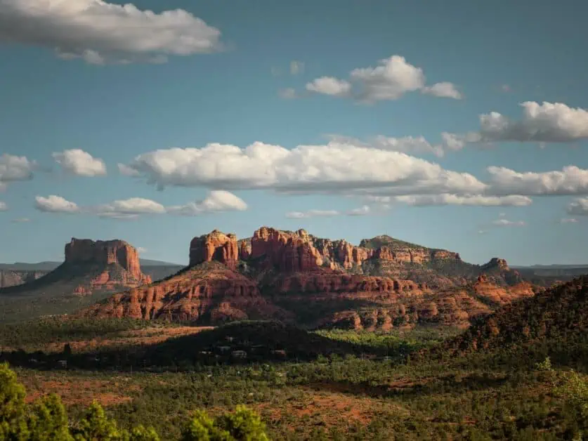
As you can see, hikes in Sedona are plentiful – you can find a trail to suit anyone as there is so much to see and do. What’s fantastic about hiking in Sedona is that you can get just as much from shorter trails with limited ascent and descent as you can harder, more challenging hikes with significant elevation gain, and we love that! When you add in swimming holes, hidden caves, other worldly rock formations and vortex sites, you really can’t find a much more unique place to explore.
Whether this is your first time in the area, or you’ve been numerous times and are just looking for some inspiration for hikes around Sedona, we hope this guide has given you some inspiration for just what’s out there. One thing is for sure – you won’t be disappointed. Sedona will stay in your memories for a long time.
If you’re looking for more information on planning your entire trip, be sure to check out our related article to this, things to do in Sedona.
Disclaimer: This article contains Affiliate Links. You won’t pay any more for buying through these links, but we may receive a commission from any purchases made through them. As an Amazon Associate, I earn from qualifying purchases. If you choose to support us by buying through our links, we thank you as it helps us to continue providing the resources we do to help you enjoy the outdoors more!