
The Italian Dolomites undeniably are home to some incredible outdoor activities. Whether outdoor sports or driving tours are more your thing, there is such a vast array of landscape to explore that you could return time on time again and never become bored. The Dolomites have become incredibly popular, particularly in recent years, and social media, like with many places around the world has had a huge part to play in that. It’s easy when you do a search on Instagram for the Dolomites to find endless pictures of ‘that church’ , ‘that lake’ or the Tre Cime di Lavaredo, and whilst those areas are popular for a reason, there is so much more on offer, with a very different experience to be had. If you’re planning to visit The Dolomites we would really recommend taking in some of the famous hikes in the area, but with the fact that they are so iconic, comes large crowds of people.
If you’re craving a quieter experience of The Dolomites where you can find genuine space, we’ve put together a list of our four favourite, slightly off the main tourist track trails which will allow you to see a different side of the Dolomites, really take in how varied the landscape is and find the opportunity to explore a vaster area.
The hikes we’ve put together all vary in difficulty, length and landscape and we’ve also suggested an ideal time to complete these based on our experiences in both summer and winter in the area. You’ll find many trails that present themselves to you whilst on the original trail. Some of the hikes we’ve provided are to give you a taster of the area, and if you’re feeling like you want to explore more, be sure to take some of the other trails. Traditionally, the Alps are all signposted quite well, but it is always advisable to have a map of the area.
Hiking in the Dolomites Route 1
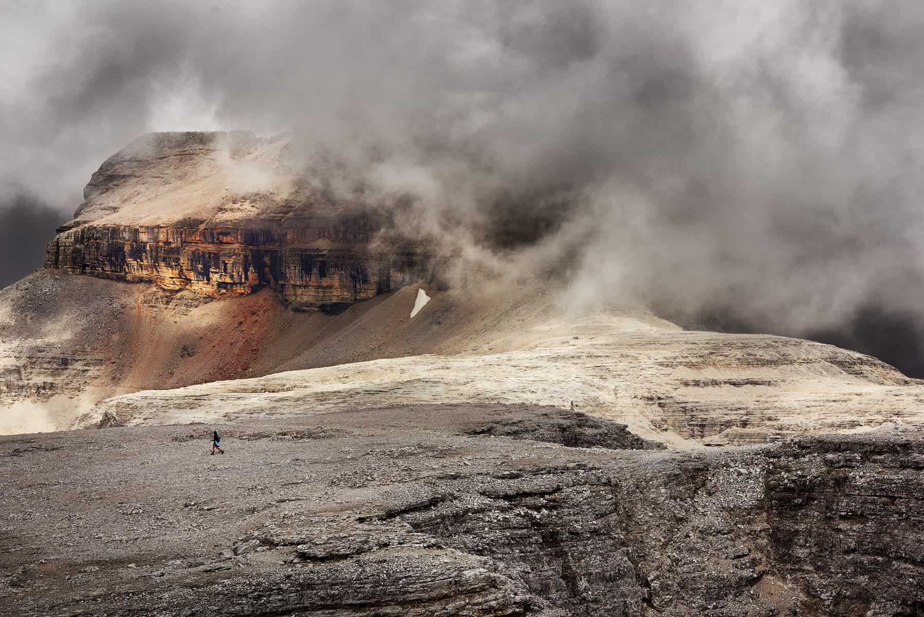
Monte Piana Hike with an alternate view of the Tre Cime di Lavaredo.
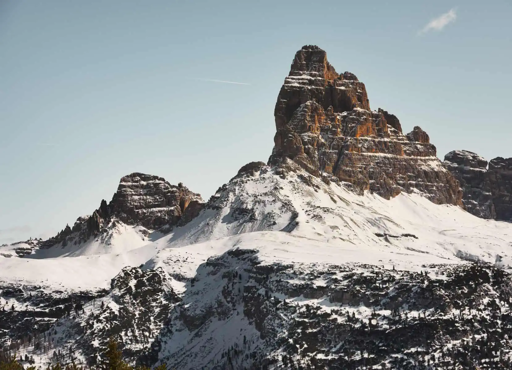
The view from Rifugio Bosi looking out onto the Trees Come di Lavaredo
Parking: On the main road SP49 into Misurina, take a left just before you arrive at Misurina and there will be car parking just on your left. It is free in winter, but must be paid for in the summer months.
Length: 5km one way, 10km return
N.B: In the winter months (between December – end of March there is a Snowmobile service from the refugio at Monte Piana which will take you back down to where you parked. The price of this is 20 Euros per person. These run from 9:30am – 3:30pm. If you are planning to take the return journey down, the office for this is located at the side of the car park. It is best to speak to them before you head up to make sure it is possible that day.
Ascent: 581m
Descent: 716m
Min. Elevation: 1760m
Max. Elevation: 2205m
Difficulty: Medium
Accessibility: The trail is accessible in both summer and winter. In summer, the trail is an access road to the Rifugio, and in winter, the road is essentially a ski piste that is kept groomed by the snow mobile services that serve the area. In summer, normal hiking boots will be fine, but in winter, whilst it is possible to do this hike in hiking boots, we’d recommend snowshoes. Snowshoes are fantastic for helping you to feel much more secure, and whilst the snow is usually compacted down, it is impossible to predict if this is the case all the time: there may be areas that have looser or deep snow. If you’re planning to do this hike with snowshoes, it’s advisable to get a little experience in moving with them on and to be aware that snowshoeing can be quite strenuous so please adjust your expectations based on how you feel on the day – the views are great anywhere along the trail.
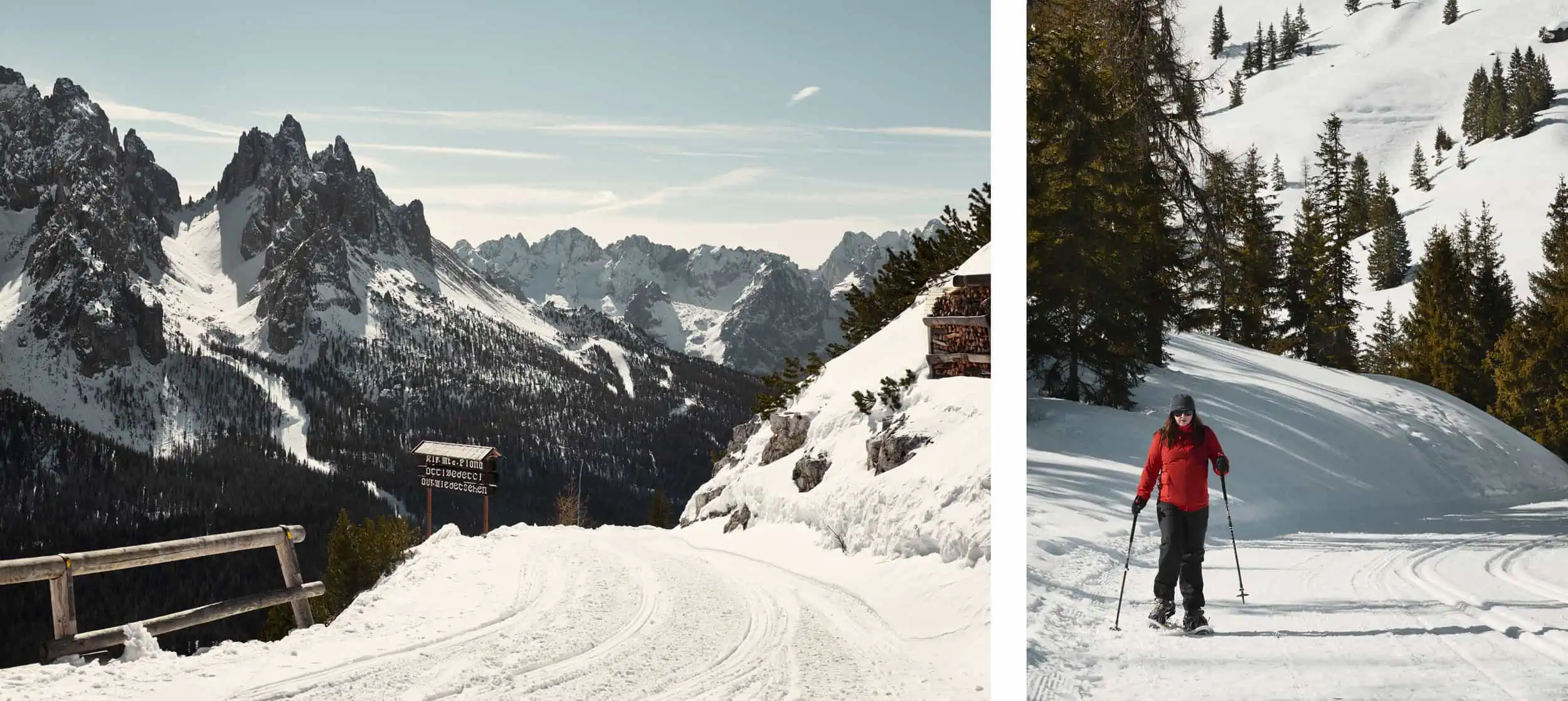
The well groomed, wide winter trail both from the top and as it winds its way up through the forest before the views open out
This high Alpine hike is a great alternative to the incredibly packed Tre Cime di Lavaredo and gives you amazing panoramic views over the Tre Cime from an angle you won’t be quite as used to seeing. Trailing up through Alpine forest, the trail opens out to a wide track that switchbacks up to Rifugio Angelo Bosi al Monte Piano. This is one of our favourite views in The Dolomites and you can be safe in the knowledge that you have one of the quieter views! There is also the option from the Rifugio to take a trail up to the top of Monte Piana, adding a roughly 100m ascent extension, this is possible in both summer and winter (there is a trail cut out which leads from the left as you look straight out at the Rifugio.
Hiking in the Dolomites Route 2
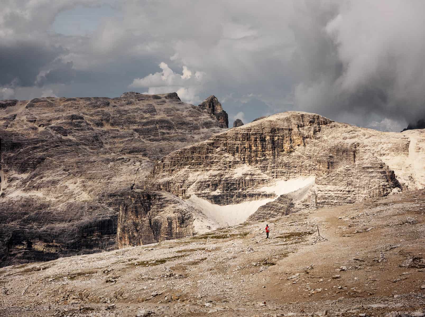
Lago di Val Parola Hike
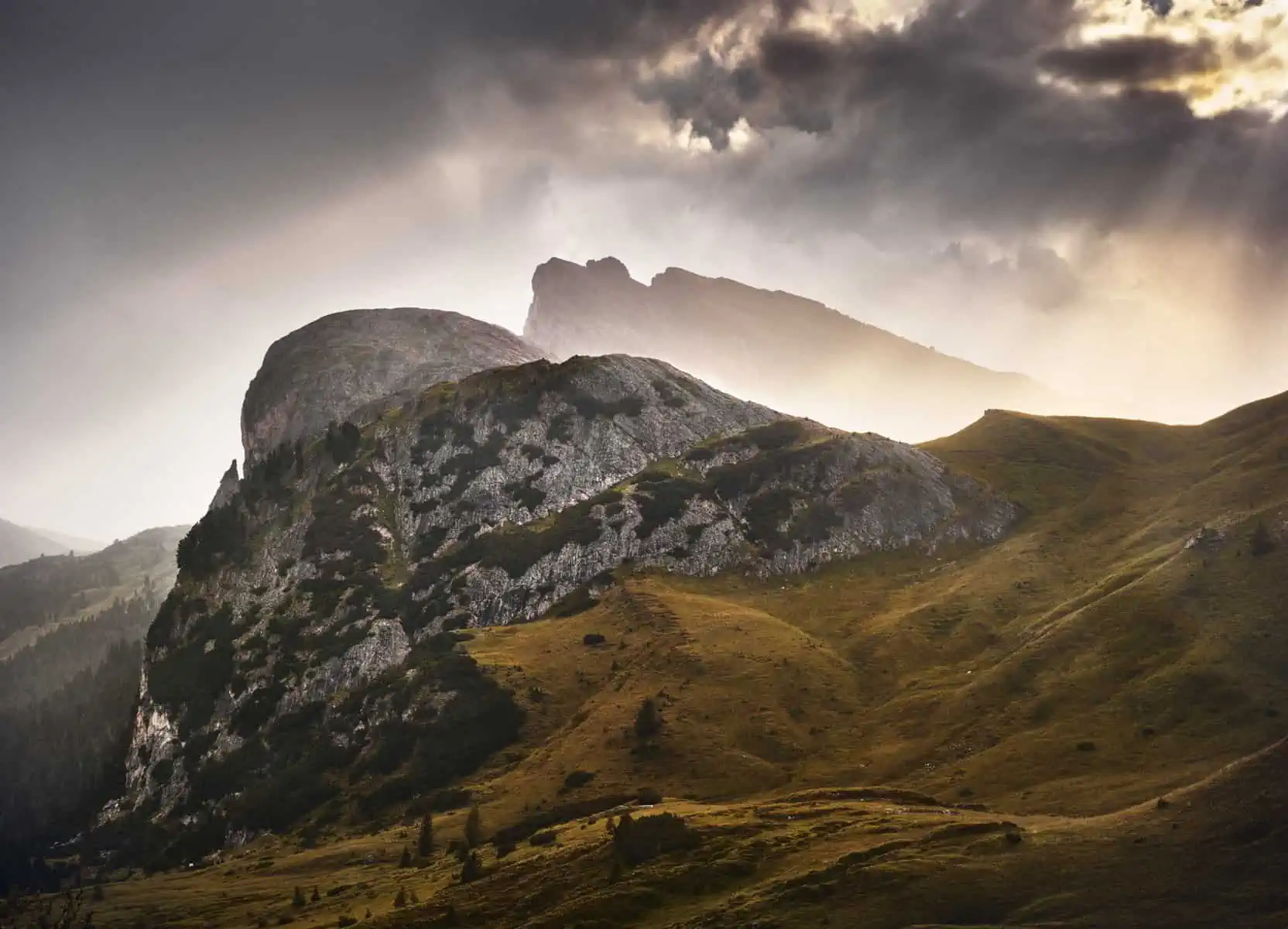
The view from the trail are incredibly beautiful towards the evening where otherworldly shafts of light often peer through the clouds
Parking: If you search for Lago di Val Parola on Google, you’ll see that it’s just off the SP24 road, there are a couple of car parks either side that can be used – it is best to pull in where you see the opportunity. Parking is generally free, or for a small fee. If you’re arriving in winter, the lake will not be visible due to it being iced and snowed over, but the various ski lifts in the area all have open car parks which you can park in.
Length: 4.3 km circular with optional extensions through various trails
Ascent: 326m
Descent: 322m
Min. Elevation: 2278m
Max. Elevation: 2103m
Difficulty: Easy/Medium (because of altitude – this affects people differently)
Accessibility: The trails are accessible both in summer and winter, but route finding can be harder in winter, and you will need to potentially break the trail with snowshoes. Check local weather reports ahead. In summer, the trail is really obvious.
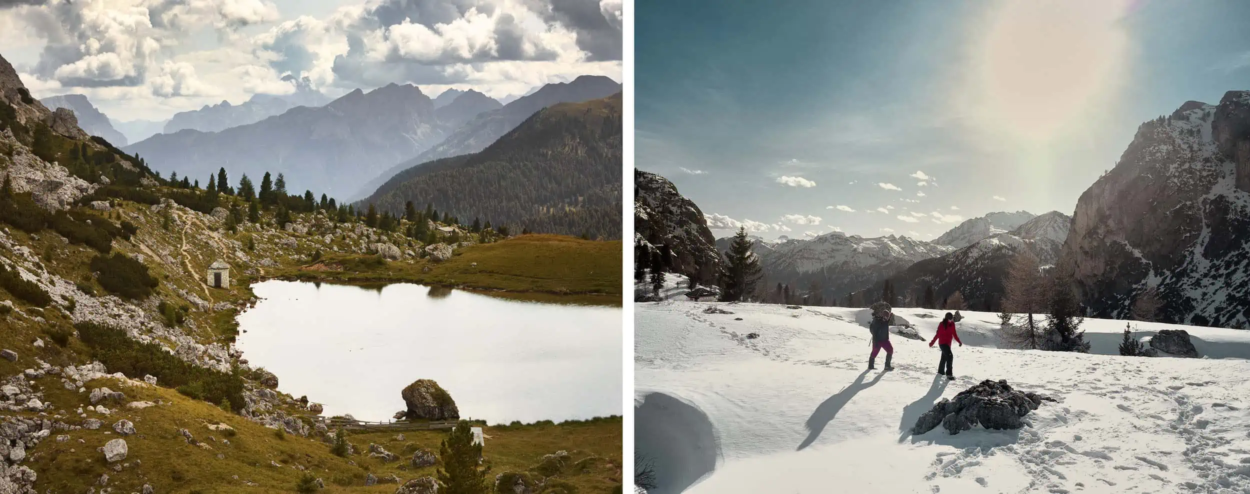
Lago di Val Parola in summer and the more challenging (but fun) winter hiking in the area
This short circular route takes in some spectacular scenery whilst giving you a taster of what is in the area. With undulating terrain, the route uses the lake as its basis, but it is very clear from the trail that there are many further ones you can take to extend your hike. This is also a great area for spotting Marmots in their natural environment.
Hiking in the Dolomites Route 3
Sass Pordoi – The Dolomite Panorama Terrace Hike
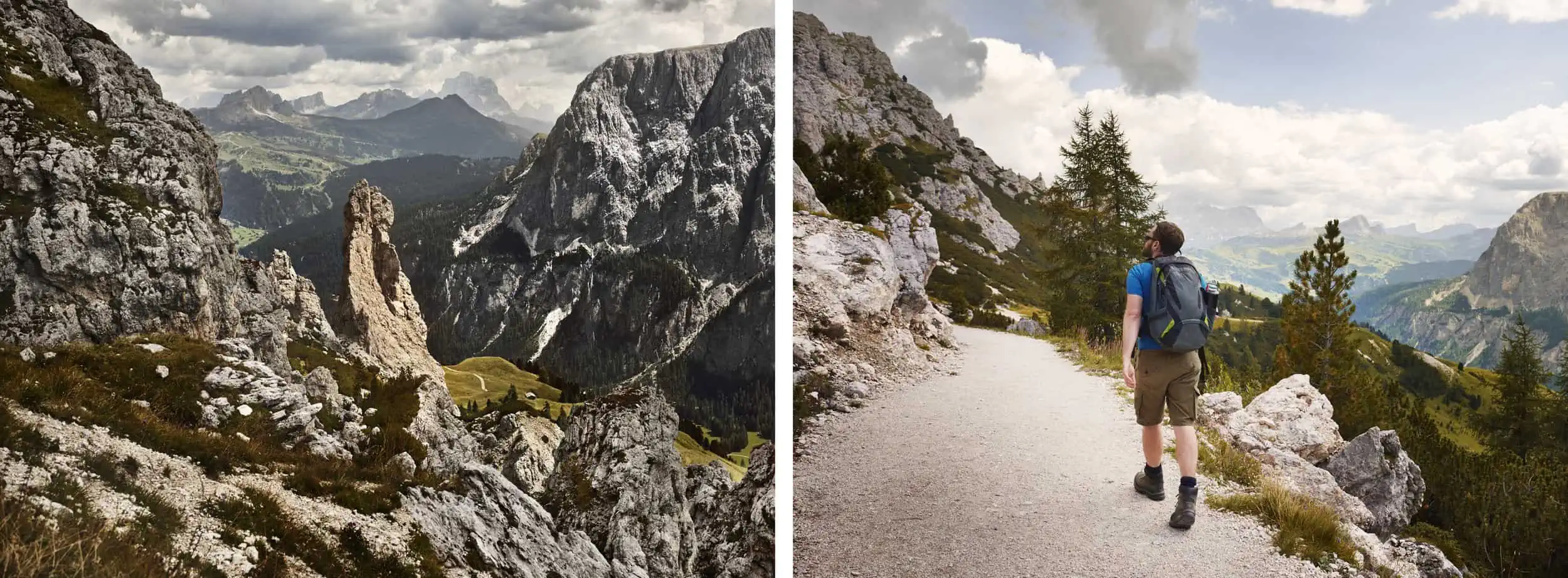
The view from the trails out from the cable car look almost like the surface of the moon
Parking: There is a car park for the cable car that takes you to 2,950m to the terrace of the Dolomites. This can be reached from the top of the Passo Pardoi which is road SS48.
Length: 6.59km
Difficulty: Easy/Medium (because of altitude – this affects people differently and also dependent on which trails you take)
Accessibility: Best in summer. The cable car runs all year round, and in summer the walks are very accessible, ask at the cable car ticket desk for a map of the top. In winter, the cable car still runs, but the area is mainly for skiing and winter hiking is not really achievable, however the views are still great.
High above the vegetation and lush pine forests below for an unforgettable experience
From the top of this cable car route, there is the option to take many shorter or longer hikes after exiting the cable car station. This is a breath-taking area and unlike anything else. This high-altitude environment allows you to see some of the most famous sights in The Dolomites whilst enjoying as much or as little hiking as you wish.
Hiking in the Dolomites Route 4
Across the Puez Odle Alto Piano Hike
Parking:The trail starts in Selva di Val Gardena, in the Val Gardena region.You can park at the cable car station, the cable car is called Dantercepies.
Length: 18.1km circular (shaving off a portion at the beginning for the cable car ascent)
Ascent: 500m (first 700m shaved off through cable car ascent)
Descent: roughly 1300m
Min. Elevation: 1572m
Max. Elevation: 2513m
Difficulty: Medium
Accessibility: The trail is only accessible in summer, and we have only attempted this in the summer.
Some of the rock spires seen from higher elevations on the trail and the wider trail lower down just before it creeps up the side of the mountain
This is possibly one of the most stunning hikes in the whole of The Dolomites. Once you have exited the cable car and taken the wide track for a while, you’ll reach Rifugio Jimmy, and No.2 trail, to the left climbs up through the mountain side. The views really start to open up and give you something spectacular. You begin to see some incredible structures as you pass on the switchbacks up the side of the mountain. The trail is really well posted, and well worth the effort to complete the full circuit.