
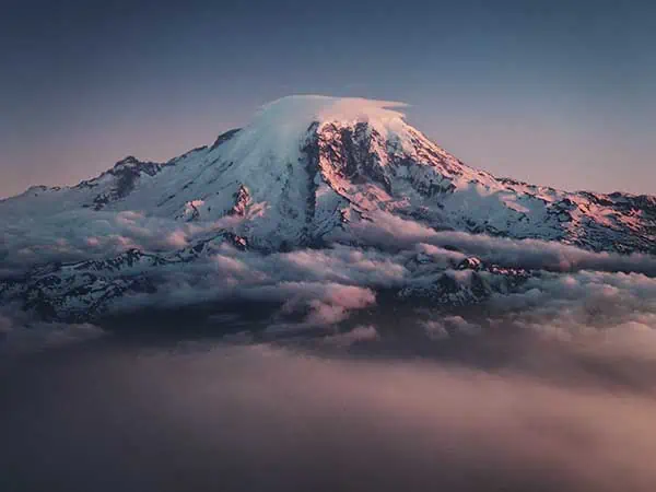
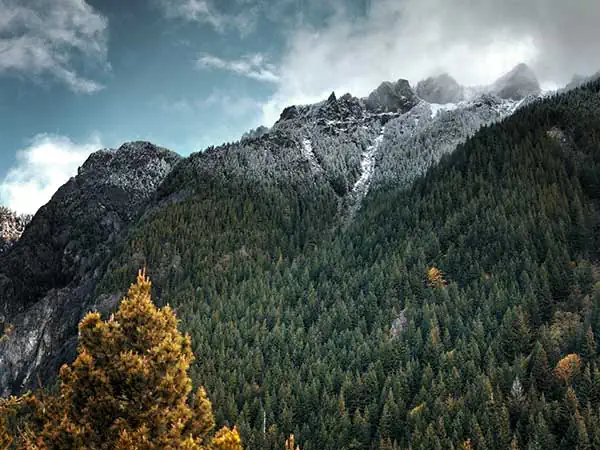
Seattle is lucky in that it has some of the best hiking in Washington surrounding it. From high alpine mountains to coastal hikes, accessible trails and even hikes in Seattle itself, there really is something for everyone, with options all year round. So, whether you’re visiting the area for a short time or live in the area, use this guide, including easy to use navigation trail maps, to help you find your next Washington state hike.
Best Hikes Near Seattle Trail Locations Map
Use this map to find hikes in the Seattle area. The locations are numbered in reference to the hikes outlined below.
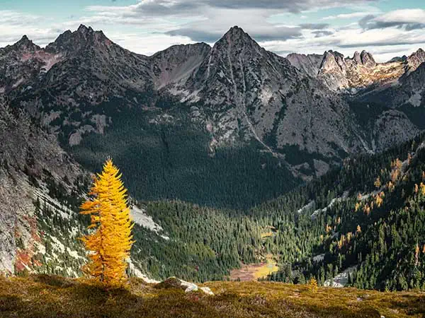
1. Maple Pass (North Cascades)
Difficulty: Considered more challenging but has a well-maintained and graded path. Some paths are narrow. Mostly gradual/steeper ascent until the highest points when it becomes steeper. Exposed trail in some sections, so a head for heights is needed. Shaded for first section.
Distance: 10.6km/6.5 miles
Elevation: 633m/2076 ft ascent and descent
When to do it: Best months are June through to October – snow can linger into July, so if you want to do this hike earlier in the season be prepared for snow on the trail.
This is without a doubt one of the North Cascades best hikes; the panoramic views from the top, the scenery along the way, the wildflowers in summer, the colors of golden larches entering the fall. The Maple Pass hike is certainly more on the challenging side but is certainly doable as a day hike close to Seattle. Be mindful that the parking lot does fill up quickly, so aim to get there early (typically before 10am if possible). Some hikers prefer to do this hike in reverse – saying it’s easier on the knees, however if you do it clockwise, you do get the steeper ascent out of the way earlier on into the hike and when it is potentially cooler. Whichever way you decide to tackle this trail, you won’t be disappointed.
You can also add on a relatively short, relatively flat detour to Lake Ann (0.6miles/0.9km round trip), which is well worth the extra effort. This North Cascades day hike certainly requires a head for heights on the ridge and does involve some steep ascent, but the sheer variety on offer here is bound to please everyone in your group.
It’s worth noting that you’ll need a National Forest Pass which is $5 a day for this Washington hiking spot. You can fill out one of the day passes at the trailhead, deposit your envelope and display the pass on your dashboard (be sure to bring a pen to fill this out). If you have an America the Beautiful Pass, this isn’t required, simply place this instead on your dashboard.
About our free downloadable trail maps: We use Outdooractive map plugins for all of our hiking guides to give you an interactive map that you can download and save offline for your hike. Saving your map offline to your device is a must as reception isn’t guaranteed!

2. Gold Creek Pond (Mount Baker Snoqualmie National Forest)
Difficulty: This short trail features paved asphalt, one section with a wooden boardwalk with barriers and wooden bridges with railings and is marked as suitable for wheelchairs, adaptive equipment and strollers. The path is typically at least 6 feet in width and has no more than a 5% or less grade.
Distance: 1.9km/1.18 miles
Elevation: 28m/91 ft ascent, 30m/98 ft descent
When to do it: It’s open all year – in summer, the best months are between June and October to see wildflowers and everything in season. In winter, this makes a great snowshoe trail.
At just under an hour’s drive, this is one of the iconic hikes near Seattle that you could, in the summer months, easily fit in after work or for a shorter nature fix on the weekend. So, if you’re looking for short hikes in Washington, we’d recommend trying this one. What we love as well is how accessible the trail is – not only is it one of the best short hikes near Seattle, making it more manageable for people with a range of different outdoors experiences and abilities, it’s also well graded and suited for wheelchairs and adaptive equipment.
Be mindful, this trail is popular for obvious reasons, so you’re unlikely to have it to yourself, but it also makes a great place to sit down and enjoy a picnic too. In the spring, and summer months, you’ll be treated to what seems like endless wildflowers – the colors against the mountainous backdrop are just gorgeous. In the winter, you can snowshoe around the lake. The parking lot can get busy, so be sure to plan accordingly.
Please note that a valid Recreation Pass (which you can buy online and print at home to display is required for this trail. You can either buy a day pass or an annual pass. In Winter, you’ll need a Sno Park permit. Whilst this is certainly on the ‘easier side’ of hiking in the state, we think this is one of the most beautiful hikes in Washington and shows that you don’t always need to be moving vertically to get a great experience of the outdoors.
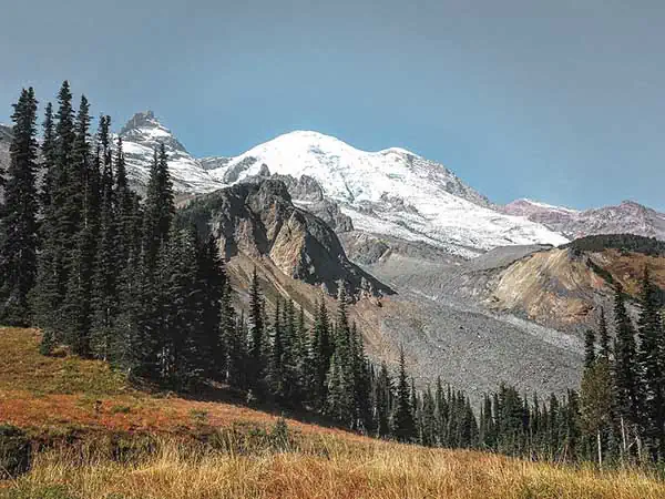
3. Summerland (Mt. Rainier National Park)
Difficulty: Long distance day hike with significant elevation gain on uneven, rocky paths – we rate this trail as moderate to difficult. Many areas in open sun.
Distance: 15.8km/9.81 miles
Elevation: 759m/2490 ft ascent, 779m/2555 ft descent
When to do it: Between June and end of September (be mindful due to weather, there may still be snow on the ground earlier on in the season).
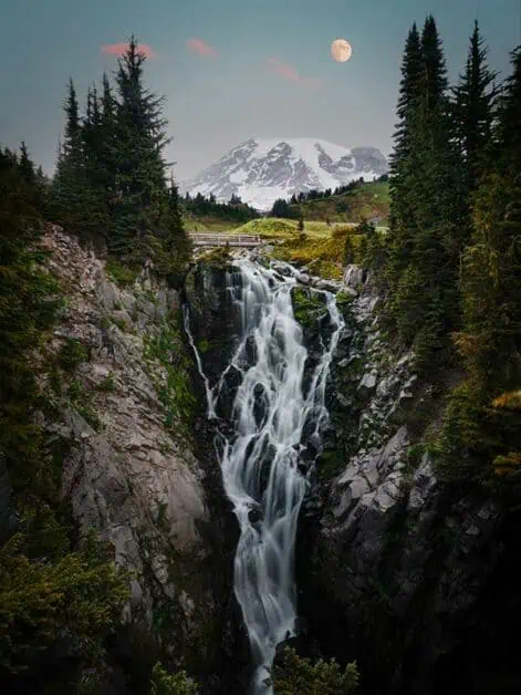
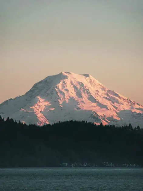
Mt. Rainier National Park near Seattle is an absolute hiking paradise and if you’re looking for one of the best hikes in Washington state, in our opinion, this is up there. Why? You get the best of everything on this trail – stunning mountain views, the hypnotic sound of rushing waterfalls and wildflower meadows that are teeming with life in abundance. You’ll also get to take in views of some of the most famous mountains near Seattle such as Mount Rainier (in fact you could argue that this hike gives you one of the best views of Mt. Rainier), Goat Island Mountain and Little Tahoma.
The trail starts off with time in the forest before you hit the switchbacks which are usually in full sun when the weather permits, so be sure to bring sunscreen and plenty of water. This is when the views start to get incredible. After Fryingpan Creek and the switchbacks you’ve just journeyed up, you’ll head through a meadow before then approaching a steep (but relatively short) climb up towards Summerland. This is certainly one of the busier hikes near Seattle, Washington, but you’ll understand why when you’re out on the trail. That said, it’s wise to get there early.
The distance from Seattle to Mt Rainier National Park is about 96 miles and you’ll need to pay for entry to the National Park – or use an America the Beautiful Pass to enter.
4. Barclay Lake Trail (Mount Baker Snoqualmie National Forest)
Difficulty: Well-maintained trail with gradual incline and some elevation gain over the entire hike, this trail is considered easy/moderate.
Distance: 7.2km/4.47 miles
Elevation: 206m/675 ft. ascent, 214m/702 ft. descent
When to do it: Year-round, depending on weather conditions
If you do a search for mountain lakes in Washington, there’s a good chance you’ve seen this place before; it’s pretty iconic in the area. This trail is classed as one of the more moderately easy hikes in Washington, but don’t let that fool you – the views are simply stunning. It’s also a great one to take on if you’re looking for short hikes near Seattle, as you could easily fit this in, in the summer months after work or if you have limited time on the weekend but still want to get your nature fix. It’s also a great trail to do as an overnight backpack trip as when you reach Barclay Lake itself, you’ll come to Barclay Lake Backcountry sites. Please note whilst this is established camping, there are no facilities, and be sure to pack in and out whilst leaving no trace. You’ll need a valid Recreation Pass which you can buy online beforehand as a day pass or an annual pass to park at the trailhead. This is one of the busiest hiking trails Seattle has to offer, and it’s not hard to see why, so, if possible, consider heading out mid-week.
5. Ebey’s Landing (Whidbey Island)
Difficulty: Exposed trail without shade for most, some steep drop offs along the trail. Some uneven rocks and sandy paths on return route, if this is an issue, you can return the same way you came. This trail is classed as an easier to moderate route.
Distance: 5.9km/3.6 miles
Elevation: 114m/374 ft. ascent and descent
When to do it: Open year round
At roughly 59 miles away, this is some of the best hiking near Seattle, especially if you’re looking for something a little different to high alpine hiking. That’s not to say you won’t have incredible views, in fact, if you head there on a clear day, you’ll have one of the best views of Mt. Rainier. This stunning coastal hike is iconic when it comes to Seattle trails and what makes it even better is that it’s accessible all year round. The trail is pretty narrow in parts, so you’ll be hiking single file at times and there are also steep drop offs in some areas so a head for heights is needed. That said, if this is a problem, you can always walk out and back on the lower, return trail but this is much rockier and sandier. There is no shade on the trail so be sure to bring sunscreen and water on hotter days. You don’t have to pay to enter the reserve itself, but you will need to have a Discover Pass to enter Ebey’s Landing to park up for the hike.
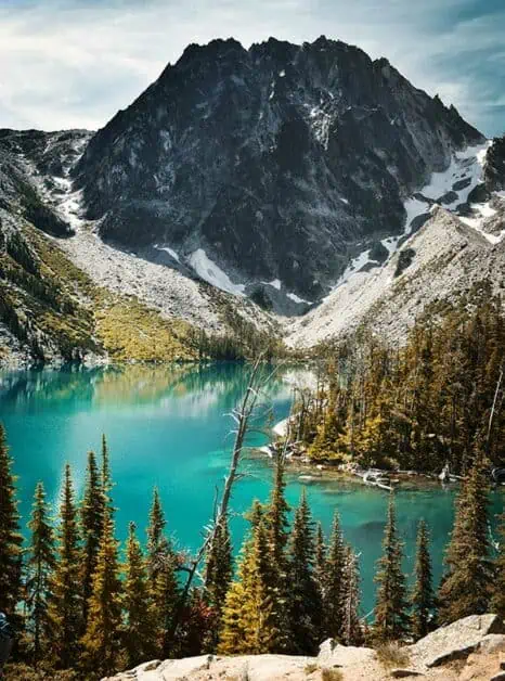
6. Snow Lake (Alpine Lakes Wilderness)
Difficulty: There and back with steep ascent over a narrow trail, this hike is classed as moderate to hard.
Distance: 11.3km/7 miles
Elevation: 567m/1860 ft. ascent, 569m/1866 ft. descent
When to do it: July to October, but be mindful that there may be snow on the trail earlier in the season. It is possible to snowshoe in winter, but there is always a risk of avalanches. Only visit in winter if you have adequate safety gear and experience.
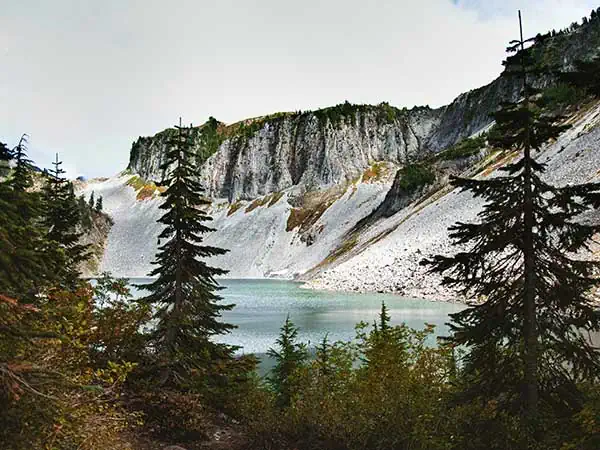
If you’re looking for a quiet Seattle hike, Snow Lake may not be for you, but if you go prepared that you’re likely to not have the trail to yourself and immerse yourself in the iconic alpine views you’ll experience, this without a doubt one of the best hiking trails in Washington. Because this trail is busy, it’s recommended to get to the parking lot earlier on in the day, even though it’s a fairly big parking area. You’ll need to display a Forest Pass to park at the trailhead which you can buy from various vendors, such as REI, a Forest Service Office or Oregon Parks Forever. It’s pretty much uphill the whole way, but you’ll be treated to truly stunning views of the surrounding mountains on this Snoqualmie Pass hike. Once you reach Snow Lake itself, you’ll be mesmerized by some of the clearest turquoise water you’ve ever seen. Walk around the lake a little and you’ll find some great spots for a swim to cool down. You could very easily spend the whole day up there taking in the views and relaxing.
7. Rattlesnake Ledge
Difficulty: Some steep terrain on switchbacks and steep ascent over shorter distance. Well maintained trail which is wide enough for two-way traffic in most parts.
Distance: 8.5km/5.3 miles
Elevation: 609m/1998 ft. ascent and descent
When to do it: This is great year-round and makes for a great Seattle winter hike.
Rattlesnake Ledge or Rattlesnake Ridge as it’s sometimes also known is a very popular year-round hike in Washington, so if you have the option, it’s best to visit on a weekday or earlier on in the day if possible. That said, this hike gives you something truly incredible to experience. The magnitude of the trees, the views from the various ledges on the way up to the Upper Ledge and the general sense of expanse you’ll feel whilst looking out at the landscape. What’s more, it’s a perfect hike to complete in winter when some of the higher alpine trails are less accessible and at roughly 34 miles away, it’s a great day hike from Seattle. Once you’re done and headed back down, be sure to visit Rattlesnake Lake too, where you can go swimming, kayaking or paddleboarding to cool off with beautiful views of the surrounding mountains. There’s no parking permit required here either.
8. Tolmie Peak (Mt. Rainier National Park)
Difficulty: Alpine, mountain trail with uneven terrain and steep ascent and descent. Steep drop offs and exposure along parts of the trail. This hike is considered medium to hard.
Distance: 9km/5.6 miles
Elevation: 505m/1656 ft. ascent, 496m/1627 ft. descent
When to do it: June to September, weather dependent
If you’re looking for one of the best hikes within 2 hours of Seattle, we couldn’t recommend Tolmie Peak enough. The last 15 miles is down a gravel road, but it’s well worth the effort to get there, just be sure to drive carefully and if you have AWD, you’ll find it a breeze. Don’t let that put you off though, as the views, from start to finish on this hike are stunning and it’s some of the most quintessential hiking in Washington. Once you’ve cut up past the lake (which you’ll want to stay at forever and you could easily if you wanted to make a day of it) the trail starts to gradually go uphill where you intersect the Ipsut Pass. There are some fairly steep drop offs on your way up, so be sure to have a head for heights. You’ll then come to a series of switchbacks up to Eunice Lake before taking the final ascent up to Tolmie Peak and Tolmie Peak Lookout.
The combination of wildflowers, alpine meadows, majestic towering mountains and piercing blue lakes make this one of the best Mt. Rainier day hikes and an absolute must in the area. As with many Washington hiking trails, you’ll need to pay a fee to enter the National Park and use the parking lot at the trailhead. You can also purchase an annual America the Beautiful Pass to enter and you can display this on your dashboard.
9. The Enchantments Traverse (Central Cascades)
Difficulty: Significant distance trail, with a lot of a lot of ascent and descent. Narrow trails, steep climbs, and uneven paths class this hike as hard or challenging.
Distance: 29km/19 miles
Elevation: 1,400m/4593 ft. ascent, 2,025m/6643 ft. descent
When to do it: July to October, though some snow is likely on the trail earlier in the season.
If you’re looking for one of the best North Cascades hikes to do as a weekend backpack, we’d recommend The Enchantments Traverse without a doubt. It is also possible to do this Cascades hike in a day, but due to the distance and ascent/descent, we recommend doing this over a two-day, one night trip. Due to its length, you’ll need to take the shuttle, which is reservable in advance to get to your starting point and leave your car at the other end for your return. We recommend parking at the Snow Lakes parking lot to then be taken to Stuart Lake Trailhead to start your hike. Check out Leavenworth Shuttle & Taxi for more information on bookings, times and up to date pricing.
Like many hiking trails in Washington state, If you’re going to camp, you’ll also need a backcountry permit which you can find more information on booking here. If you love the clearest alpine lakes you’ll possibly ever see, then you’ll love this hike. Whilst it is certainly strenuous, you’ll be rewarded with endless mountain views that will have you wanting to stay out on the trail for longer than a couple of days.
This hike is no joke – it’s a serious amount of ascent and descent and can be slippery when wet (which the area is well known for), and there are some difficult sections of Aasgard Pass. The Enchantments region really is one of the most iconic areas in the Cascades within driving distance of Seattle, and this hike will stay in your memories for a long time.
10. Discovery Park and Lighthouse Loop
Difficulty: Well graded trails with minimal ascent and descent. This circular Seattle walking trail can also be cut shorter using some of the side trails and is classed as easier to complete.
Distance: 7.2km/4.47 miles
Elevation: 155m/508 ft. ascent, 159m/521.6 ft. descent
When to do it: A great Seattle hiking spot for year-round hiking, though best between April and October.
At such a close distance (about 6 miles), this Seattle day hike is a perfect one to have in the bag for days where you don’t have a lot of time to spare, or simply don’t want to spend long in the car to get your nature fix. What makes this a really special place to walk is you will feel a million miles away from the hustle and bustle of Seattle. You’ll also have incredible views of the mountains surrounding with unique views out into the sound and ocean. This hike does get popular with its approximation near to downtown Seattle, especially on weekends, so be prepared to see others out on the trail. However, there is so much to explore that this shouldn’t bother too much. What’s more, its free to visit, park and explore all year round. If you’re looking for hiking in Seattle without a longer drive attached, especially in winter, we’d really recommend this trail.
11. Kendall Katwalk Trail
Difficulty: Long distance hiking route with significant ascent and descent. Narrow trails in places with some drop off and exposure rates this hike as one of the more challenging/hard Washington day hikes. However, the incline is steady and gradual and is a well-maintained trail.
Distance: 22.9km/14.2 miles
Elevation: 882m/2893 ft. ascent, 887m/2910 ft. descent
When to do it: June to September
The interestingly named Kendall Katwalk is an exposed, narrow pathway which is blasted from sloped granite on the ridge of Kendall Peak. It offers uninterrupted views of the surrounding mountains and is also part of the Pacific Crest Trail, and it is without a doubt one of the best hikes in Washington. It’s a long trail and could easily be turned into a backpacking trip over two days and one night, but if you’re looking for day hikes near Seattle that’ll challenge you, it can be completed in a day if you’re prepared for a long day on the trail. You’ll need a head for heights as there are some very narrow paths in parts of the trail, and particularly on the Kendall Katwalk itself. It’s also one of the best fall hikes near Seattle and is particularly beautiful as the seasons start to change, with the whole area’s larches becoming alive with shades or orange, red and gold. The views on this trail are unparalleled. You’ll need a Northwest Forest Pass (which you can buy online from REI), National Parks Pass/America the Beautiful Pass to park at the trailhead.
12. Shadow Lake (Mount Rainier National Park)
Difficulty: This easy-to-follow trail is well maintained with minimal ascent and descent and is marked as easy.
Distance: 4.7km/2.92 miles
Elevation: 81m/265.7 ft. ascent and descent
When to do it: Best between June and September, though later in the season is possible dependent on the weather.
If you’re looking for a Mount Rainier hike that is more accessible, this trail is sure to tick all the boxes and we’d say that it’s one of the best lake hikes near Seattle by far. The trail has endless, jaw dropping views along the way with various look out points that are well worth the very short diversions to get to. These include Emmons Vista, where on a clear day, you’ll have stunning views of Mt. Rainier and couldn’t feel further away from Seattle if you tried! What’s great is this trail puts you high up from the start as you take the trail to Shadow Lake, so still getting those big alpine views in a more accessible way.
On your way to the lake, you’ll also be treated to wildflower meadows which are just breath-taking in summer. Once you reach the lake, it’s a great place to relax and spend some time. We’d really recommend this trail, of course, there are much more difficult and challenging trails in the park, but it doesn’t always need to be. It might not always be possible either, so having something like this as an option is amazing – in fact, we think it may just be one of the best alpine lakes in Washington through and through for the payoffs you get.
As with many hiking trails near Seattle, you’ll need to pay a fee to enter Mt. Rainer National Park and to park at the trailhead. You can also purchase an annual America the Beautiful Pass to enter and you can display this on your dashboard in any National Park, so is great value.
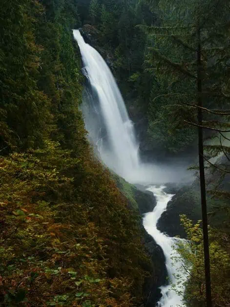
13. Wallace Falls (Cascade Foothills)
Difficulty: Well-maintained trail but significant ascent and descent in the last section of the hike before the upper falls, this route is classed as moderate to challenging but is a great one to do all year round.
Distance: 7.8km/4.84 miles
Elevation: 394m/1292 ft. ascent and descent
When to do it: Year-round and in fact, this is one of the best winter hikes Seattle has to offer.
One of the things we love about Seattle hiking is that there is so much variety within a radius of the area, and with that, so many trails that are possible in winter when others are cut off due to snow conditions. At roughly an hour out of the Seattle, the Wallace Falls trail is located at the foothills of the Cascades mountains. The majesty of the falls, the sound of the water and the deep emerald pools that you’ll see make this steep hike worth the effort and a Seattle waterfall hike you won’t want to miss. If you want to make your hike less strenuous, you could visit the Lower Falls which is roughly two thirds in, and then return.
Alternatively, if you want to extend to something much longer with more ascent and descent, you can take the Greg Ball Trail which is just under two thirds into the trail and the trail marked on your left-hand side up to Wallace Lake for picturesque alpine views (worth noting this additional section is only possible during summer months). Hiking in Washington state doesn’t get much better than this!
As this hike is within Wallace Falls State Park, you’ll need a Discover Pass to park, which you can buy online by following the link. However, the parking at Wallace Falls also has an automated machine that allows you to buy one day or annual passes.
14. Little Si
Difficulty: Steep sections at the start and end with more challenging rocky areas, with some flatter sections between these. Well maintained trail, some significant ascent and descent makes this Seattle walk moderate to challenging.
Distance: 5.9km/3.66 miles
Elevation: 333m/1092 ft. ascent and descent
When to do it: Between May and October, though those months can extend depending on weather conditions
With its proximity (roughly a 45-minute drive), it’s not hard to see why Little Si and its neighboring Mt. Si are some of the top hikes near Seattle. It really goes to show that you don’t need to go far from Seattle to experience incredibly scenic trails which offer beautiful views of the surrounding Cascades. The Little Si trail has something for everyone – it’s steep ascent over a relatively short period will give you a workout and challenge, whilst also not being so domineering as to put less experienced hikers off. In fact, if you visit earlier in the year, you’ll likely encounter other hikers prepping and getting into the best shape they can for Mt. Rainier and other backpacking trips later in the season. It’s also possible to include Mt. Si in this hike too, but it will extend it by a good distance (Mt. Si length in total is roughly 12.4km/7.7 miles).
On your return down from Little Si, about a third of the way from the end, take the Boulder Garden Loop Trail which will be on your left (if you decide to do Mt. Si alone, take the Little Si Trail from the parking lot and the Boulder Garden Loop Trail will be on your right). Keep following this uphill until you reach Mt. Si (though we’d recommend mapping this and saving offline if you want to do this trail).
Due to its proximity, this is one of the busier Seattle hiking trails, so if possible, go early or midweek. You’ll need a Discover Pass to park at the trailhead.
15. Poo Poo Point (Tiger Mountain State Forest)
Difficulty: Well graded, wide trail, with rough sections at points (two thirds up) with consistent incline all the way to the top. Mostly shaded, this trail is classed as moderate to challenging.
Distance: 11.3km/7 miles
Elevation: 559m/1833 ft. ascent, 563m/1847 ft. descent
When to do it: This trail is great all year round making it a really accessible winter hike from Seattle
If you want something that won’t have you in the car for ages, this is one of the best hiking trails near Seattle. It’s even possible to take the 554 bus from downtown in roughly a 30 minute to 1 hour journey dependent on traffic. What’s great about this trail is that it combines wonderful lookout points with far reaching views with wonderful forest, creeks and small waterfalls along the trail and it’s one of the best Seattle hikes if you’re short on time and don’t want to travel too far. It’s an especially great one as well for the winter months and if you’re training for some of the harder hiking trails in Washington later on in the season. When you look at the map, you may see that there is parking closer to the trailhead than we’ve mapped. It’s generally always better to park in the lot we’ve recommended as the lot at the start of the trail is very small and becomes full quickly.
16. Myrtle Falls (Mt. Rainier National Park)
Difficulty: Due to it being a short trail with some elevation gain, it can be steep in places (particularly at the end near the falls). However, the trail is well graded within a short distance making it one of the best short hikes near Mt. Rainier.
Distance: 1.6km/0.9 miles
Elevation: 54m/177 ft. ascent and descent
When to do it: Between June and September, though you can complete this trail earlier or later in the season, weather dependent.
What we love about the Myrtle Falls trail is its length – you get in a lot in a short time, so if you’re looking for a hike that’s that bit more accessible, then this could be a good one for you. It’s also a good one to add on to the end of another trail – so if you’re heading to Mt. Rainier as a day trip from Seattle, you can make the most of your time and get in something extra that’s well worth the effort. This is one of the more popular hikes in the area due to its length and the beauty you’ll find along it, so do be mindful of this. On a clearer day, you’ll also get great views of the mountains. We think arguably, some of the best hikes in the Pacific Northwest are within Mt. Rainier National Park and this trail makes a great addition.
As with many of the hikes in Seattle and Washington State, you’ll need to pay to park at the trailhead. As this trail is within Mt. Rainier National Park, you’ll need to pay the park entry fee. Alternatively, you can buy and display an annual America the Beautiful Pass which, if you plan on visiting the park regularly, or any other US National Parks within a year, it’s well worth it.
17. Chain Lakes Loop (Mt. Baker Snoqualmie National Forest, North Cascades)
Difficulty: Not very much shade on the trail and some exposed sections. Significant ascent and descent with uneven trail make this loop moderate to challenging.
Distance: 10.1km/6.27 miles
Elevation: 580m/1902 ft. ascent and descent
When to do it: Best hiked between June and October
Considering what you get for the effort put in on this hike, we’d be confident to say this is by far some of the best hiking in Washington state through and through. Why? Well, once you’re on the trail you won’t need any convincing. You’ll travel between four pristine alpine lakes (and actually six if you count the two tiny bodies of water near the end of the hike). If you’re into outdoor swimming, you can cool off with a refreshing dip in the lakes along your way. You’ll be high up in the wilderness, so even on a less than perfect day, you’ll get dramatic vistas of the surrounding mountains. In the early season, expect to see greenery everywhere and endless wildflowers. Whereas when fall starts to set in, picture golden larches and colors that will stay with you for a long time appear.
This hike is challenging, there is a lot of ascent and descent, but it’s well worth every second – it truly is one of the best hikes in North Cascades. If you’re not feeling the whole hike, you don’t need to complete the whole thing to still get incredible views and you could hike as far as you want and turn back. If you have time, be sure to check out Artist Point viewpoint near the trailhead too.
Like many of the hiking trails in Washington, you’ll need a Northwest Forest Pass as either a day pass or an annual pass to park at the trail head, which can be bought online via the links above.
18. Oyster Dome (Blanchard State Forest)
Difficulty: Significant ascent and descent make this route moderate to challenging.
Distance: 9.9km/6.2 miles
Elevation: 572m/1877 ft. ascent and descent
When to do it: This is some of the best hiking near Seattle to complete all year round.
Whilst this route certainly has its fair share of steep uphill climbs (particularly straight into the hike) you’ll be treated to something pretty different. Whilst a lot of the hiking around the area focuses on inland mountain views, you’re climbing higher and higher with truly mesmerizing views out into the sound and sea. It’s doable year-round, so if you’re looking for ideas of winter hikes near Seattle, this is a great one to add to the list (though depending on conditions, you may need snowshoes in winter). What’s more, this hike is roughly a 1 hour 30-minute drive from downtown, making it a great hike around Seattle when you don’t have quite as much time or don’t fancy so much driving (or when the days are shorter).
The views as you get higher towards Oyster Dome are simply stunning, and, if you fancy it, you can add on an extra section to Lily Lake and Lizard Lake. To do this, you’ll head back down from Oyster Dome itself, and you’ll take the first trail you come to that will intersect to your left. After a while, the trail will then fork, and you want to take the left which will take you to Lily Lake. From there, you can walk straight up along the left side of Lily Lake up to Lizard Lake. When you come to a trail fork, just take the right and you’ll be there in no time. Like many hiking trails in Seattle, you’ll need a valid Discover Pass to park at the trailhead which you can purchase through that link.
19. Del Campo Peak (Mt. Baker Snoqualmie National Forest)
Difficulty: Serious ascent and descent over a long distance. There is also a technical scramble required to reach Del Campo peak itself with moderate exposure. It is advised to wear a helmet. This is rated as a very challenging route.
Distance: 16.8km/10.4 miles
Elevation: 1271m/4169 ft. ascent, 1261m/4137 ft. descent
When to do it: June to October
If you’re looking for very challenging hikes on Mountain Loop Highway, you’ll want to consider Del Campo Peak. If you’re up for it, this is by far some of the best hiking in Washington. The trail is long, but you’ll be treated to stunning views as a gift for the effort you put in. Once you’ve passed Twin Bridge Campground it’s pretty much uphill the whole way until you reach a small lake. You’ll then push on to Foggy Lake before pushing uphill onto the ridge to head up to Del Campo Peak. Once you get to the scramble (and you’ll know your there) be sure of your footing and wear a helmet and remember that if you go up, you need to be able to get back down again. If you don’t fancy the scramble, you can forgo the peak itself, or even stop at Foggy Lake itself. This is a truly wonderful place to hike in Washington and you won’t feel cheated at all if that’s where you call it a day – you’ll be too distracted by the views.
Like with many of the most beautiful hikes in Washington, you’ll need a Northwest Forest Pass as either a day pass or an annual pass to park up at the trailhead, which can be bought online via the links above.
20. Cedar Butte
Difficulty: Trail can be overgrown in spots and becomes narrower the further in you go, but well-maintained trail and is noted as easier/moderate.
Distance: 6.3km/3.9 miles
Elevation: 304m/997 ft. ascent and descent
When to do it: This is one of the best hikes in Seattle to complete all year round
At a roughly 40-minute drive from downtown, you’ll love this moderately easy hike near Seattle. It’s a great one if you don’t have a lot of free time or want something you could even go and do on a weeknight in summer. What’s even better is that this trail is open all year-round and is a great short hike at any time. If you’re wanting to get out of Seattle into the mountains, without the fuss you’ll be treated to views of Mt. Si on a sunny day. This trail is also often quieter than some of the other trails in the area (though not guaranteed) so if you’re looking for some solitude this is a great trail to try. The trail follows a service road for the first section before reaching the Cedar Butte summit trail which is more rugged and scenic. It’s worth getting a Discover Pass if you want to park as close as you can to the trail, which you can purchase using the link above.
21. Mount Dickerman (Mt. Baker Snoqualmie National Forest)
Difficulty: Significant ascent and descent (especially at the start along the switchbacks). Well maintained trail with steady incline the whole way. Exposure in the last sections particularly, so wear sunscreen. This trail is marked as challenging.
Distance: 11.3km/7 miles
Elevation: 1125m/3690 ft. ascent and descent
When to do it: The best times for hiking are between July and October, though it’s a very popular route to snowshoe, making it accessible all year.
If you’re looking for a mountain near Seattle to tackle at the weekend, then consider Mount Dickerman. It’s a popular one though, so be prepared in the summer months to arrive early. The first section of this hike is the hardest by far, with the switchbacks taking over a significant portion of the climb. However, once you’re over them, you’re up into a plateau almost where the incline becomes much more gradual until you hit the final push for Mount Dickerman itself. This is certainly not an easy hike by any stretch of the imagination, but you’ll be rewarded with far-reaching views that include Mount Baker, Glacier Peak, Del Campo and Vesper. We’d say that Mount Dickerman is well worth adding to your list and we’d consider it one of the best day hikes near Seattle if you’re up for a challenge.
If you’re looking for a hike near Seattle for the winter months too, this is a great option as it’s possible to snowshoe here all year round. You’ll need a Northwest Forest Pass which you can buy online either as a day pass or annual pass for parking at the trailhead from these links.
22. Heybrook Lookout Trail
Difficulty: Significant ascent and descent over a short period, this trail is marked as moderate.
Distance: 3.1km/1.9 miles
Elevation: 264m/866 ft. ascent and descent
When to do it: This trail can be completed year-round (snow shoes will likely be required in winter) making it a great day hike from Seattle for the winter months as well as summer.
This is a great short hike, but it’s also a steep one, having quite significant ascent over a short distance. However, the lookout and the views are stunning and well worth the effort. The steepest parts are very much at the beginning and end. Due to it being short and roughly a 1-hour drive from downtown Seattle, this is a great nearby hiking trail to complete if you’re short on time whilst still showing you some of Washington’s best. The views are also stunning in winter – all those snow-covered peaks make for a great snowshoe adventure. What’s more, parking is free at the trailhead, and you don’t need a pass or permit, like many of the other trails, to enjoy this hike.
23. Summit Lake (Clearwater Wilderness)
Difficulty: Significant ascent and descent. Access road has rough surface, and this trail is marked as moderate to challenging.
Distance: 9.3km/5.77 miles
Elevation: 458m/1502 ft. ascent and descent
When to do it: Late May to October
The road to this trail certainly isn’t in the best shape – it’s very rocky with some bumpy sections, so be prepared. It is possible if you are careful and drive slowly along it with caution. However, this is one of the best Washington hikes to see Mt. Rainier from Summit Lake. It’s classed as moderate, but it’s a relatively short incline and is on the easy side of moderate hikes near Seattle. The views from the lake are truly stunning and is especially picturesque close to sunrise and sunset. As with most hiking near Seattle, you’ll need a Northwest Forest Pass which you can buy as either a day pass or annual pass for parking at the trailhead from these links.
Essentials for Hiking Near Seattle
- Layers: Some of the best hikes Seattle and Washington state have to offer are at high altitude, so you need to be prepared for things to get colder. Also be prepared for how this might be at different times of year. Lightweight, if possible, to keep your pack light. Rainwear is a must!
- Bug spray: Because of the humid temperatures, there can be a lot of bugs on the trail. Bug spray is a must to make sure you don’t come back unnecessarily itchy.
- Food: Trails near Seattle are usually remote, so come prepared and bring more than you need.
- Hiking poles: We believe that hiking and trekking poles are a must on many of these Washington hikes due to the steep and uneven terrain encountered. They make a huge difference to your recovery after. If you are yet to get hold of a pair of hiking poles for your time on the trail, be sure to check out our guide to the best trekking poles.
- Good hiking shoes: You’ll want to make sure you have a well-fitting, well-worn in pair of hiking shoes for your time out on the trail. Especially so if you’re planning to do any of these hikes as an overnight. Your shoes can literally make or break your time on the trail. In Washington, we’d always recommend opting for a pair that are waterproof – there are some great lightweight options these days. Be sure to check out our guide to the best waterproof hiking shoes on the market right now.
- Maps and Navigation: You may typically rely on your mobile device for your maps these days, so if this is the case be sure that your maps are downloaded offline before you head off. Make sure you bring a chargeable battery pack just in case also. However, it’s also a good idea to bring a map and compass too. If you’re unsure about compasses, our guide to hiking compasses can help you make the right decision for the trail.
- Small first aid kit: This can be simple and doesn’t need to be a whole pharmacy. Plasters, antiseptic or antibacterial wipes, pain medication such as ibuprofen or paracetamol. We’d recommend something small like this HART Outdoor Day Hike First-Aid Kit.
- Daypack: Your day pack should be big enough to hold your essentials, something around 20l – 28l should be suitable. You’ll want something comfortable with adjustable fixtures for the perfect fit for all day wear and adequate shoulder padding. Especially if you’re carrying a camera (which is a must for all those beautiful views). We’d recommend the Osprey Talon 22.
- Water Bottle or Hydration Pouch: You should always be bringing more water than you think you need – in fact, up to 4 liters is a good estimation, but you can play this one by ear when it’s cooler. We love Hydro Flask products – and would recommend the 32 oz Wide Mouth option, especially for hotter days on the trail where they’ll keep your water cold all day. They are on the pricier side though, and Nalgene’s bottles make a cheaper alternative. You can also look at hydration pouches or water bladders such as the Osprey Hydraulics LT 2.5L as an alternative that you can use on the go so to speak, without having to stop to take out your water bottle.
- Headlamp: Having the ability to see more clearly when it gets darker makes things a lot safer. It’s also really handy if you’re planning to hike out during sunrise or near sunset to see some of the most amazing Seattle mountain scenes at their best. There are many cheaper options on the market, but we really recommend the Petzl Swif RL Headlamp as it’s rechargeable and very easy to use – well worth the investment.
- Leave No Trace: Last but by no means least. Not a physical item but extremely important to Leave No Trace – be sure to pack in and out all trash. It’s wise to take this home with you and dispose of it there. Always park in marked areas and stick to designated camping areas/permit zones when in the backcountry. Have backup plans for a busy trail. These principles will help us keep nature beautiful for years to come.
FAQs about Seattle Area Hikes
What is Seattle’s Elevation?
The city of Seattle, Washington sits at 53m/175ft above sea level. Which, considering the altitude of many of the hikes in and around, makes it low altitude. As you will likely be hiking at altitude for many of the hikes listed, you’ll want to make sure you acclimate properly.
What Are Some of the Easy Hikes in Washington?
Of course, ease is a relative concept, and what is easy for one person may not feel the same for another. We always rank our difficulty ratings based on trail conditions, ascent and descent and exposure. From our guide, 2. Gold Creek Pond, 4. Barclay Lake Trail, 10. Discovery Park and Lighthouses Loop, 12. Shadow Lake and 20. Cedar Butte can be considered easier.
What Mountains Can You See From Seattle?
You’ll be able to see Mt. Rainier towering over Seattle. In general, though, Seattle is bordered by two mountain ranges – which is the Olympics to the West and the Cascades to the East. Seattle is amazingly positioned for mountain hiking, and you’ll find some of the best Washington hikes near Seattle.
Enjoy Exploring the Hiking Trails Near Seattle, Washington
Whether you’re visiting for a short time or looking for some new inspiration for your time outdoors, we hope this guide has given you a taster of some of the most incredible hikes Seattle has to offer. Seattle couldn’t be any more perfectly placed to explore the outdoors and you’ll no doubt find some of the best hikes in Washington just a stones row from the city. There are possibly endless places to explore in the National Parks, National Forests and other areas that surround as well as trails in Seattle itself, and we can guarantee that you won’t run out of things to do here!
Disclaimer: This article contains Affiliate Links. You won’t pay any more for buying through these links, but we may receive a commission from any purchases made through them. As an Amazon Associate, I earn from qualifying purchases. If you choose to support us by buying through our links, we thank you as it helps us to continue providing the resources we do to help you enjoy the outdoors more!