Every time I think of Parc Cenedlaethol Eryri (Snowdonia National Park), I think of jagged peaks, quiet lakes, and incredible views, with a healthy spattering of rain and every kind of bad weather imaginable thrown at you for good measure! Some of my favourite experiences in the mountains have come from time spent here. I also think of the times I’ve hiked Yr Wyddfa and had to get to the Pen-Y-Pass car park near the Youth Ho
stel at 6am or feel trapped unsafely on a mountain side as hordes of people go past. As someone who enjoys the peace, quiet and solitude of the outdoors, peak bagging on the busiest mountains has never really been something that appeals to me. When you reach a famous viewpoint and it feels like you’re in amongst the paparazzi, well, that just isn’t something for me. I want some time to really take in the views and feel a sense of calm and peace. I can of course understand why Yr Wyddfa is so popular – it is the highest peak in Wales after all. It is something that many people want to tick off a list of achievements, and that is fantastic. For many people I’ve spoken to in the UK, Yr Wyddfa was the first mountain they ever climbed, and it was the first experience they had that made them really fall in love with the outdoors and mountain adventures. Speak with hikers you meet on the trail in the UK, and you’ll soon be hearing plenty of fond storied of Mount Snowdon and walks in Snowdonia! However, the mountain’s popularity means that many of the other remarkable trails nearby get overlooked – I just know that there is so much more to North Wales than Yr Wyddfa.
What’s great about North Wales and Eryri/Snowdonia?
Eryri (Snowdonia) – and North Wales in general – is a fantastic area not just for hiking, but also for a whole range of outdoors adventure: there are plenty of crystal-clear mountain lakes and streams, ideal for wild swimming, canoeing and paddle boarding. The mountains are also popular with climbers: drive up the Pen-Y-Pass from Llanberis and you’ll regularly see people bouldering on the rock formations the line the road. What’s more the higher rock walls in the area are home to world-famous climbing routes. Edmund Hilary and Tenzing Norgay stayed in the Pen y Gwryd hotel when training in the area prior to their ascent of Everest in 1953. This is also a landscape of myth and legend. Stories of the semi-mythic King Arthur, the Lady in the Lake, Merlin, Camalot, Excalibur and The Knights of the Round Table can all be traced back to North Wales. The Arthurian Landscape of Eryri has inspired artists, writers and humble visitors alike for centuries and it’s no hard to see why.
What’s the best time of year to visit Eryri/Snowdonia?
Many people would say that late Spring through to early Autumn are the best time to visit North Wales,and, for sure, this is when the weather will likely be the best.However, the season is no guarantee that the weather will be good and we’ve experienced days of heavy rain and fog even in the middle of the Welsh Summer! I like to think of North Wales as a year round destination: Unlike, say, the Alps, there isn’t really an ‘off season’ in Eryri and the main roads, plus most hotels and restaurants generally stay open all year round – though we have found that some of the smaller roads don’t get cleared after snow, so be aware of this! We’ve had some great trips to North Wales in the depths of winter and the landscape takes on a whole new form of beauty in this season. Some of the higher routes become much more technically demanding once there’s snow and ice on the ground, and this puts them beyond the reach of all but the most experienced mountaineers, but the more sheltered Eryri/Snowdonia routes in valleys are generally accessible all year round.
Where to stay on your Eryri/Snowdonia hike
The area is well-suited for visitors wishing to get outdoors. A wide range of different accommodation types is available in the area including camp sites, youth hostels/bunk houses, hotels and, of course, holiday homes and apartments – we usually use Booking.com to book and find hotels in the area – check out booking.com for the latest deals. The towns of Llandberis, Btews-Y-Coed and Beddgelert all offer accommodation, places to eat and drink, general stores and even outdoors shops all right in the heart of the park. These are great places to base your stay and there are fantastic routes starting right in the centre of all of these towns. Accommodation and places to eat and drink are also available in smaller villages like Nant Peris and Capel Curig. For those who don’t mind travelling a little further, larger towns like Bangor, Caernarfon, Conwy and Llandudno are just outside, but still very close to the park. You can find more budget-friendly accommodation in these places alongside amenities such as larger supermarkets. These larger towns also put you on the beautiful North Wales coast – Conwy and Caernarfon Bay, and the Menai Straits that connect them are all well worth exploring.
Yr Wyddfa/Snowdon
Most of this article will be spent talking about the alternatives to hiking on Yr Wyddfa, but it’s worth taking a moment to mention what this mountain does have to offer. It is popular for a reason! At 1085m, it’s the tallest peak in Wales, but beyond this, it’s an absolutely gorgeous mountain offering a number of different routes and marked paths to the top, ranging from accessible paths to more advance mountaineering routes including the iconic narrow ridge of Crib Goch. Many visitors will make a beeline for Crib Goch, but this route is not to be underestimated – it’s definitely a mountaineering rather than hiking route, comprising a narrow ridge with near vertical drops on either side. Sadly, I’ve often seen the mountain rescue helicopter hovering above it. The mountain offers something for a range of different hiking abilities and fitness levels. Uniquely, there’s also a mountain railway from Llanberis to Hafod Eryri, the highest visitor centre and cafe/bar in the UK which sits just a few meters below the summit, making the mountain top uniquely accessible. The Snowdon Mountain Railway and Hafod Eryri Visitor Centre are open form Late Sprint until the end of October each year – the exact dates depend on weather conditions and it’s worth double-checking online if your visit will hinge on using these amenities.
Getting around in Eryri/Snowdonia
I used to always say that a car was essential to get the most out of a visit to North Wales, but this is less and less the case. Thanks to the proximity of the major ferry port of Holyhead (on the stunningly beautiful island of Anglesey – which is well worth exploring in its own right), the area is well connected to major cities by rail and once there, the Snowdon Sherpa (currently being rebranded as Sherpa’r Wyddfa), is a great way to get around. The Snowdon Sherpa is a network of bus routes through the park connecting the towns with many of the popular trail heads. The explosion in popularity of the park during the pandemic has meant that car parking on popular routes – such as the Watkin Path and especially the Pen-Y-Pass car park are often full very early in the day and Sherpa Bus is often the most sensible way to get to the trails even if you’re driving. For example, you can avail of the plentiful and relatively inexpensive parking in Llanberis and hop on the Sherpa Bus to most of the major trails in the park. The area is also fantastic for cycling – both on and off road. There are some steep climbs for sure, but the roads are good and, as always, the slower pace of cycling gives you a chance to take in much more of the scenery than you would from a car.
The Weather in Eryri/Snowdonia
We can’t talk about Wales without talking about the weather. I’ll be blunt: it rains there a lot! In Winter you can also expect snow and freezing conditions on some of the higher peaks. The weather can change quickly in these mountains, and we’ve experienced the change from sunny days to thick, cold fog (and visa-versa) in a matter of minutes. Always check the weather forecast before you head out – especially if you plan to head to some of the higher peaks which are exposed to the elements. Mobile phone reception is very limited in the park, and whilst the Llanberis Mountain Rescue are absolute heroes, who can and do present many disasters each year, you can’t rely on phoning for help if you get into trouble on the trail.
What to pack for your Eryri/Snowdonia Hike
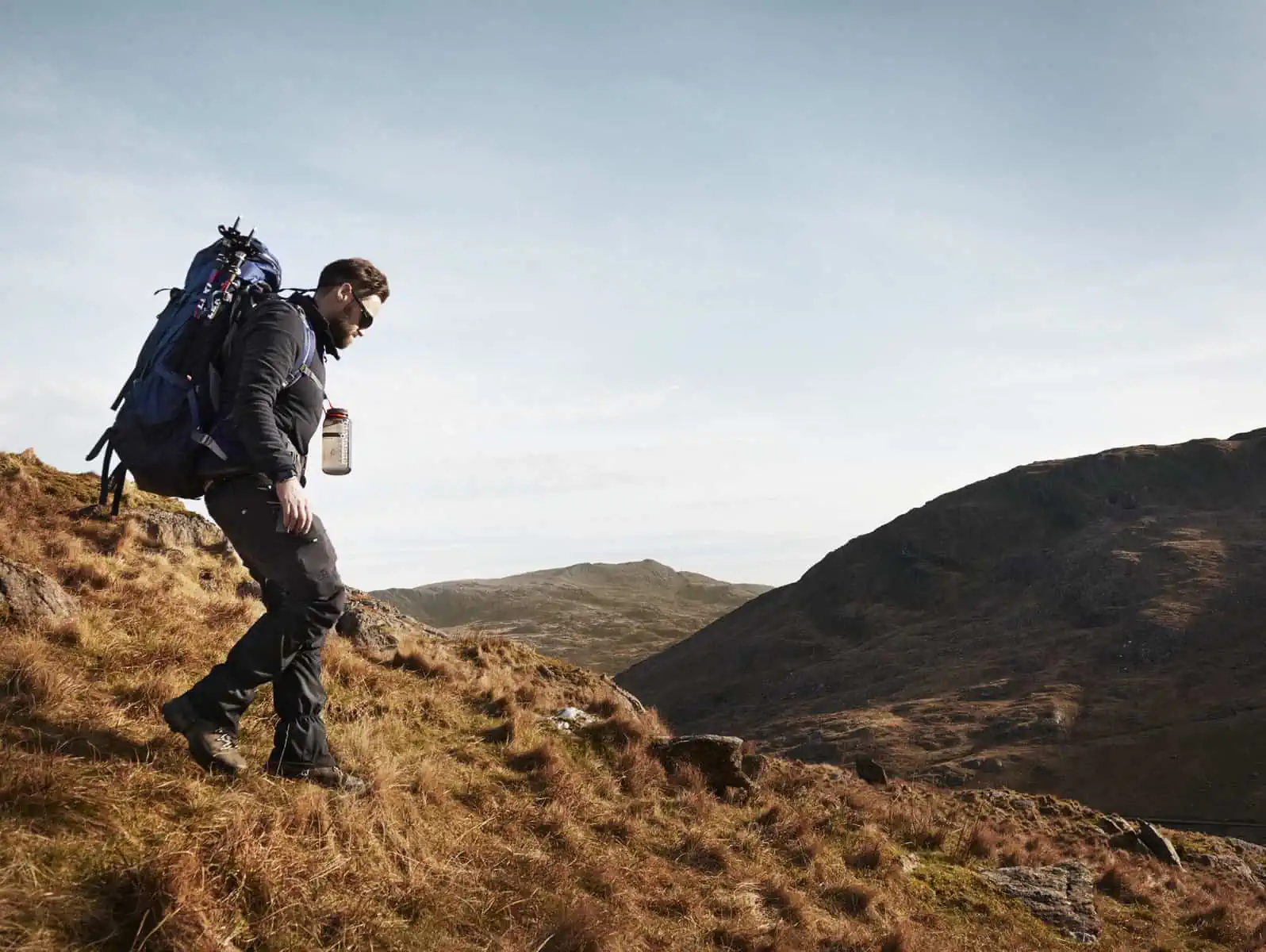
As with most outdoor destinations, preparation is key if you want to get the most from your visit and your Eryri/Snowdonia walks!Proper outdoor equipment is vital to hiking any of these Eryri/Snowdonia routes, not just for your enjoyment, but also for your safety on the trail.
Hiking Boots
North Wales can get muddy and cold, particularly in winter so it’s a good idea to wear comfortable walking shoes that are going to keep your feet warm and dry. In the summer months, a good pair of walking shoes will do the job. We’d recommend the following: Columbia Newton Ridge Plus Waterproof Hiking Shoes
- Karrimor Cheetah Weathertite Hiking Boots
- Berghaus Hillmaster Waterproof Hiking Boots
- KEEN Targhee Waterproof Hiking Boots
Waterproof Coat
Layers are a great idea for any kind of hiking, but with the changeable weather in North Wales, they make extra sense. A good raincoat is integral to keeping you dry from unexpected downpours or allowing you to enjoy getting outside in less than perfect weather. Something that packs down small into a backpack when not required is perfect. We’d recommend the following: Columbia Rain Scape Waterproof Jacket
- Columbia Hikebound Waterproof Rain Jacket
- Mountain Hardwear Acadia Jacket Rain
- Regatta Birchdale Waterproof Hooded Jacket
Somewhere to Store Your Maps Offline
Having a map and knowing how to read it is essential to safely enjoying the outdoors and increasingly hikers use digital maps. Whilst there are some areas in Eryri that have good phone signal, you’ll find this is patchy at best in most of the park. So downloading your map and making sure you have access to it offline will avoid any problems on your walk. A smartwatch can also double as your mapping device; here are our recommendations on best watches for hiking.
Top Eryri/Snowdonia Routes
The hikes below are some of my favourites in North Wales and all are within the bounds of Parc Cenedlaethol Eryri (the Snowdon National Park). They create that perfect balance between amazing views, rocky paths, challenging terrain, and peace and quiet.
The hikes below are some of my favourites in North Wales and all are within the bounds of Parc Cenedlaethol Eryri (the Snowdon National Park). They create that perfect balance between amazing views, rocky paths, challenging terrain, and peace and quiet.
Watkin Waterfalls and Yr Aran
The Watkin Path, named after the 19th Century Liberal Politician and Railway Entrepreneur Edward Watkin was, until recently the ‘quiet route’ to the summit of Yr Wyddfa (Snowdon) – certainly in comparison to the much more heavily trafficked Llanberis Path which follows the route of the Snowdon Mountain Railway or the Pyg and Miners Track which start at the Youth Hostel at the Pen-Y-Pass. However, in recent years, this trail, which starts at a small car park at Nant Gwynant, has become a much more popular route – and in many circumstances you will struggle to get a parking space at the designated car park during peak times and on good weather days. The Watkin Path is stunningly beautiful, starting with a gradual climb through ancient woodlands before a section of open fells culminating with a steep climb to the summit through a field of loose scree. If you do want to climb Yr Wyddfa, we’d say this is the way, but it’s also considered one of the hardest routes and it’s busy too: You certainly won’t get that feeling that you’re the only person on earth.
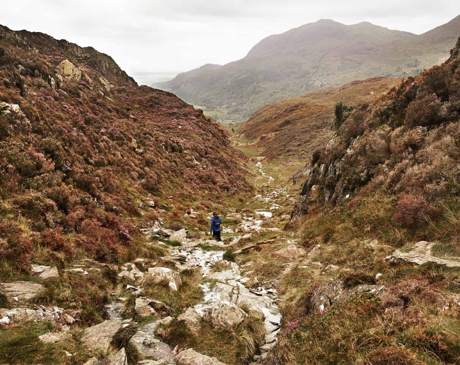
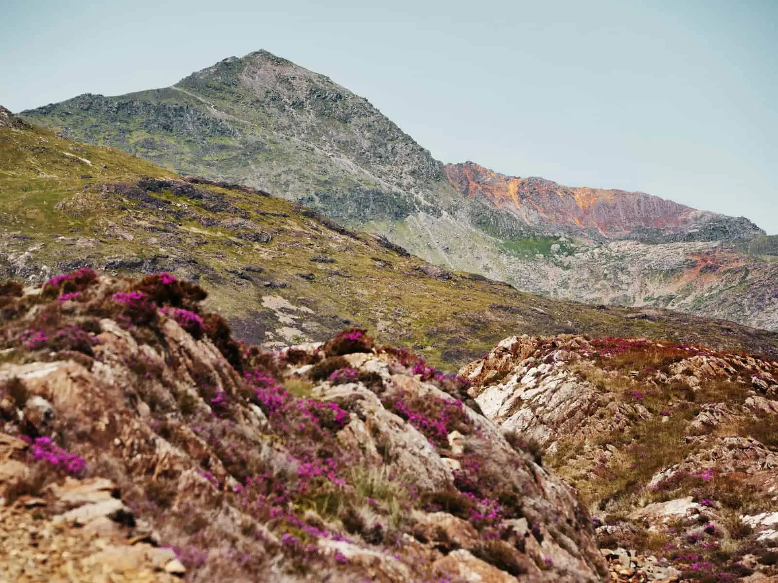
Our alternative route, starting just outside Beddgelert at the National Trust’s Craflwyn Hall won’t take you to the summit of Yr Wyddfa, but it still gives you many of the things that makes the Watkin Path great plus a whole new set of challenges to boot. When I first plotted this trail along a path I’d never seen before I was excited – and when we completed this trail, both myself and Matt agreed it was one of the most incredible circular routes we’ve done in the park. It offers a genuinely different perspective on a landscape you may already be well familiar with. You see stunning views in new ways to how you’ve seen them before. You get to experience a path with scrambles, rock hopping, steep ascents and a good level of concentration is needed to complete it. We’ve never experienced another soul on this path – apart from when you connect to the Watkin trail in the middle (but this is for a very short section). This trail is a good challenge due to the terrain being a little slow going, but if you’re feeling like you want a bigger challenge, the trail can be extended to take in the peak of Yr Aran. At the end, you’ll also be treated to a gentle finish around Llyn Dinas, which, if you fancy a swim, is one of my favourite locations in the area and an incredible experience.
Llyn Bochlwyd, Castell Y Gwynt & Y Gribin
This trail is in the Ogwen Valley. Your starting point is the car park by the Youth Hostel at Llyn Ogwen.It is worth noting that the start of this trail gets busy – and with that, the car park can fill up quickly (we’ve found it full by 8am in the past!). But, wait a little while for a spot and one will come available – there seems to be a steady flow of traffic in and out of this spot due to people walking the relatively short and straightforward route up to Llyn Idwal (this is a lovely trail if you’re short on time). Alternatively, the start of the trail is serviced by Snowdon Sherpa bus service.
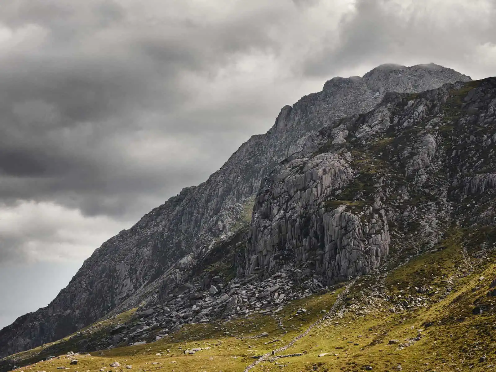
Get on the trail, and where you’ll turn off, most people will continue in a different direction for a different view. The superb views of jagged and iconic peaks in this range, are, in my opinion, some of the most spectacular in the whole park. Couple that with challenging ascents and exposed ridges and edges at points, it is a thrill of an adventure. Our route takes in the summit of Tryfan – one of the most iconic peaks in North Wales – before following the sometimes narrow ridge around to Glyder Fach, Castell Y Gwynt and then back down to Cwm Idwal – the amphitheatre that surrounds Llyn Idwal. On the descent, you’ll have amazing views over the Ogwen Valley including Llyn Ogwen, Llyn Idwal and Llyn Bochlwyd. The Ogwen Valley is part of the so called ‘Mach Loop’ where the RAF and Allied air forces conduct low-altitude training flights and it’s not unusual to see low-flying fighter jets pass by whilst hiking here – this can be quite startling if you’re not expecting it!
This is a wonderful trail, but it is also challenging and definitely one of the hardest routes in this guide, bordering on mountaineering and will require a good level of fitness, experience and the right equipment too. It takes you to some exposed spots on the mountains, so, you should absolutely check the weather forecast before you head out. There are multiple trail options within this area and you can easily modify our route to make it shorter and with less climbing or even more challenging if you wish.