This post is sponsored by Enterprise and Visit California, all opinions are our own
Mention Los Angeles and many people immediately think of a sprawling metropolis, and this image is certainly reinforced if you have ever flown over the city – especially at night when it is lit up.Most people visiting LA – whether for a family holiday or a business trip – will consider their time there as a city break.Whilst the city certainly has plenty of urban attractions to keep visitors happy, it is a shame that more people don’t see the potential LA has as a base for outdoor pursuits – in our opinion, it’s actually perfectly located for hiking!
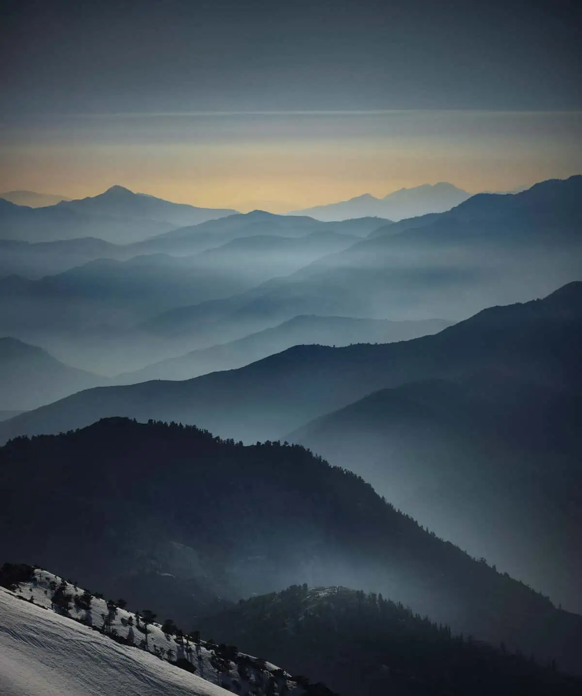
Let’s look at the geography for starters: The city is flanked to the North by the Santa Monica Mountains and to the East by the Angeles National Forest and The San Gabriel and San Bernardino Mountains – these ranges include several peaks over 10,000ft (3,000m) and in winter there is enough snow here to support several ski resorts.Skiing in LA! It’s not an activity most people would associate with a city that’s essentially in a desert!To the west, the Pacific Coast is lined with numerous stretches of beach, and further afield to the south you encounter more mountains and forest before open desert.
Beyond this immediate circle, there are plenty of other places of interest to hikers willing to look a bit further afield: Yosemite National Park, the Sierra Nevada and Death Valley to the north, and there’s also Joshua Tree and the area around Palm Springs to the south.These are all reachable in less than half a day’s drive and what’s more, this list just scratches the surface!
If you’ve followed our blog or Instagram for a while, you’ll know that we are regularly in LA, but our most recent trip in September 2019, where we created much of the content for this article and was made possible by partnering with Visit California and Enterprise, who both kindly supported us on this trip. It’s worth mentioning that if you have some extra time available on your trip (or you’re just in the area and want to see something new that you may not have thought of) the Visit California website has a wealth of ideas and places to visit. You’ve also got to have a car in LA, and what we love about Enterprise is that they help enable us to have incredible adventures. We collected our vehicle from the Enterprise rental desk near LAX Airport and, as usual, came away feeling confident due to their fantastic customer service.
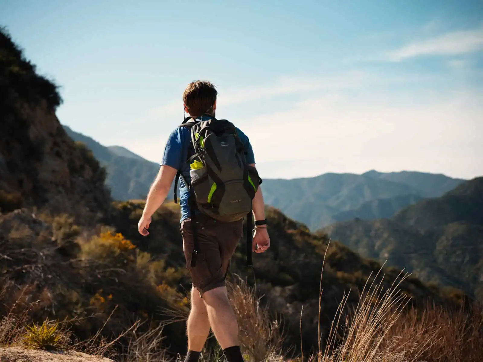
Before we launch into the routes we’ve selected, let’s talk a little about hiking in and around LA.The first thing to remember is that LA can get very hot!If you’re not used to it, this can come as a shock.It’s not uncommon during summer months for the temperature to exceed 90F (30C), and the further inland you go, the warmer it gets.With the exception of the routes in the San Gabriel mountains, many of the routes we’ll talk about offer little by way of shelter, so not only will you be hiking in the heat, but you will also often find yourself in direct sunshine.What all of this means is that you will need to be sure to bring plenty of water on any hikes you go on along with sunblock.Most hikers you see around LA will be wearing hats too, and there’s good reason for this – we strongly recommend doing likewise!
Trails are generally well marked, but even so, we always recommend you carry your own trail map.Cell phone reception can be a bit patchy in some of the areas listed below, so don’t rely on online mapping – Google or Apple Maps, for instance – for your route.An offline electronic map on your device – or good old-fashioned paper – is the best way forward here.
You are required to display a valid Adventure Pass or Interagency ‘America the Beautiful’ Pass in your vehicle when parking in some locations in the Angeles National Forest and San Gabriel Mountains or risk a fine if you don’t.At the time of writing, an America the Beautiful pass costs $80 for a year and gets the holder free access to National Parks.We think this pass is well worthwhile if you intend to visit a few National Parks, but for some visitors, this option would make little sense and the Adventure Pass – which currently cost $5 daily or $30 annually – is a much better option.The problem is, where to buy an Adventure Pass!It is not as simple as it sounds. Some of the vendors listed on the Forestry Service website don’t actually sell them, and we even saw a sign at a closed information station suggesting a lengthy backtrack to purchase one.For what it’s worth, we purchased ours from the Shell garage at the intersection of the 210 Freeway and the Angeles Crest Highway (this is a route we have often taken into the San Gabriel Mountains).The passes are also available from the Haramonkngna American Indian Cultural Centre at the Junction of the Angeles Crest Highway and Mt. Wilson Rd. – though if you want to purchase from this location, it would be well worth calling ahead to check they will be open.
For this article, when we were planning our trip, we worked with Visit California’s help to determine a great location to base ourselves – which was West Hollywood. The great thing about West Hollywood is that you’re really close to the freeway, which allows you to get to all of the hikes we’ve detailed below really easily, whilst having a huge range of options available in terms of amazing restaurants and a vibrant, community feel.
Many of these routes are also easily achievable for families with children or those without a high level of physical fitness, but if you are an experienced hiker, don’t worry, there’s still plenty of challenging routes in this list, including a peak over 10,000ft (3,000m).
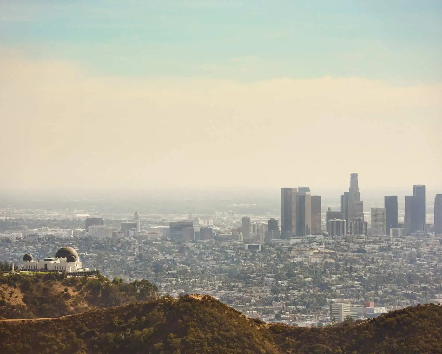
Griffith Park
We are going to start our guide with one of the most obvious, but nonetheless spectacular locations: Griffith Park.Griffith Park encloses the Hollywood Hills, including the Hollywood sign, the Griffith Park Observatory and the LA Zoo.It’s a huge area of mostly hilly parkland, but its real attraction lies in just how convenient it is: if you are visiting LA for pleasure, you’ll almost certainly head to Hollywood at some point, and if you are over on business, there’s a good chance you’ll be around Downtown, Hollywood or Beverley Hills – all of which are very close to Griffith park with many of the hikes being able to be completed in an afternoon.The classic hike here is the Hollywood sign and there are several possible routes.The most direct route involves parking on North Beachwood Drive.Looking at a map, it would suggest you can drive to the end of this street before continuing on foot up the The Hollyridge Trail, however, in reality this route is not possible as it crosses private land and is blocked by the substantial gates to the Sunset Ranch (whenever we walk this route, we invariably get asked by lost tourists how to get onto the trail to the sign).Nonetheless, it is possible to park on North Beachwood Drive (though please check the restrictions which are in place on certain days) and walk up Linforth Drive followed by a right on Deronda drive which will take you to the entrance to Griffith Park.From here, you can either walk up to a viewing area for the sign or continue to hike up Mount Lee, ultimately arriving at a viewing point behind the sign.Most of the trails in Griffith Park follow paved access roads, so this is one walk that does not specifically require hiking boots.
Walking at a moderate pace, it’s possible to walk to the sign and back from North Beachwood Drive in around two hours, however, do be aware that it is all up hill on the way out!
There’s a lot more to Griffith Park than the Hollywood sign though.The observatory is a fascinating destination in its own right and if you are feeling like a longer walk, you could take in the Hollywood sign and the Observatory in a single route – even though these two locations are not massively far apart, the fire road that connects them does follow a meandering route, so this could easily be most of a day hiking if you were not in a rush.Another interesting add-on is the Wonder View Trail to Burbank Mountain – you’ll see this narrow dirt path signposted near the final turn in the ascent to the Hollywood sign.
All in all, Griffith Park is a fantastic pace to visit, and we would recommend it to anyone visiting LA.Walking up to the Hollywood sign is relatively quick and easy and does not have to take up a full day.If you do make it up to the viewing area above the Hollywood sign, you may notice a large lake to your right.This is the Hollywood Reservoir and there is a fantastic nature trail around this – well worth visiting if you have some spare time in the area.
When to visit
Griffith Park is open all year round, and we would say that the walks in the park are appropriate year-round too.Bear in mind that it can get very hot in the summer months, so at this time of year, you may want to plan your visit for early or late in the day to miss the worst of the midday sun.
Orange County
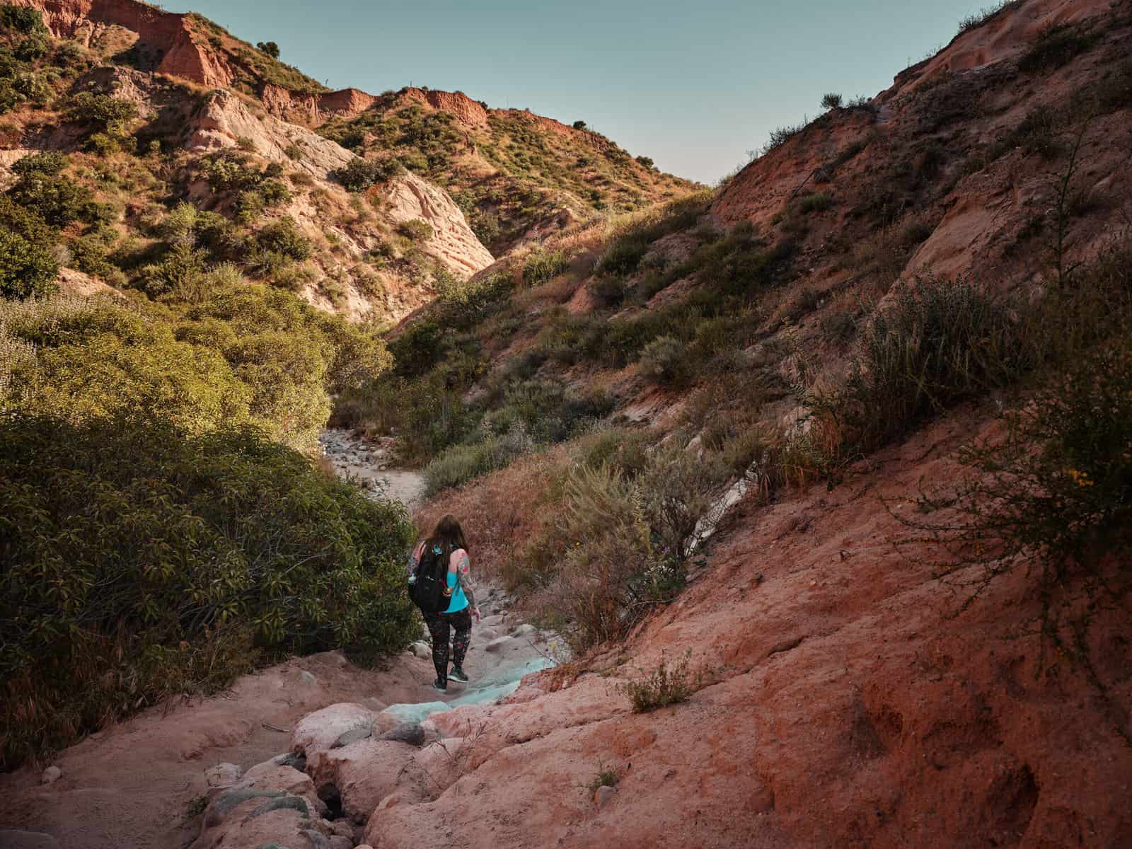
Heading South from Downtown, you’ll reach Orange County.Most visitors heading this way will be aiming for Disneyland, but head a little further south, and you’ll find some interesting hiking options.Looking on a map, you’ll see plenty of green space, and there’s surely plenty of hiking here.It’s an area we fully intend to explore more!This time, we headed to the Whiting Ranch Wilderness Park where we combined two trails: The Borrego Canyon and Red Rock Canyon trails.Together, these form a nice there-and-back trail that can be completed in a couple of hours at a moderate pace.The car park and trailhead suggest that this is going to be a manicured park, but that is definitely not the case, and you’ll soon find yourself in a deep wooded area that eventually opens out into a steep-sided red rock canyon – something that you might more reasonably expect to see in Utah rather than a few hours’ drive from Downtown LA!This trail is pretty easy going – it’s relatively flat and very well established – so easy to follow.It is popular with mountain bikers – especially in the evening, so keep your eyes open – especially if you have small children with you.
It would be a great shame to travel to Orange County and not visit the coast, so after your hike we’d recommend a trip to Laguna Beach – a great place to grab some food and watch the sun go down!
When to Visit
Year round! The Borrego Red Rock Canyon trails are both quite well shaded, so even in high summer, they offer a good option.Be aware that these trails do follow the course of a creek, and bugs can be an issue here – with this in mind, it is worth bringing insect repellent along just in case!
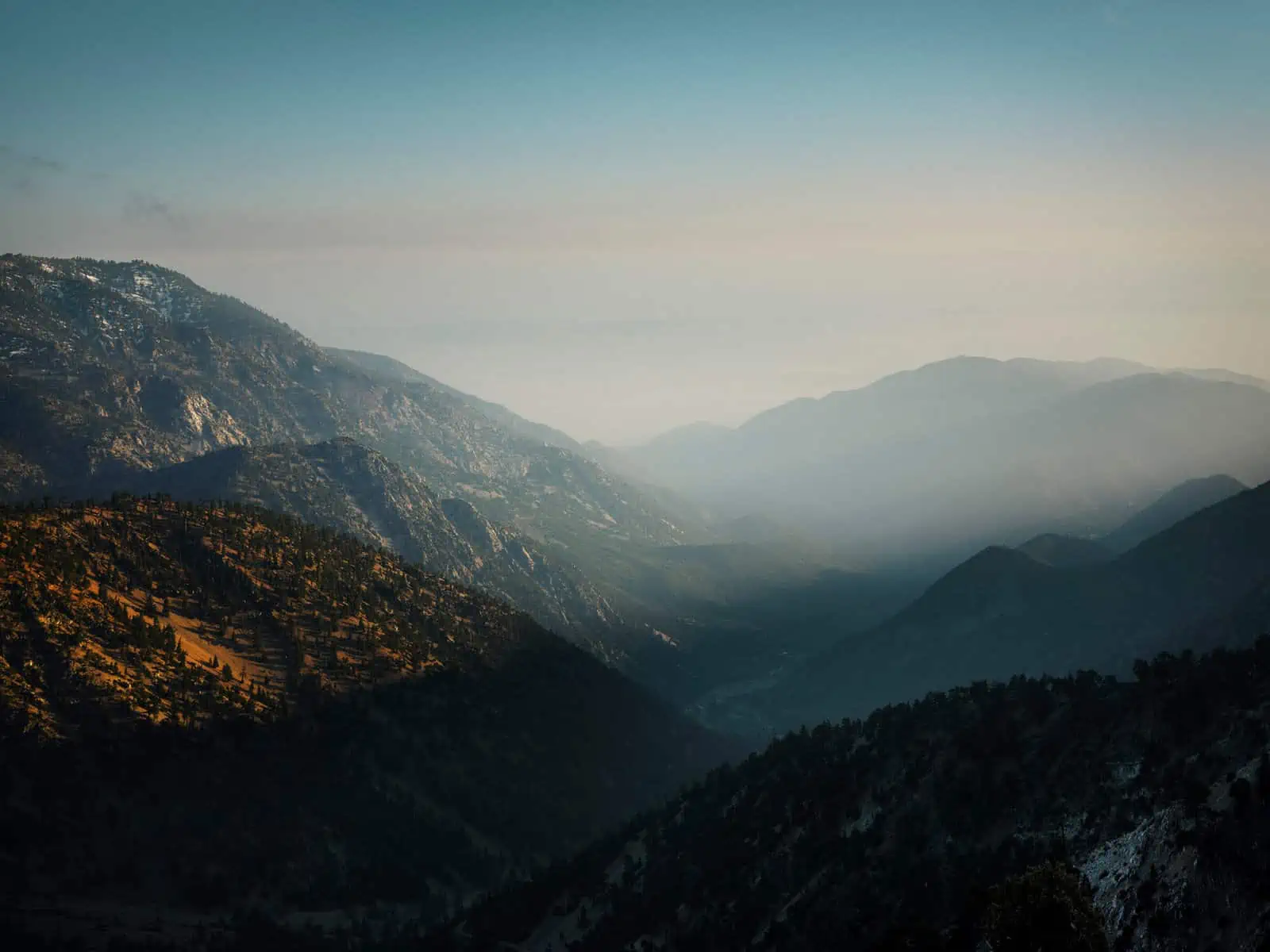
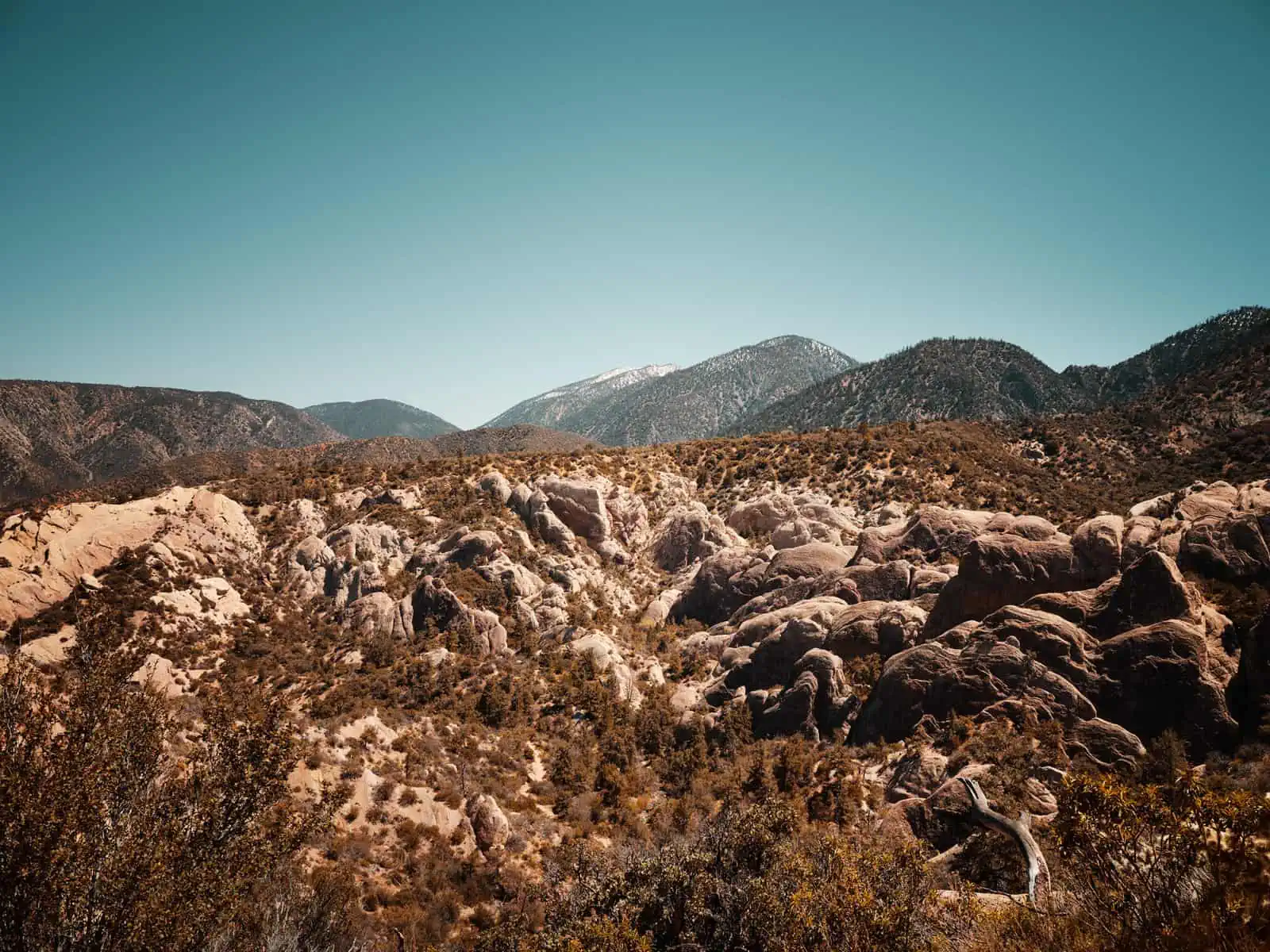
The Angeles National Forest and the San Gabriel Mountains
Bordering Los Angeles to the East, the Angeles National Forest and San Gabriel Mountains are a huge area.You could likely spend a lifetime exploring here.The mountains offer a massive variety of trails – ranging from shorter family-friendly hikes to more advanced mountaineering routes.
Mt. Baldy
For those looking for a more advanced route, Mount San Antonio – better known by its nickname ‘Mt Baldy’ is the ultimate prize in the area.At 10,046ft (3,062m), it is the tallest peak in the San Gabriel Mountains.Parking at the Manker Flats campground, there are two routes up: the shorter – but far steeper – Baldy Bowl and the much longer Devil’s Backbone trail.These routes are often combined into a circular route with many hikers going up the Backbone and down the Bowl.We did it the other way around.There’s no escaping it- this is a long, steep route.From Manker Flats, there is just over 3,000ft (1,000m) of climbing to the summit.The first half of the Baldy Bowl route is a relatively straight forward ascent to a ski hut run by the Sierra Club. For many hikers, this is as far as they will ascend, and it does make for a great hike in its own right.Pressing on, the route becomes noticeably steeper as you near the summit – you are also at high altitude, so expect progress to be slow.Take a moment to look around you, though, the views through the trees are stunning and you can also expect to see a wide range of wildlife.Eventually, emerging from the trees, you will reach the summit.The summit sits above the tree line and really is like a bald patch – you can see how the mountain got its more common name!The initial descent on the backbone is even more spectacular than the ascent. Looking left, to the east, you will have a view over the Mojave Desert whilst looking right to the west will give you a view over Los Angeles as far as the Pacific on a clear day.Ultimately, the backbone descends through the Mt. Baldy ski area before linking up with a fire road that will bring you back to Manker Flats.This is a full, long day’s worth of hiking and should not be undertaken by those who are not sure of their hiking ability or fitness.Whilst there is no actual rock climbing involved, several parts of the trail are narrow and on the edge of very steep drop-offs.Snow can be a major hazard, and in winter, it can make the trail unsuitable for all but the most experienced mountaineers.
When to Visit
The hike is best attempted in late spring and late summer (given a lower day temperature).The key factor is snow. If there has been heavy snow fall, then the route will be unsafe to the point of being lethal (unless you are an extremely experienced Alpinist).We first attempted this climb in May, and there was still a fair amount of snow on the ground at higher altitude, but no really deep drifts.We brought crampons with us for the hike and we did use them.Whilst we were certainly glad of them, they were probably slightly overkill that day and we could have made use of ‘micro spikes’ in their place.
Switzer Falls
The Switzer Falls Campground is located in a valley just off the Angeles Crest Highway a few miles before the turn off for Mt. Wilson Rd.You can either park in the lot by the highway or drive down into the campsite itself where there is further parking available.The campsite is the starting point for a linear trail that follows the valley floor.We decided to head South – in the direction of Mt. Wilson Rd.We arrived at the trail late in the day and consequently had just a short walk here, following the trail for about an hour before turning back and retracing our steps to the car park.The trail climbs gradually through the valley, roughly following the course of a creek.It is quite heavily wooded, and this provides some welcome shade from the sun.This trail is fairly easy going, without any substantial climbing and it would certainly be suitable for family groups with children.As mentioned above, we completed this hike as the evening drew in, and we were treated to the unexpected sound of bullfrogs calling on the final section back to the car.
When to Visit
This is an easy-going route well below the snow line.As it’s also well shaded, we would say this is suitable for hiking year-round. Visit in late spring/early summer if you want to hear the frog chorus!As the trail follows a stream, it’s wise to bring some insect repellent just in case!
Stoddard Peak
This is a moderate route that follows a fire road most of the way up to minor summit (you can take a detour up to actual summit if you wish).The trailhead is located off Mt. Baldy Rd. at the junction with the Barrett Stoddard Fire Road.The starting point is relatively high, so you get fantastic panoramic views over the landscape – one way the city lies below you, then on the other, Mt. Baldy towers above.The views make this trail well worthwhile!This is a linear route – roughly six miles as a round trip, but of course, you can easily make this shorter if you wish.Whilst it is not overly steep, the route does consistently climb, and it is quite exposed after an initial wooded section, so with this in mind, we don’t think the trail would be suitable for much smaller children.Nonetheless, it’s a great route that can easily be fit into a morning or as part of a longer day exploring the mountains.
When to Visit
The trail is suitable to hike all year round, however, it will get very hot on the trail in high summer and much of the trail offers no shade from the sun, so be sure to arrive prepared.
Trail Canyon Falls
This is a four mile there-and-back hike.The trailhead is just off big Tujunga Canyon Road near Sunland.The trail basically takes you up to a waterfall.Along the route, you’ll need to cross a stream several times and this, combined with the consistent up-hill along with some scrambling, would lead us to classify this as a medium-to-advanced route.Nonetheless, if you are prepared to get your feet wet, it a great trail with a rewarding objective at the end!
When to Visit
This trail may be tackled year-round.We would advise exercising caution if there has been consistent rainfall (a rare event in LA – but not completely unheard of!) in the days before you attempt it, as the river may be higher than normal.As the trail is close to water, we would recommend bringing bug spray.
The Devil’s Punchbowl Natural Area
This is technically still part of the San Gabriel Mountains, situated over the mountain range from LA on the edge of the desert.However, to us it felt like a very different place, so we’re treating it as a separate location!This area is basically a large canyon formed over time by water runoff from the nearby mountains.There is one trail that follows the rim of the canyon before plunging down to its floor, following it a while and then climbing back up to the visitors’ centre.The scenery here is truly spectacular and, we’d say this area is well worth visiting, even if you think you’re all ‘mountained-out’ after other hikes in the San Gabriel Mountains, as the landscape here really does feel different – much more desert-like than the forests of the mountains.As you hike, keep an eye on the rock walls. We saw several rock climbers on our visit, and these often-solitary figures on the rock walls help you to realise the scale of the place.There are some steep and narrow sections in this trail, so we would recommend appropriate hiking gear and a good head for heights on this one! There is also the opportunity for another hike from the visitor centre – The Devils Chair. This is around a 7.5 mile there-and-back trip – plenty worth the effort if you fancy something more strenuous.
When to Visit
All year round. You’re in the desert for this hike, but you are at a relatively high altitude, so rather than preparing for extremely warm weather, you should prepare for it to be cold. Gloves and warm hats would be a smart addition to your backpack, even in early summer.Also, don’t forget that just because it’s cold, it doesn’t mean you can’t get sun burn.The route is very exposed, so do bring some sun block and do make sure you use it!
Malibu and the Santa Monica Mountains
As if we could write this article without mentioning Malibu! This place has had our hearts since the first time we headed to California. Head north from LA on the Pacific Crest Highway, and Malibu is the next major centre of population you will hit.The hills and mountains inland of Malibu are correctly referred to as the Santa Monica Mountains, but many people will just refer to the whole area as Malibu.Most people will come here just to see the beaches (which are beautiful, by the way – more on these later!), and maybe to take a drive inland to Topanga with its multitude of quirky stores, but there’s a lot more to this area if you want to hike.
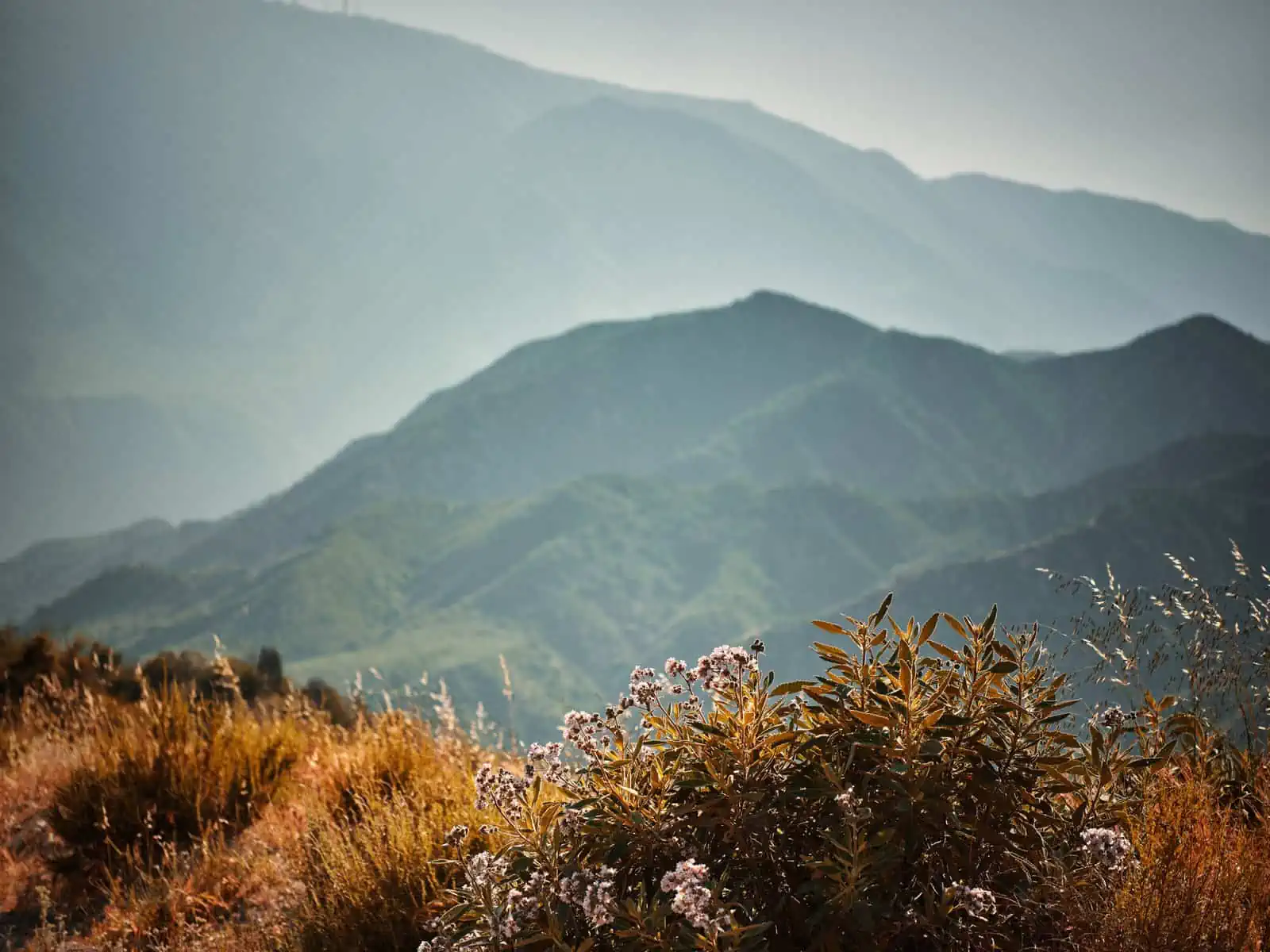
The Santa Monica Mountains are nowhere near as tall as the San Gabriel Mountains, but don’t let this fool you into thinking that all of the hiking here is easy. The hills here are steep, and there is often a lot of up and down and up again on the trails here, so if you’re counting, the altitude gain certainly does add up!Added to this, the area is very exposed and generally very warm too – be sure to bring plenty of water and sun block, especially in the summer months.
The exposed nature of the landscape lends itself well to epic views, and these are the rewards of most of the high walks in this area – often the hills will frame the ocean in the distance.The landscape here is also very changeable – later in the year it is often quite monotone, with parched vegetation and muted colours.However, in spring – and subject to the rain – there can be a spectacular wildflower bloom that carpets the landscape in vivid greens, purples and oranges.If you time your visit right, this is well worth seeing!
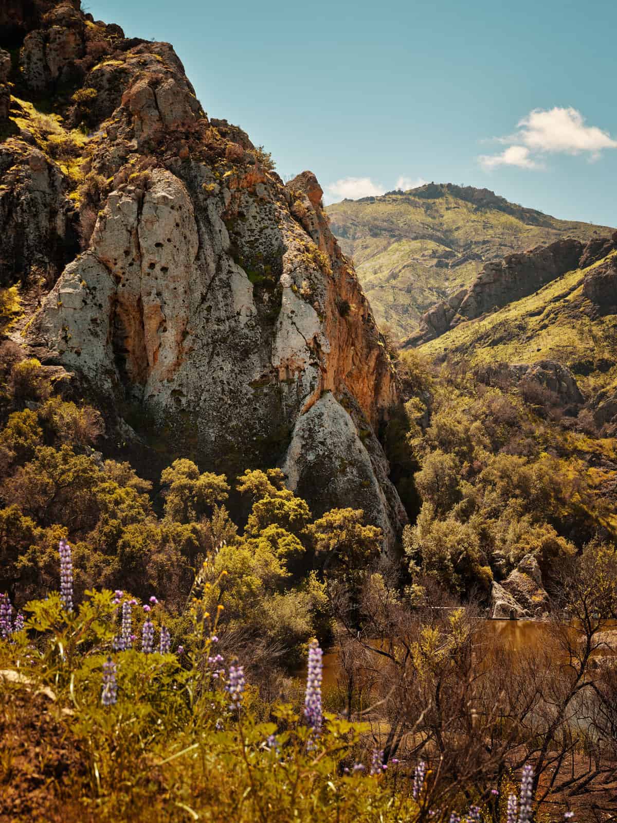
The Santa Monica Mountains were ravaged by the Woolsey Wildfire in November 2018.On some of the hikes we’ve listed below, you can see the evidence of this in the form of charred tree trunks on the routes.The good news is that nature has bounced back and fresh plant growth is already well established in the areas affected by the fire.
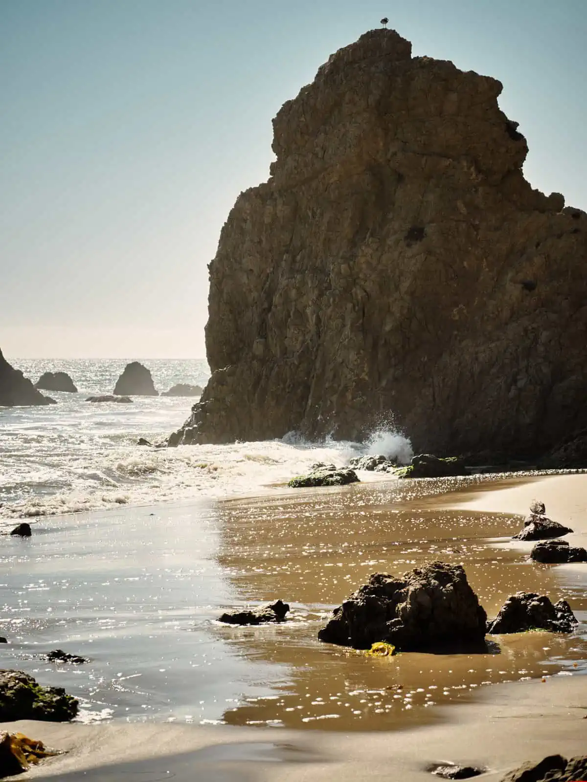
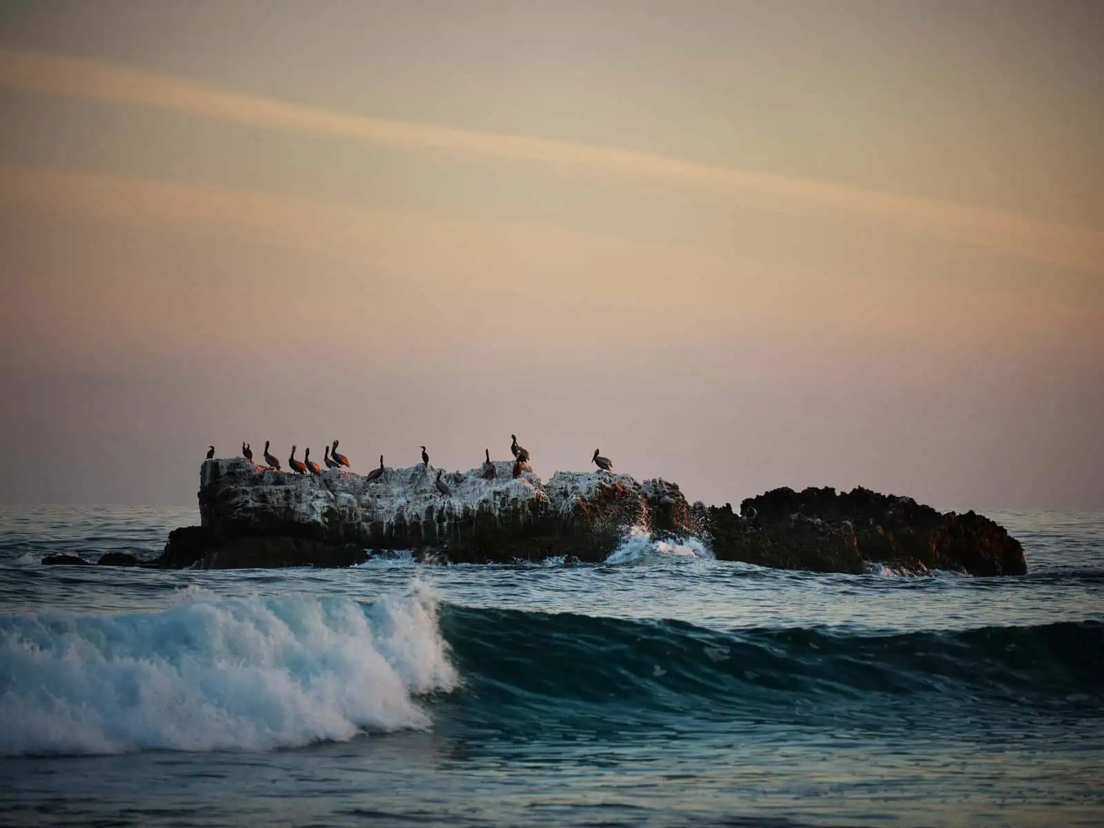
Many of the hikes listed below will not take a full day, though there is a whole network of interconnecting trails here, so those looking for something longer can certainly improvise and extend the length of any of these easily.Once you’ve finished hiking, we recommend a trip to the coast. There a are plenty of beaches around Malibu, though some are private.We were particularly taken by El Matador Beach, which is further north along the Pacific Crest Highway from Malibu itself.The landscape here was rockier with steep columns of stone rising from the beach and ocean.A great place to watch the sun go down!
All of the hikes listed below are on well-marked trails and to an extent, all are family friendly.
Malibu Creek State Park – Cistern and Lookout Trail
For a long time, one of the key attractions at Malibu Creek State Park was that it had been the filming location for the 70s TV show M*A*S*H.Traces of the set survive, but they have taken a battering from various wildfires over the years.
This trail – actually a combination of two formal trails –starts at a car park on Mulholland Highway and descends into a valley where it meets a creek and reservoir.At this point, you simply turn around and retrace your steps to the start.The first section is quite exposed, and here you will see plenty of evidence of the 2018 Woolsey fire.At the bottom, the trail levels out and some shade is offered by trees.This is a popular route, and it gives spectacular views of the surrounding hills as you descend.
Mesa Peak
Starting at the Piuma Trailhead on Malibu Canyon Road, this trail climbs steeply to give spectacular views over the surrounding hills and, as you climb further, even out to the Pacific.It’s a there-and-back trail, connecting to other routes, so it’s possible to either have a short hike, taking in some views before returning to your vehicle, or a much longer hike. We saw few other hikers on this trail, but plenty of wildlife including a couple of snakes (we gave them plenty of space and didn’t get close enough to clearly identify them) plus deer too.
Sandstone Peak
Further north and a bit further inland, you’ll find the Sandstone Peak Trailhead off the winding Yerba Buena Road, relatively close to El Matador Beach – this is an incredibly beautiful drive in its own right to get there – on this trip, we made a point of hiring a slightly larger, more powerful vehicle than we have in the past. This made driving through the hills a real pleasure.
We’ve had a few people ask us if it is possible to travel around LA without a car, or by just getting the smallest most budget option possible. The fact of the matter is that whilst this is probably possible, to get the most out of a trip to this area, you really do need a car, and it becomes the key to unlocking the adventures you’re going to have. As we’ve mentioned earlier, Enterprise is our first choice for car hire in America – their great service allows us to get on with enjoying what we came here for – our adventures and feeling inspired.
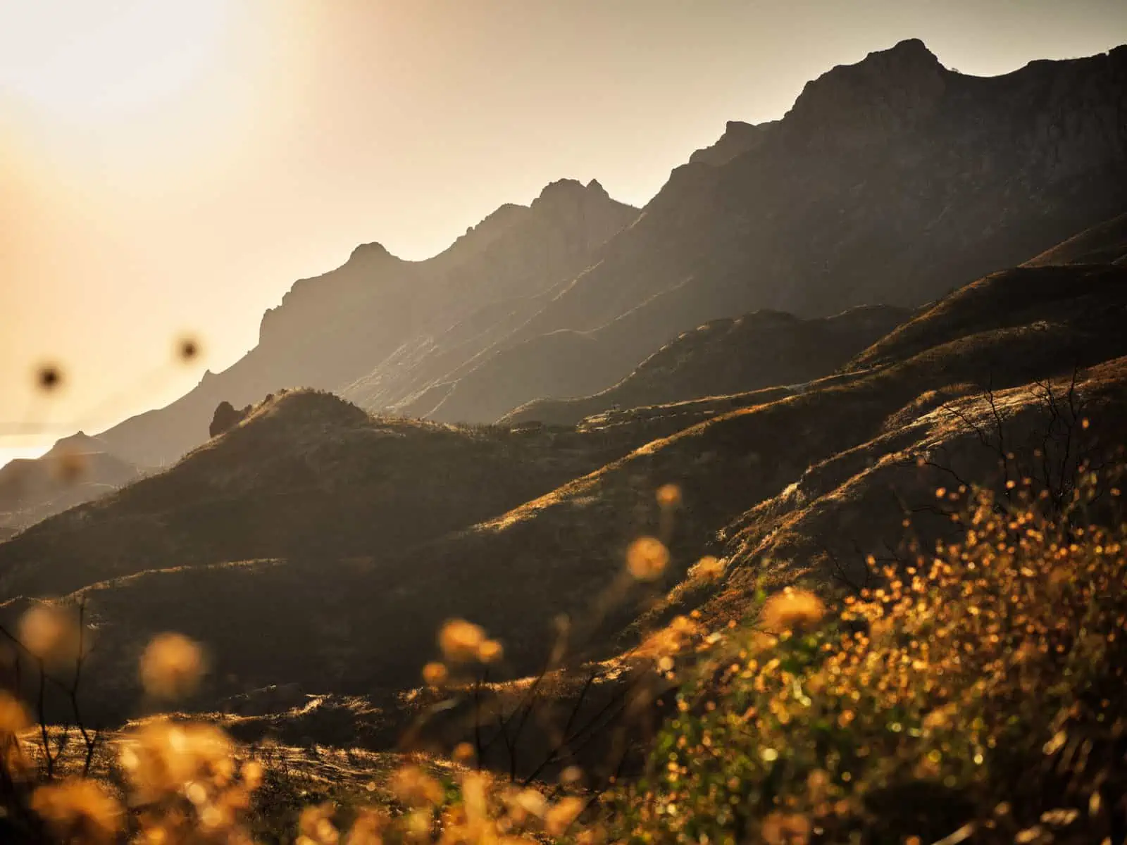
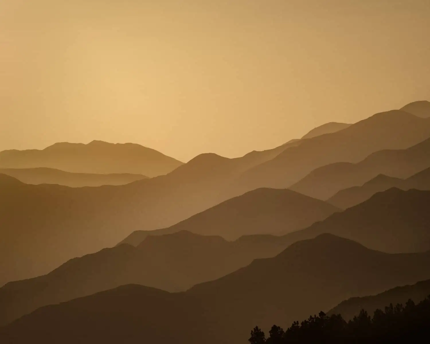
The hike up to Sandstone Peak is relatively short. The whole hike can be completed in a few hours at a leisurely pace, but it is steep in places.The views from this route are incredible, and you get fantastic vistas of the ocean framed by lower hills. Even the view from the trailhead car park is spectacular.This is a hike that’s worth attempting later in the day, as the light from the low sun paints the landscape a hazy golden hue – truly beautiful, and you see how California came to be known as the Golden State!
When to Visit
You can visit Malibu and the Santa Monica Mountains all year round.The key issue you will encounter here is heat in high summer – temperatures truly can soar.Be sure to bring plenty of water and sunblock.
It might seem to odd to think of LA as the base for hiking, but the potential in the surrounding areas is vast and frankly, we think it’s a crying shame to visit and not try to get in some hiking!Even if you live in the area, there is so much to see and do right on your doorstep. The suggestions above are some of our favourites, but this is far from a complete list.