This post is sponsored by Visit California, all opinions are our own
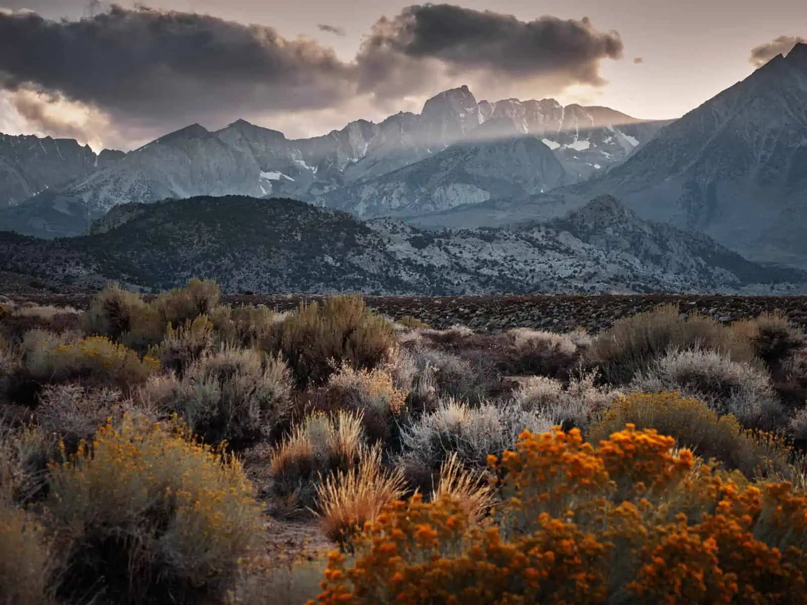
Our first glimpse of the Sierras was all too fleeting.We spent April and May of 2019 based in Los Angeles and had taken an overnight trip up to a town called Lone Pine to check out an area called the Alabama Hills (We actually wrote a blog piece about this all too brief trip focussing on how to get the most out your landscape photography when you are just passing through). We knew the Sierras would be the backdrop for this visit and we had read about how tall they got and seen plenty of pictures online too – but none of this prepared us for the impact these mountains and this area would have on us.Driving North along the 395, the mountains seemed to grow – and frankly keep growing – out of the desert.By the time we reached Lone Pine – still in the desert, but much greener than the landscape further South, the mountains were towering spectacularly to our left.Until that moment, we had not seen anything in America that rivalled the Alps in Europe for pure impact.But here it was.It doesn’t seem right to compare places like this, but these mountains – still with substantial snow cover in May – instantly put us in mind of the Dolomites in Northern Italy with their sheer walls and jagged peaks.That visit did not give us enough time to explore the mountains and we knew as soon as we arrived that we would want to return.We were there that time to see the Alabama Hills and the mountains would have to wait.
Soon after that trip, we started making plans for a longer visit to the Sierras and fortunately, thanks to a partnership with Visit California, an opportunity to make this trip a reality came up shortly after our first visit.We returned to the Sierras in September 2019 – just four months after our initial visit – and this time had a much more in-depth itinerary, though, as we will see, even on this trip, we will only get to scratch the surface.
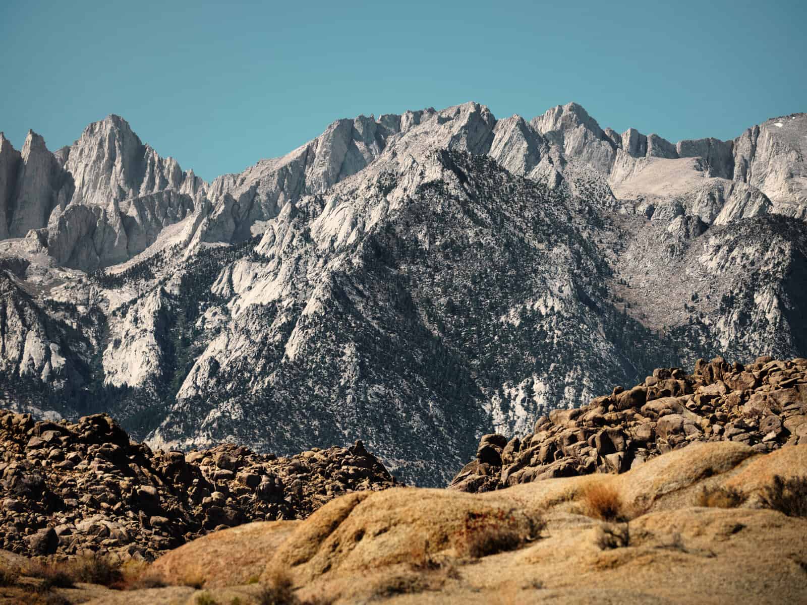
Before we go much further, let’s talk a little more about the Sierras.The Sierra Nevada Mountains – to give them their full name and not to be confused with the mountain range of the same name in Spain – run approximately 400 miles (640km) South to North roughly parallel with the Pacific coast.The Sierras are a vast mountain range – starting just North of Los Angeles and carrying on well past San Francisco.Look on a map and you will see plenty of areas in and around the mountains designated as National Parks and National Forests.There are also countless mountain lakes including the saline Mono Lake.The Sierras are home to Mt Whiney – the tallest peak in the ‘Lower 48’ states at 14,505 ft (4,421m) – and a check online tells me that there are twelve other peaks in the Sierras plus two more in the nearby White Mountains above 13,130 ft (4000m).It is clear this area has plenty to offer hikers and mountaineers.In Winter, there can be substantial snow fall and the Sierras host several ski resorts – perhaps the best known is Mammoth Lakes.When we first visited in April there was still plenty of snow on the ground at higher altitudes.By the time of our second visit in September, much of the snow we had seen earlier in the year was gone, but at some of the higher altitudes we visited, fresh snow was just beginning to fall again.Some of the peaks in the range host glaciers – perhaps the best known of which is the Palisade Glacier.
Coming from Europe, one thing we have struggled to come to terms with is the sheer scale of the wilderness in America.True, there are vast areas of wilderness and huge national parks across Europe, but the scale of somewhere like the Sierras in on another level completely.Look again at a map and you’ll see that there are relatively few roads into the Sierras off the main highway.Indeed, many of the access roads you will see on the map will turn out to be unpaved and very uneven – many of them are only suitable for high clearance 4×4 vehicles or ATVs.This means that if you really want to explore, then you will have to go by foot, and you will have to be prepared for long, multi-day hikes and this will require camping.
If you wish to camp in the Sierras, a permit is required.There are limits on the number of permits issued per day and this can be problematic if you wish to hike and camp on some of the more popular trails (for instance around the Palisades), so it is always wise to plan some flexibility into your itinerary.The permitting serves two purposes: first to ensure that the trails are not over-run and second to ensure that visitors are aware of the potential dangers and expected behaviour on the trails: Camp fires are forbidden, for instance and, as you will be travelling through bear territory, it is a legal requirement for overnight hikers to carry food and scented items in a suitable ‘bear cannister’. Permits may be reserved online at the recreation.gov website for a small fee, or can be ordered in person at the Eastern Sierra Inter Agency Visitor Centre just outside Lone Pine – where many are free of charge.Regardless of how you order your permits, they must be picked up at the Inter Agency Visitor Centre (and do expect an on-the-spot quiz from the issuing ranger about food storage and fire safety before they will issue the permit).This can add another layer of complexity into your plans: The permits are generally only issued a few days in advance, so if you want to do several hikes including camping, you may need to plan several trips to collect the required permits, which, depending on where you are staying, may not be a trivial detour!The permit system itself is also quite complex, and the exact permit you need will vary depending on where your entry and exit trailheads are, where you intend to camp and how many people will be in your group.Frankly, it can be overwhelming, but, as always, the Rangers are there to help and if you have any doubts, a call to the Inter Agency Office will clear things up!
The good news is that permits are generally only required if you intend to camp on the trail.For day use, most routes do not require permits (Mt Whitney is a notable exception).None the less, day hikers still need to be aware of certain issues in the mountains, chief amongst which is not encouraging bears.Any food you bring on to the trail must also be brought off it – it goes without saying that you shouldn’t litter but leaving food waste behind is particularly problematic.Once they have a taste for human food, bears are more likely to seek it out and to become problem bears as a result.In the worst case, a problem bear may have to be killed by the Rangers – not ideal!Most trailhead car parks will also have ‘Bear Lockers’ – basically steel cupboards where you can lock up any scented items from your car (food, toiletries etc.) whilst you are hiking.Bears are attracted to these items and can and do cause substantial damage to vehicles trying to get to scented items that have been left inside.
As mentioned above, the range’s Southern end is just North of Los Angeles and from here, you can travel Northbound on the 395 Highway – which ultimately heads through Carson City and Reno.After a stretch through the open desert, the 395 heads into the Owens Valley – the Sierras make up the wall on the West side of this valley whilst the East wall is provided by the Inyo and White Mountains.Lone Pine – approximately 3:30hrs and 210 miles (337km) from Downtown LA is the first substantial town you’ll encounter in the Owens Valley and from here, if you keep heading North you will pass a string of smaller towns – the most notable of which are Independence and Big Pine – before finally arriving at Bishop, a further58 miles (93km) from Lone Pine.This stretch of the 395 between Lone Pine and to just beyond Bishop would be the basis for our exploration and all of the trails we would attempt could be accessed from this stretch of highway.US National Parks are truly spectacular, but we wanted to avoid these well-trafficked areas on this trip and present you with a guide to some perhaps often overlooked areas instead. This area, bracketed roughly by Sequoia National park to the South, Yosemite National Park to the North and Death Valley National Park to the East provided ample opportunity for this.
Looking on the map, this ‘home’ stretch of the 395 appears to be roughly equidistant from Los Angeles and San Francisco, so you might think that either city would serve as a good starting point for a visit to the Sierras.This is certainly true, but it’s worth noting that access to the Owens Valley from San Francisco involves crossing the mountains on roads that can be closed by heavy snow and, even if they are open, the route is several hours longer.
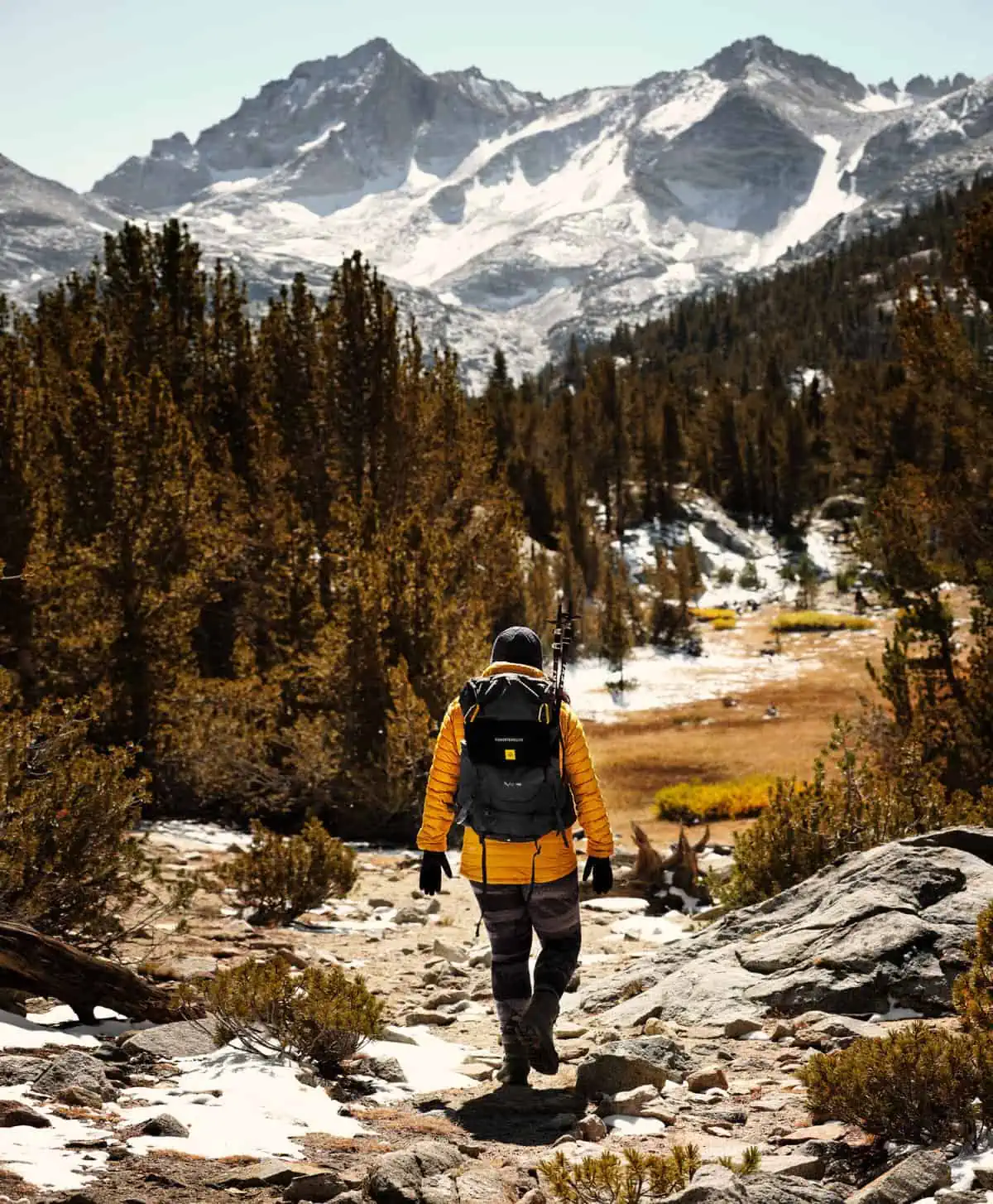
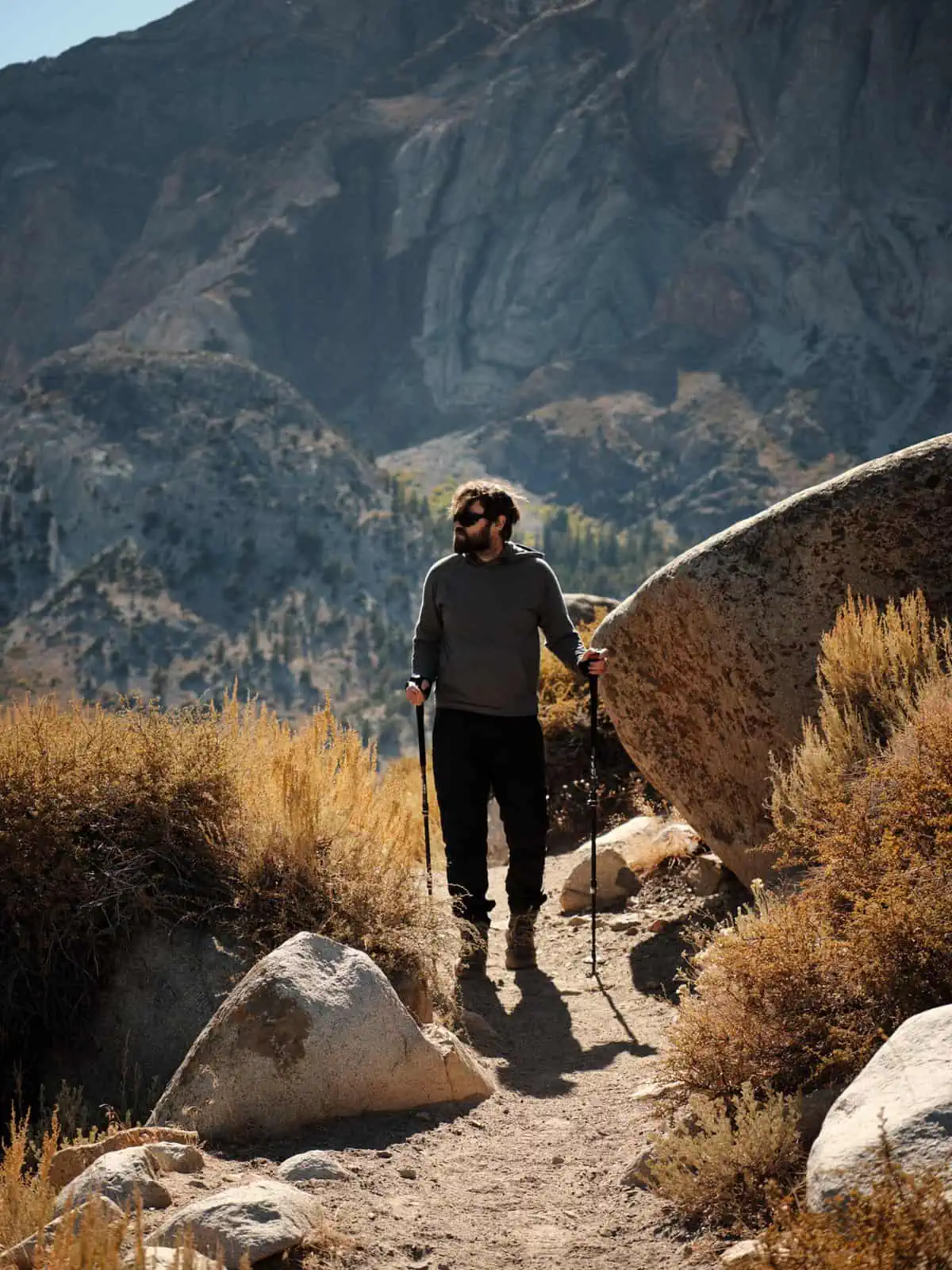
Much of the hiking you will do in the Sierras will be at high altitude.There’s just no escaping this if you want to get into the mountains.Some of the hikes we have listed below have starting points above 10,000 ft (3,048m).Whilst more experienced hikers and mountaineers may not consider this to be much of an issue, altitude is ignored at your peril!We have written an article about preparing for high altitude adventure and what to expect from it. You might want to give it a read if you are considering a visit to the Sierras (or anywhere high up!) and have limited experience of high altitudes.
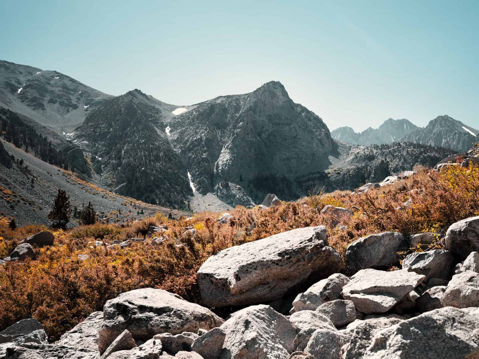
Big Pine North and South Fork – the Palisades
We were very excited to be back in the Sierras and our first stop, after driving from LA and collecting some permits we had reserved online in Lone Pine was to head up to Big Pine, turn West of the highway and drive in the Golden Trout Wilderness where Glacier Lodge – a collection of chalets at 8,000 feet (2,438m) – would serve as our base before hitting the trail the next day.Glacier Lodge sits at the trail head for the North and South Forks of the Big Pine Trail and, as our first proper hike in the Sierras, we could not have wished for a more spectacular introduction.Both the North and South Fork are long distance trails and really, the choice is yours with regards to how far you want to go.The North Fork will ultimately take you past a series of lakes before ascending to the Palisade Glacier.This is not a trivial hike!You start off at a high altitude already – you can certainly feel the thin air when you head off on the trail – and the trail only keeps climbing.The final ascent to the glacier is accompanied by some tough scrambling.We’d both managed to catch colds a day or so before we arrived so, sadly, we did not make it as far as the glacier this time.However, patches of year-round show and ice were clearly visible on the mountain in the distance as we hiked and what we saw was truly spectacular.The South Fork is slightly easier going and again, leads up to a number of lakes.Even if you didn’t want to hike at all, the view into the mountains from Glacier Lodge – presenting pine forests above which the mountains with their snow and ice tower – was mind-blowing.This was definitely an Alpine environment with pine forests and hardy shrubs growing.The owner of Glacier Lodge had told us they sometimes get over twelve feet of snow here in Winter!Despite all of this, though, we still spotted the odd small cactus growing along the trail.An unexpected sight for sure!
The trails here are apparently very popular, but when we visited, we met with only a handful of other hikers.
Little Lakes Valley to Gem Lake, the Morgan Pass and Morgan Lakes
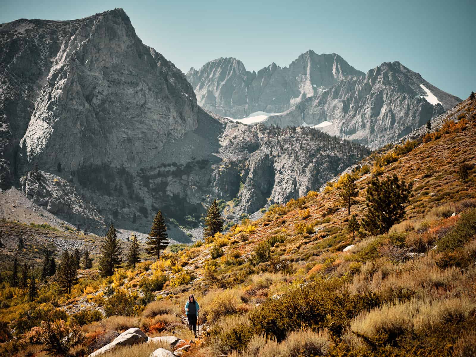
This is a fantastic trail!To reach the trailhead, keep going North on the 395 past Bishop until you reach the intriguingly named Tom’s Place.Here, you turn onto Rock Creek RD and continue until the road runs out and that is the starting point!By the time you reach the trailhead you are already at 10,000 feet (3,048m), so even if it’s warm in the valley, you can expect it to be noticeably colder up here (the general rule of thumb to follow is that temperature drops 1C for every 100m you ascend).We were certainly glad we brought along plenty of layers, gloves and hats.This was the route where we saw fresh snow fall and wouldn’t be surprised if, as we write a little over a month after visiting, if there is already substantial snow on the ground on this trail.The air also felt thin here – even more so than it did at Glacier Lodge – so we decided to adopt a more gradual pace than we normally would for this trail.At first many other hikers were speeding past us, but our decision paid off and we soon found ourselves overtaking many of these hikers who seemed to have run out of steam very quickly!
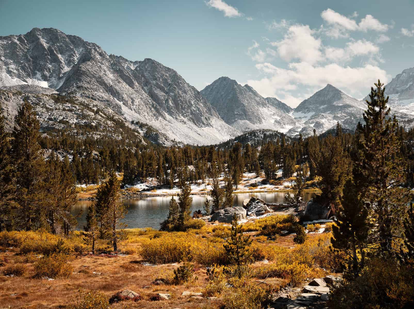
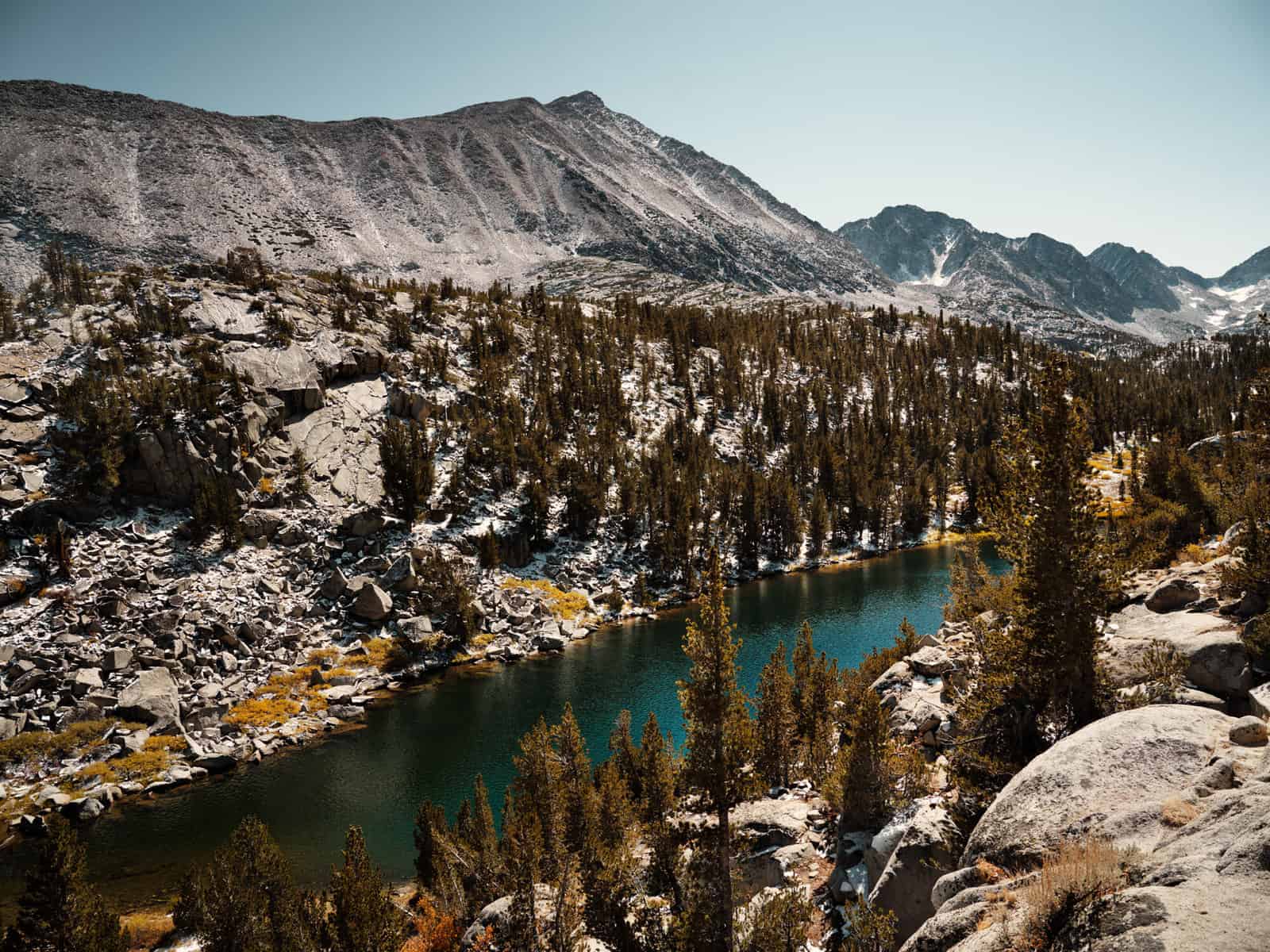
This trail rates as our favourite from our visit to the Sierras.It starts out at a place called Mosquito Flats.The weather was too cold for them when we visited but, as American place names tend to be quite literal, we’d suggest bringing some insect repellent should you choose to hike here in the Summer months.A well-marked path follows a string of lakes into the mountains.The path is constantly climbing, but relative to many of the other trials you’ll encounter here, the ascent is fairly gradual and the trail certainly does not feel like an up-hill slog.
As you progress through the hike, each lake seems more spectacular than the last – in many cases they beautifully reflect their surroundings. It is possible to add on a further section to this trail taking in the Morgan Pass and Morgan Lakes (again, this section only climbs gradually).The full trail – including the Morgan Lakes extension, would be possible as a there and back in a day assuming a not too hectic walking pace.
The trail was busy – and we can certainly understand why – and many of the people we met had chosen just to walk to the first or second lake – and this would be a great walk in its own right too.
We can thoroughly recommend this trail and we would go as far as to say it is essential for anyone visiting the Sierras!
Ancient Bristlecone Pine Forest
We can’t start this section without telling a little story: one morning, towards the end of our trip, we were in the Lone Star Bistro in Lone Pine getting a coffee. A biker walks in: ‘I’ve seen signs for this Ancient Bristlcone Forest.Is it worth going up?’The answer came straight away: ‘If you like looking at old trees it is!’
Technically, the Ancient Bristlecone Pine Forest is not in the Sierras, but rather in the White Mountains on the other side of the Owens Valley – Indeed the forest sits on White Mountain itself, which at 14,252 ft (4,344m) is the third highest mountain in California.However, it is a fascinating and spectacular location with a very different ‘feel’ to the Sierras and, as it is easily accessible from Big Pine, it makes sense to include it in this article.
Bristlecone Pines are amongst the longest-living organisms on Earth and the groves here contain an individual tree – named ‘Methuselah’ after the long-lived Biblical Patriarch – that is 4,851years old, making it the oldest known living thing on earth.It is remarkable to think that when this tree was a sapling, the Great Pyramids in Egypt had yet to be built, Mammoths still roamed the Earth and Humans were still in the Bronze Age.There is speculation and indeed some evidence that Methuselah may not even be the oldest tree in the forest.
To reach the forest, take the East-bound 168 from Big Pine.Turn left onto White Mountain Road, and follow this to the visitor centre. From the visitor centre, there are two walks – a short nature trail, plus a longer 4.5mile (7km) hike around the pines.This longer walk – called the Methuselah Trail – will take you past Methuselah itself, though it is not identified and its exact location is kept secret to protect it from vandalism.
The Visitor Centre is at high altitude – 10,100 ft (3,077m).The day we visited it was bitterly cold, despite being quite warm lower down in the valley.As always with hikes at such altitude, be aware of the thin air!We saw a few hikers on the trail who obviously were not prepared for this and were struggling badly as a result.
The landscape on White Mountain is, as mentioned above, very different to what you experience across the valley.It seems much drier and more desolate.Aside from the twisted, gnarled Bristlecones, there is little other substantial plant growth here.You will see fallen Bristlecone trunks on the ground that seem to have almost petrified in the dry air (and the fact that the wood does not rot away is very valuable for scientists studying long-term climate change as it provides a tree-ring record going back close to 9,000 years).It is a very other-worldly experience.
Past the visitor centre, the road becomes unpaved, but it is still passable in a regular car provided you drive carefully and slowly.After 13 miles (20km) of this, you will reach Patriarch Grove at 11,000 ft (3,352m).This is a further grove of Bristlecones set in a lunar landscape.There are a few short trails here that offer spectacular views over the landscape below.
It is possible to drive past the turn off for Patriarch Grove to the White Mountain Trailhead 3 miles (4.8km) further along the road.A high-clearance 4×4 vehicle is recommended for this last section and, from the trailhead, you can ascend to the summit of White Mountain.This is a 15 mile (24.2km) round trip and is considered difficult.We did not attempt it this time, but we would imagine it would require a full day to complete.
All in all, the Ancient Bristlecone Forest is a spectacular place to visit.The ‘feel’ of the landscape and the views it offers are quite different to the rest of the Sierras.Be aware that the roads do get closed during periods of heavy snow, so if you think this might be an issue, then it is well worth phoning the visitor centre before driving up.Even when the road is open, be aware that there is nofuel or food available on this long drive, so ensure you set off with a full tank and plenty of food and water for the day.
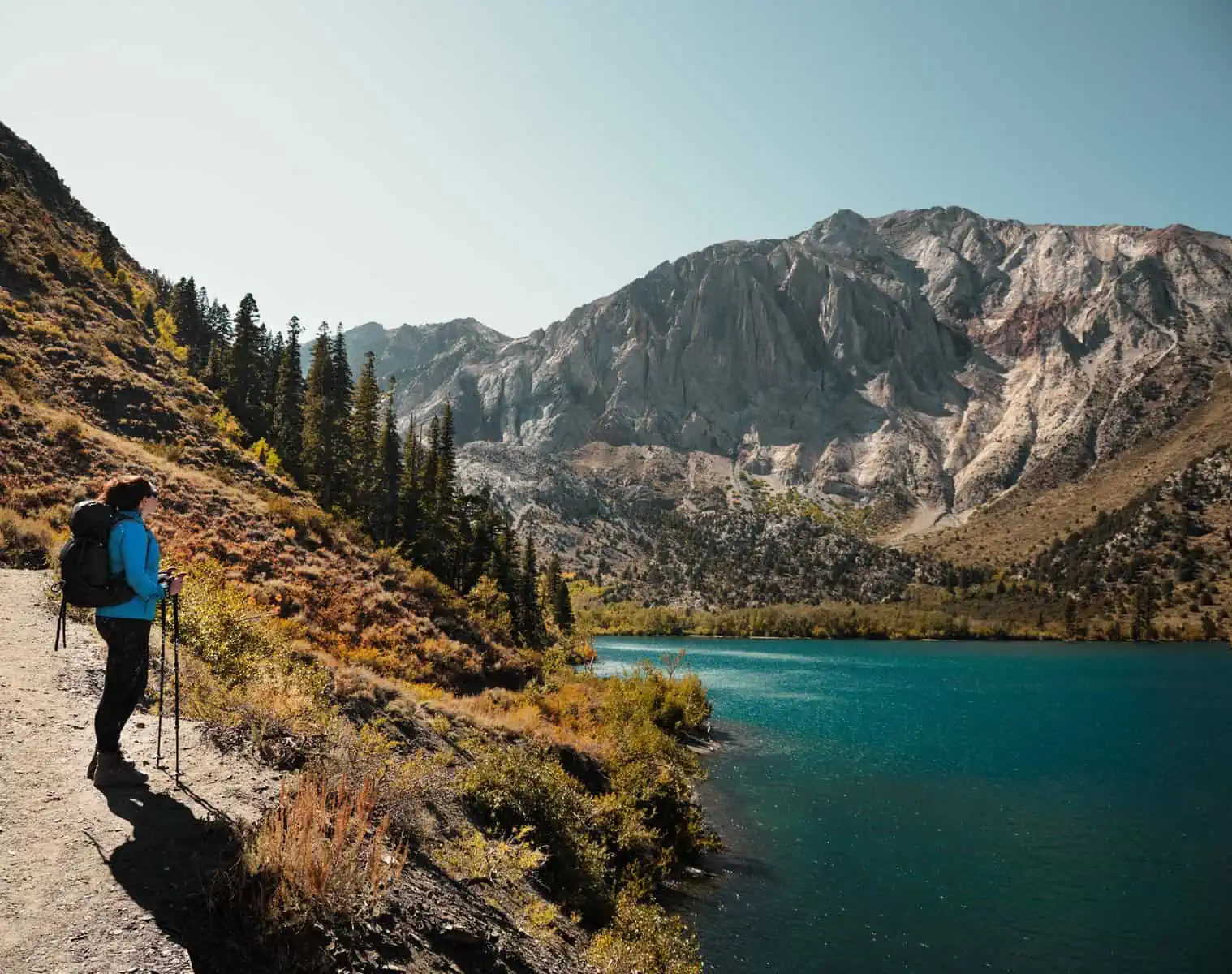
Convict Lake
We’ve already mentioned that there are countless lakes in the Sierras.Convict lake – which gets its name from a shootout that occurred between a group of escaped convicts and a posse in 1871 (it didn’t end well for the escaped convicts…) – is one that particularly caught our attention.To reach the lake, carry on North on the 395 from Bishop and past Tom’s Place (the turn off point for the Little Lakes trail detailed above).You’ll see the turn-off for Convict Lake signposted as you pass the Mammoth Yosemite Airport.
At 7,645 ft (2,330m), Convict Lake is still at high altitude, but noticeably lower than some of the other hikes we have listed here.
There is a short and relatively flat 2 mile (3.2km) circular trail around the lake – though if you wanted to turn this into a longer hike, there are signposted routes to further lakes higher in the mountains on the Northern shore of Convict Lake.The main attraction here, though, is the beauty of the scene.The blue water of Convict Lake is framed by pine forests and the peak of Laurel Mountain.
There’s little in the Sierras that isn’t spectacular, but the landscape around Convict Lake brings a lot of elements together to provide stunning views in a very short distance from the car park.This is a great trail for those with younger children or who do not feel up to some of the more intense trails in the area.However, even for experienced hikers, we feel the views make this trail well worth-while and its short length mean it can be completed before moving on to another trail – and due to its location, would be a great compliment to the Little Lakes trail.
One piece of advice is that it’s best to visit Convict Lake earlier in the day.In the early afternoon, the Sun will be below the mountains, plunging the whole lake into shadow.It is still spectacular in these conditions, but for the best experience we’d advise getting there earlier so you can see the landscape in full Sun.
Lone Pine – Alabama Hills and Whitney Portal
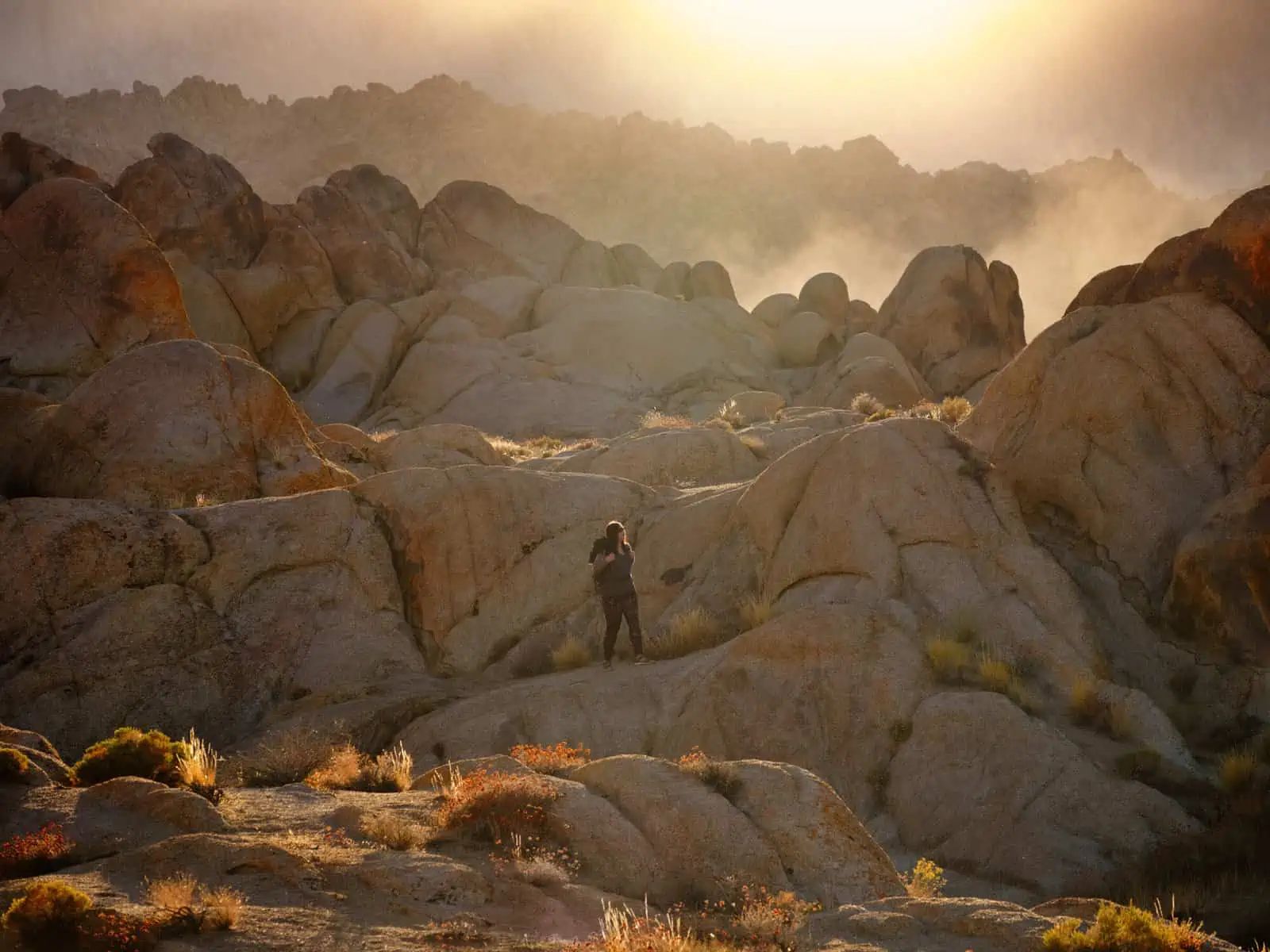
For the last two locations in this article, we’re heading back South along the 395 to base ourselves in Lone Pine.The most obvious places to visit from Lone Pine are the Alabama Hills and Whitney Portal.The Alabama Hills – which were named by gold prospectors after a Confederate warship sunk during the American Civil War – are a series of desert rock formations and low hills.You’ll find natural arches in the rock here and, whilst they are nowhere near the height of the nearby mountains, there’s still plenty of scope for scrambling and exploring in the rocks.The Hills have long been a popular filming location – initially in the golden age of Westerns, but they do still crop up in modern movies too.This history is evident in the names you’ll see on the map – the main ‘Movie Road’ branching off to ‘Lone Ranger Canyon’ for instance.
There are not many formal trails here – though the very short Mobius trail, which includes the natural arch that gives the trial its name – is worth doing.For the most part this is an area you can just wander around and explore at your own pace.The landscape – which offsets the red desert rocks against the high mountains is stunning and this area is an absolute paradise for photographers.
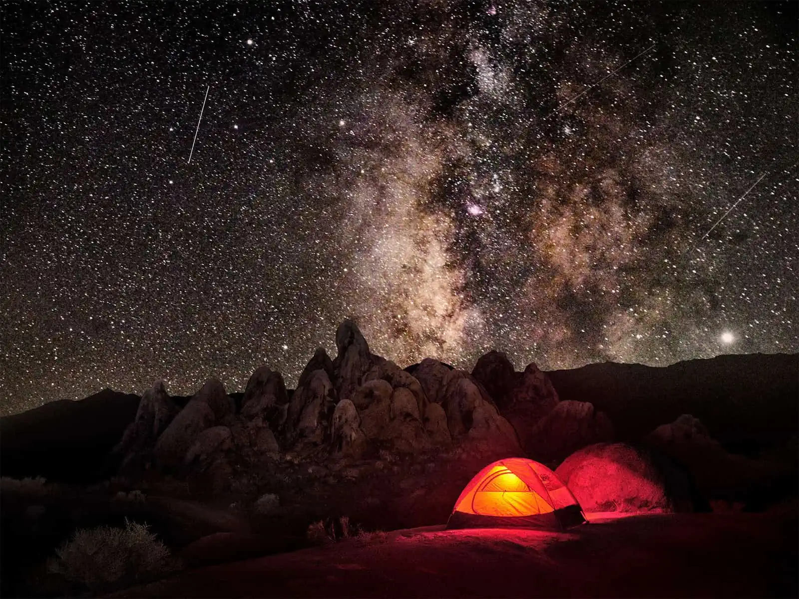
The Alabama Hills are Bureau of Land Management (BLM) land – that means the land is publicly owned but not subject to the same strict regulations as National Parks.As such, you can camp here without requiring a permit or paying a fee and most evenings you‘ll see the area fill with RVs and tents.If you do intend to camp here, be aware that camp fires are forbidden and you do require a permit to operate a camp stove (you can get this permit – which is valid for a year at locations throughout California – free online after answering a short fire safety quiz).Also be aware that this is not a developed camp site – so there is no drinking water or toilet facilities available.Night in the Alabama Hills is pretty special – the area is a designated clear skies zone, so it’s the perfect spot for star gazing.Even without a telescope, you can easily see the Milky Way on a clear night.
If you drive past the turn off for the Movie Road, you can continue up the Whitney Portal Road to Whitney Portal itself – the trailhead for the shortest route to the summit of Mt Whitney.It is worth bearing in mind that even day hikers require a permit for this route and it does get very busy.None the less, even if you do not intend to hike, the drive up is spectacular and gives some fantastic views not just of Mt Whitney itself but also of the valley floor below.
Horseshoe Meadow Cottonwood Lakes Trail and Cottonwood Pass to Chicken Spring Lake
Starting off on the Whitney Portal Road again, a left turn just after the Movie Road puts you on the Horseshoe Meadows Road.As you follow this road, it climbs steeply into the mountains – switching back several times.Soon you’ll have a splendid view of the valley below – with the Alabama Hills presenting as an interesting texture on the valley floor.At the end of the road, you will have reached the Horseshoe Meadows Campsite.This is a large developed campsite – more accurately a complex of several campsites – that serves as a trailhead for numerous routes and includes a section of the Pacific Crest Trail (PCT) – an ultra-long distance route the goes the full height of the USA from the border with Canada to the border of Mexico or visa-versa.It is not unusual to meet PCT Hikers here.With the camp site situated at around 10,000 ft (3,050m), Horseshoe Meadows is also a popular location for hikers intending to summit Mount Whitney to spend a day or two hiking to acclimatise to the altitude – Indeed there is a longer route to the Summit of Mt Whitney starting from Horseshoe Meadows and this is the route PCT hikers will follow.
We were interested in hiking two routes that both have their trailheads here: The Cottonwood Lakes Trail and the Cottonwood Pass to Chicken Spring Lake.Both of these routes snake through dense pine forest and involve sections of steep climbing.The complete routes for either could be tackled in a full day’s worth of hiking or more leisurely with an overnight stay on the trail (remember, you’ll need a permit if you want to camp on the trail!).Both hikes offer beautiful scenery and are made more challenging by the high altitude.Be aware that it can get bitterly cold at these altitudes, and we’d advise anyone attempting these routes to bring plenty of warm layers – particularly if you are there late in the season as we were.If you intend to camp here, it’s worth researching just how low the temperature can get at night and choosing your sleeping bag accordingly – you may be surprised at how quickly you need a bag rated for extreme cold.
When to Visit
Snow is the main issue in terms of routes being closed in the Sierras.Not all roads are cleared of snow, so after heavy falls, some roads will be unpassable.All of the routes listed above are easily accessible from late Spring until early Autumn – with lower-lying routes like Convict Lake and the Alabama Hills being easily accessible all year round.Late March to October is probably a good guide for the optimum time to visit, but this is of course dependent on the snow fall: if there has been heavy snow fall, or if in doubt, ring one of the Ranger stations and they will be able to give up to date trail information.
But of course, that isn’t the end of it! We mentioned at the start that there are ski resorts in the Sierras and we have already started researching winter hiking, snow shoeing and cross country skiing options – and there are plenty! We fully intend to explore the possibilities here further in a future, Winter visit (and many more summer visits too).
As we said right at the start, the Sierras are a vast area of wilderness – the scale is almost incomprehensible.It is one thing to look at a map of the area, but another thing entirely to be on the ground and to realise that what appears to be a short hike on the map is actually a full day of trekking.The potential here is vast and many visitors will barely scratch the surface.Our extended visit- close to two weeks this time – just served to show us that there is so much more waiting to be seen and explored here.That the area is so easily accessible from Los Angeles and other more ‘mainstream’ natural attractions like Death Valley and Yosemite mean that a trip to the less-seen Sierras can easily be added to your itinerary.Even if you have just one day, we would urge you to go see the mountains and take a hike.You will not be disappointed.