
Disclosure: This post is sponsored by Enterprise ; all thoughts and opinions are ourown.
Those big open roads, those massive landscapes, those iconic vistas you’ve seen in a million and one movies. There is an undeniable charm America has on us for an iconic road trip. The West Coast and Western states have formed a particularly strong hold on people in search of a different kind of trip, and understandably so; you’re going to have one unforgettable experience as you discover truly unique places that don’t even seem real.
What we loved about this particular itinerary that we have put together is twofold. Firstly, it allows you to really take in the incredibly varied and vast landscapes of the West which changes so much over the hundreds of miles radius you’ll be covering. The second is just how much a road trip of this size will truly allow you to discover not just in terms of the landscape, but the quiet, the thinking time and the reflection time that you’ll have – it’s completely refreshing and uplifting, leaving you feeling really inspired (and possibly not wanting to go home at the end).
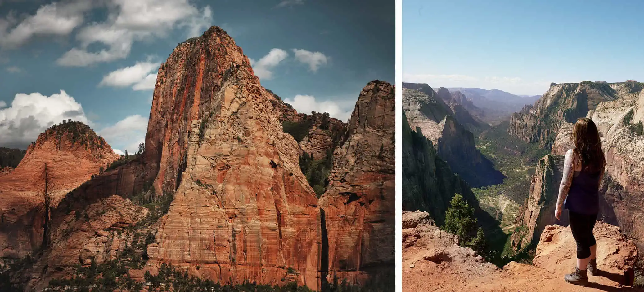
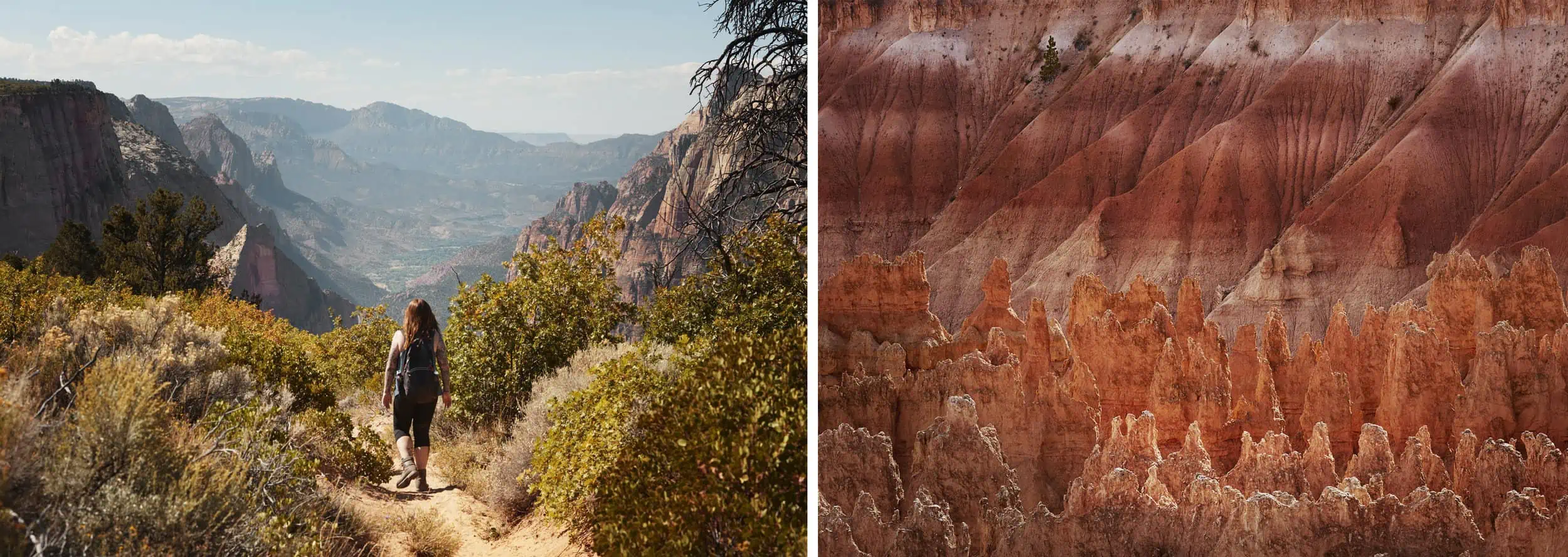
Kolob Canyon & Observation Point, Zion National Park, Utah
This road trip is called The Alternate American Road Trip for a reason. As you guys know, we are massive fans of the National Parks and all they have to offer. However, we wanted to highlight the incredible (and just a handful – there really is an incredible amount) of State Parks and Public Lands that have absolutely jaw dropping, beautiful and serene nature that will soothe your soul away from the crowds at the National Parks. Not only will you find more solitude in these areas, you’ll be finding more unique experiences and not just ‘ticking off’ a box on your bucket list.
The outlined itinerary below is exactly that, an outline. So, feel free to chop and change if there are any other areas that are calling your name. Likewise, if you have the luxury of flexibility with your schedule, be sure to leave space for extra days here and there if you find places you really, really like. We’ve based this around a big, 21-day trip, which we know is long, but you can of course make this shorter by cutting out certain sections if time is an issue. Most of the places in this outline are based around hiking and exploring wilderness areas. Whilst you will be driving through cities and occasionally based in them, we’re all about the great outdoors.Of course, if this is your first time visiting somewhere like Las Vegas, be sure to check out all there is to offer in the city too (if that’s your thing).
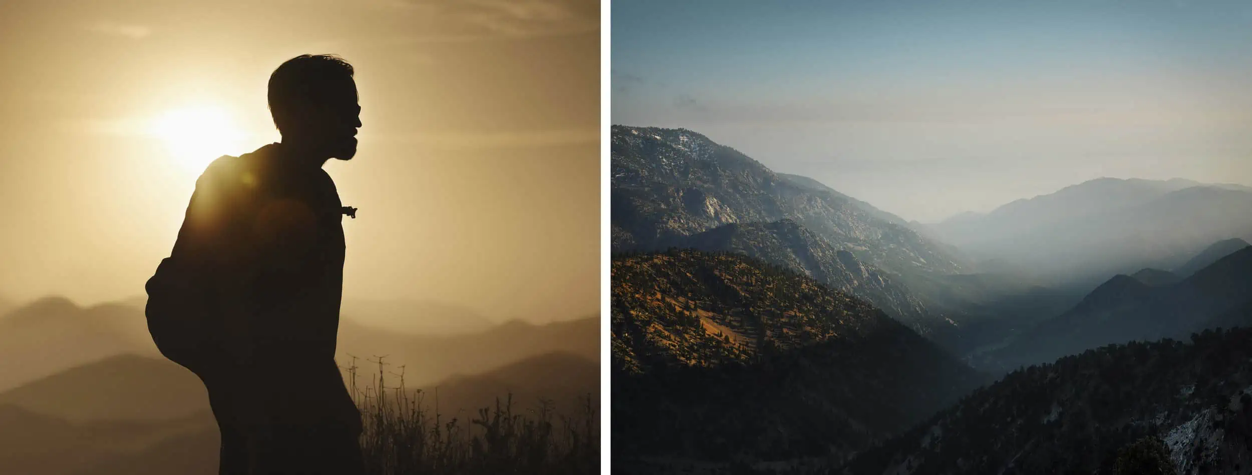
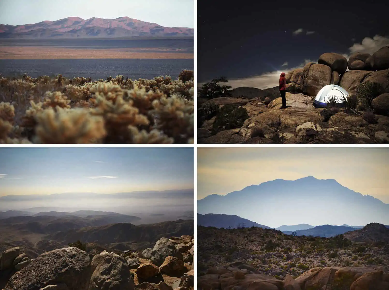
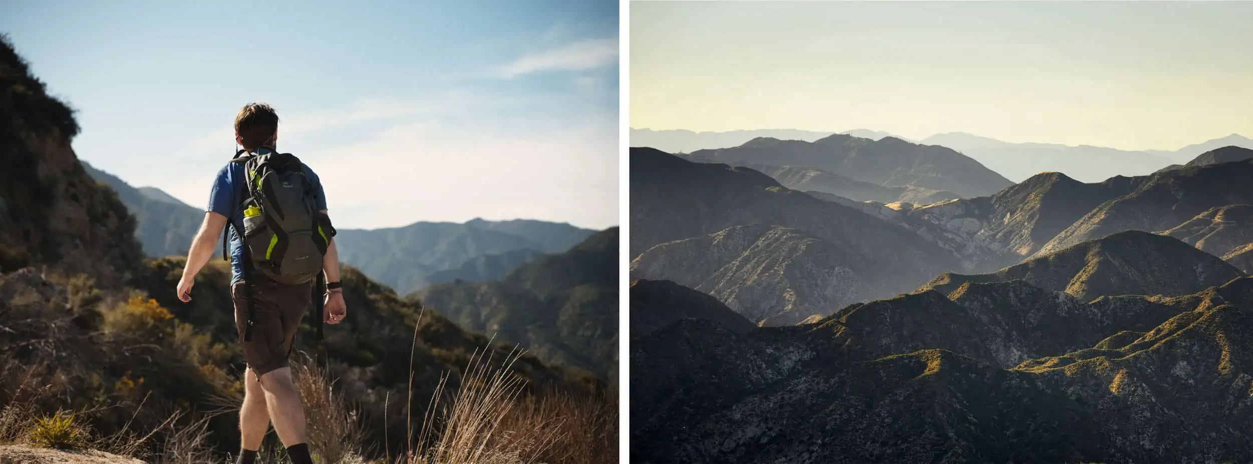
San Gabriel Mountains, California
You’ll also note that we haven’t outlined exact places to stay in each of these areas, except a couple of key areas which will be clear as to why when you’re basing yourself from somewhere, for example. This is because there are so many options in each area from motels to hotels to campsites, rentals and many more. Do what suits your budget. Whilst some places will have availability on the day, it’s always good to vaguely plan ahead. You’re most likely to find things booked up closest to the National Parks like Joshua Tree, for example. So, in these cases, it’s good to think a tiny bit further afield in neighboring towns or even some backcountry camps if you’re feeling ready for a wilder adventure. Accommodation can be incredibly reasonable in price, but of course, seasons can affect this, so it’s a good idea to have a look around when planning to work out what will work within your budget.It is also important to think about your car, and its imperative to know you can rely on your vehicle for such a long trip. Having hired from Enterprise numerous times now, we cannot recommend their car hire services enough; covering everything from reliable cars to full insurance and road side assistance at reasonable prices.
The beauty with any road trip is that you can tailor the experience as much as you want.You could easily follow our full itinerary and still keep to a tight budget if you mostly camped and prepared your own food.On the flip-side, there’s high-end hotel accommodation and fine dining available near many of the locations we’ve listed, so you easily turn the same trip into a much more luxurious experience.And, of course, there’s a whole range of options in between these two extremes!For us, that’s the best part of any road trip: truly making it your own.
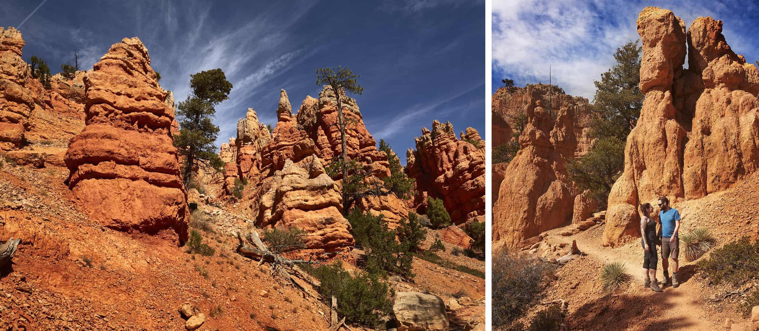
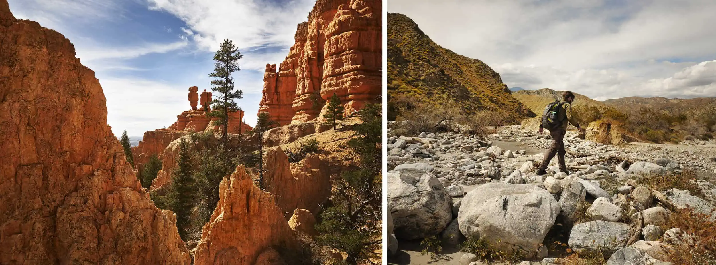
Red Canyon, just outside of Bryce, Utah
Day 1 – Arrive in Los Angeles
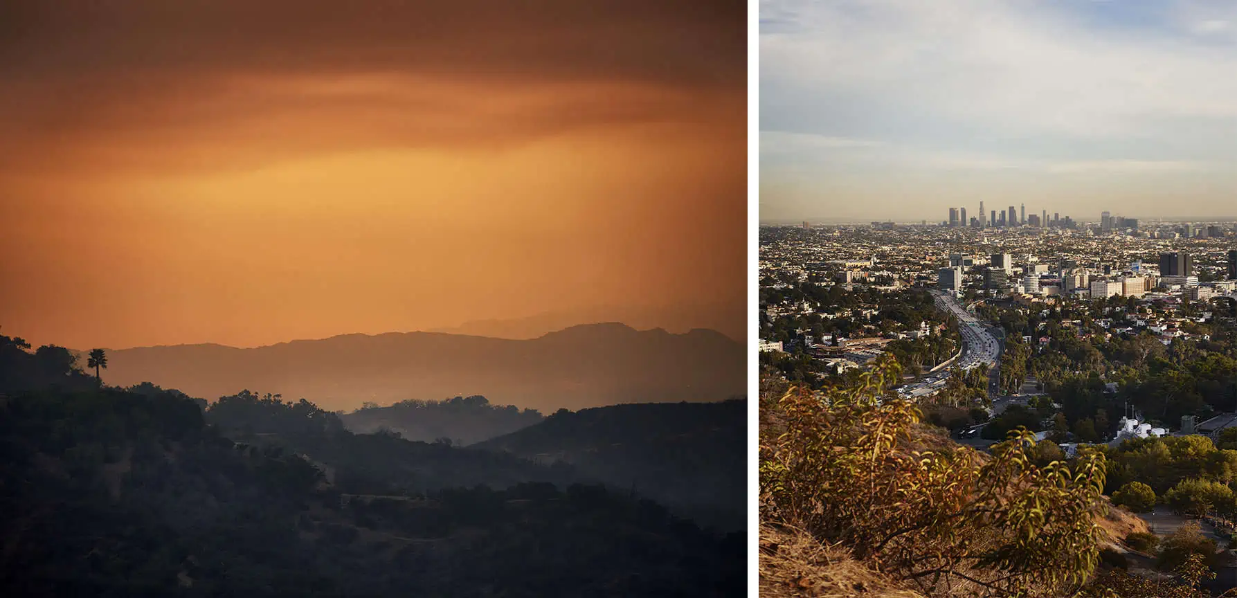
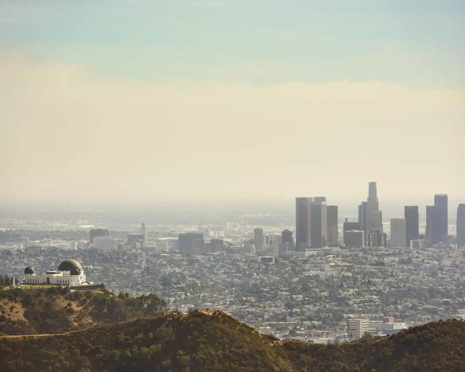
We’ve chosen to start our road trip in one of our favorite places on earth: Los Angeles.The first day is a great opportunity to pick up your hire car. Enterprise make it really easy to pick up your hire car from LAX airport, which makes all the difference, especially if you’ve just got off a long flight! You’ll be based here for the next three nights and, whilst the activities we’ve listed for our time in LA will keep you busy during the day, there will still be plenty of time in the evening to explore the city – so make sure you read up on some of the wonderful bars, restaurants and food markets around the city! You can find some of our favorite places to eat suggestionshere. LA is a huge place and finding somewhere to stay can be daunting.Our preference is always to stay around Hollywood, not just because it’s a fantastic place, but also because if puts you close to the freeways you need to get into the mountains and desert.That said, if the beach is more your thing, then by all means look to stay around Santa Monica, Venice or Laguna Beach, but just be aware that your driving time will be increased.
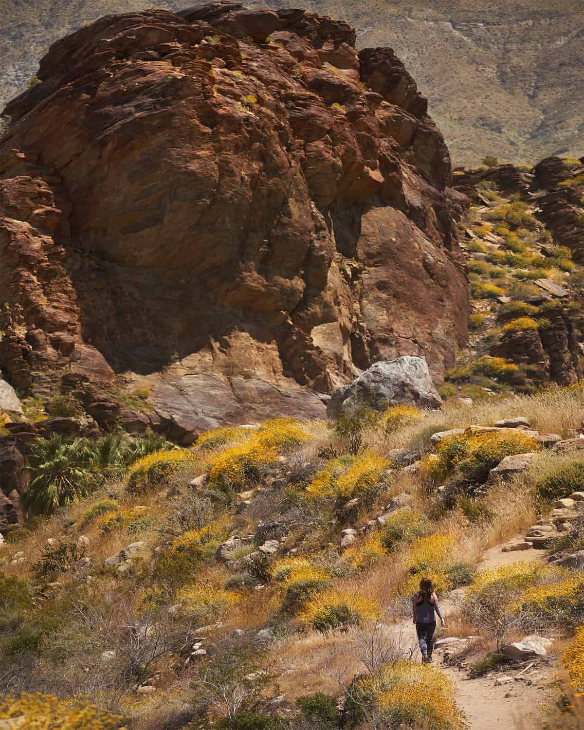
Palm Desert, California
Day 2 – Exploring West Hollywood, Hollywoodland and Mulholland
Without doubt one of the most iconic landmarks in the USA, the Hollywood Sign is a must-see for anyone visiting LA. It also involves a great introductory hike to get you stretched out and enjoy some beautiful panoramic views as you go. The sign is situated in Griffith Park, which also houses the famous observatory of the same name.It isn’t possible to drive right up to the sign but there are plenty of hiking routes that will take you there.One popular route starts from the parking lot on Canyon Drive in Hollywood. One of our suggested routes can be foundhere.If you’d rather have a longer hike, you can start closer to the observatory.Either way, you’ll be rewarded with fantastic panoramic views of the city.If you have time afterwards, it’s worth heading to the Hollywood Reservoir, where a relatively flat and shaded path takes you on a circuit of the lake.It’s also a fun way to end the day by going for a drive along Mulholland Drive and around the Hollywood Hills. You can also take in a hike at Runyon Canyon Park too, there are a variety of trails around that can be started off Mulholland Drive.
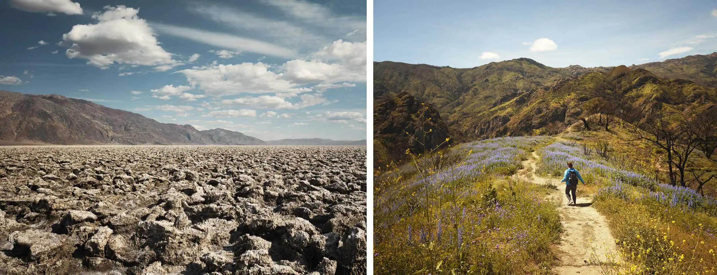
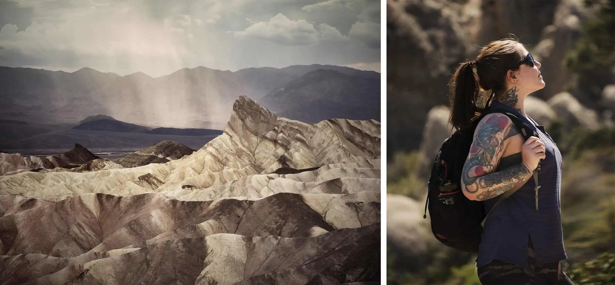
Left: Death Valley National Park, California, Right: Malibu Creek State Park, California
Day 3 – Malibu Creek State Park
Head north out of Los Angeles on the 101 (or the PCH if you are staying near the beach) and you will soon find yourself in Malibu.Malibu Creek State park is roughly a 40-minute drive and 28 miles from Hollywood.The park offers a wealth of trails in beautiful rolling countryside.When you are finished, be sure to pay a visit to the quirky town of Topanga with its many hippy stores and markets.
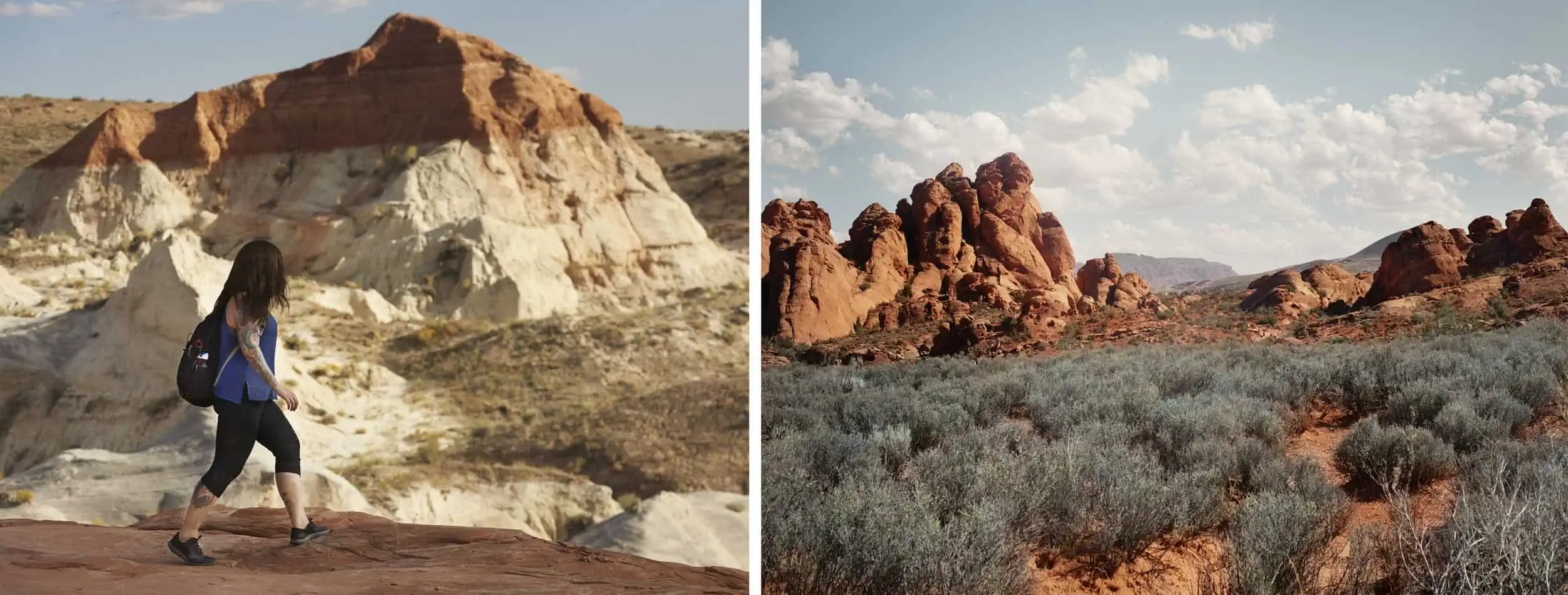
Left: Grand Staircase Escalante National Monument, Utah, Right: Red Cliffs National Conservation Area, Utah
Day 4 – San Gabriel Mountains
Drive south from Hollywood on the 210 and it won’t be long until you see the lush forested San Gabriel Mountains on your left-hand side.There are numerous major roads off the freeway crisscrossing the mountains and in roughly an hour’s driving time from Hollywood, you can be in the middle of a spectacular wilderness.The San Gabriel Mountains – much of which are considered part of the Angeles National Forest – take up a massive area and the possibilities here are enormous.There is a lifetime worth of hiking trails and for more experienced hikers, there are fourteen peaks over 8000ft.The tallest peak in the range is Mt San Antonio – better known by its nickname ‘Mt. Baldy’ – which tops out at 10,064ft.Experienced hikers can set off early in the morning to tackle the summit from the Manker Flats trailhead.In winter, the mountain is also home to ski runs, and there will often be snow near the summit until well into Summer – not something you might expect to find so close to LA!For less experienced hikers, the San Gabriel Mountains still have plenty to offer – we are particularly fond of the trails from the Switzer Picnic area.For those with an interest in space, Mt Wilson is home to the famous observatory where Edwin Hubble proved the existence of multiple galaxies.The observatory is open to the public and well worth a visit!
Finally, it is worth noting that you are required to display a valid Recreation Pass or Interagency Pass when parking your vehicle in certain locations in the Angeles National Forest. Please check online for up to date information on how to obtain these.
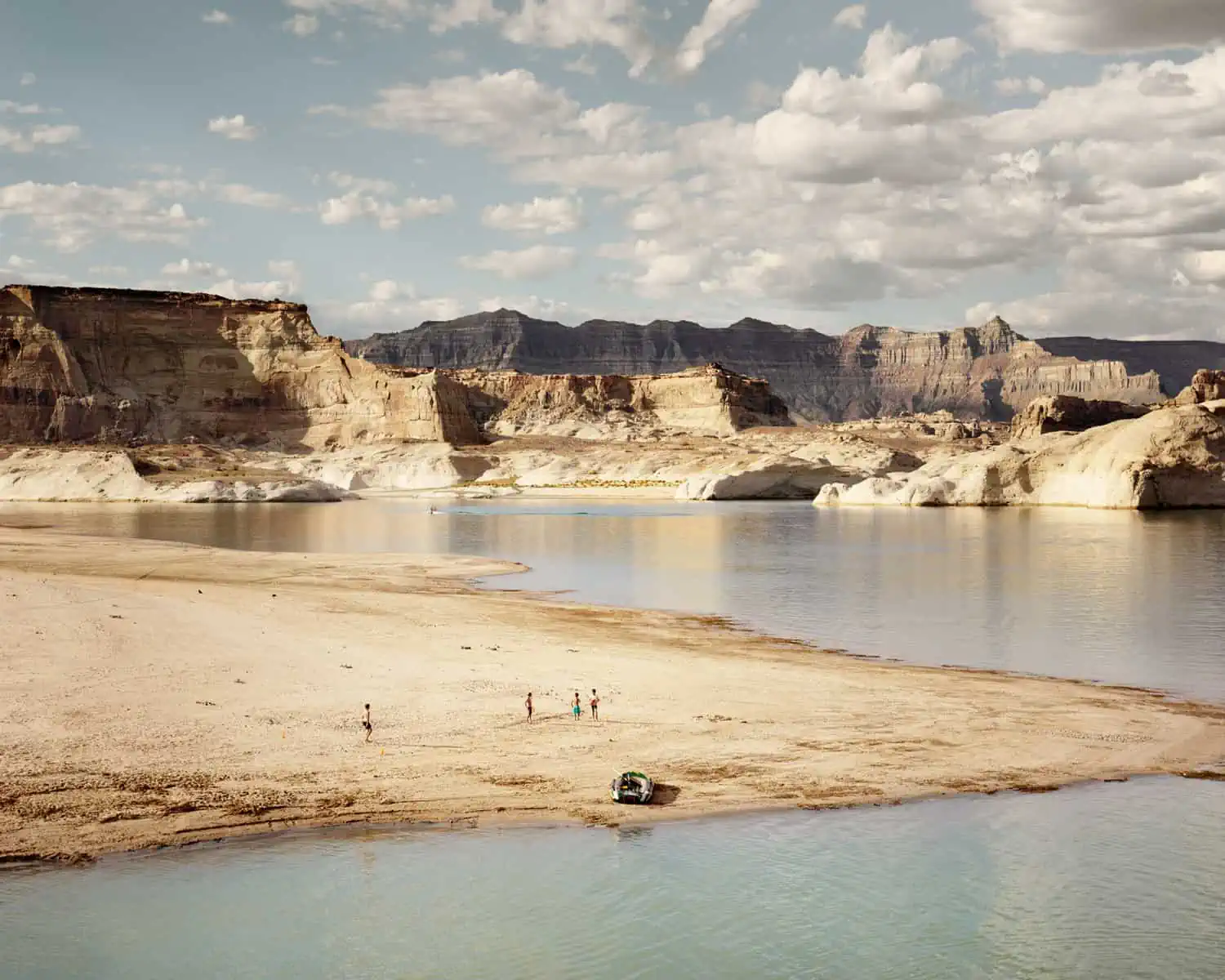
Lake Powell, Arizona
Day 5 – Drive from Los Angeles to San Gorgonio Wilderness and Sand to Snow National Monument
Driving from Hollywood to the San Gorgonio Wilderness takes roughly 2hrs and around 100 miles.You might think that the landscape here is just going to be the same as what you have already seen further north in the Angeles National Forest.However, you’re now a good bit further south and definitely into the desert.You’ll still see pines on higher slopes, but closer to sea level you will see sand cacti and date palms. For us, the most spectacular part of this landscape is the contrast between the hot desert and the backdrop of the high mountains – which are high enough to have snow on their peaks well into Spring and even early Summer.Mt. San Gorgonio is the tallest peak in Southern California at 11,502ft.For experienced hikers, there are long-distance trails here – some of which will require several days to complete – where you can start amongst the cacti and finish in the snow.For those who don’t want to go so far, there are still plenty of shorter trails and even if you don’t start to climb the mountains, they provide a constant spectacular backdrop to any hikes you may do.The desert has one more surprise: We visited in April, shortly after the area had experienced heavy rainfall and we witnessed an incredible wildflower bloom. The landscape would have been spectacular enough without this, but the extra color this added was the icing on the cake!
Looking at accommodation, there is camping available in the Sand to Snow National Monument, but also the city of Palm Springs is nearby, and this is a great option: there’s plenty of hotels, motels and restaurants here catering for all budgets and tastes.
Joshua Tree National Park, California
Day 6 – Drive to the San Jacinto State Park for the Palm Springs Aerial Tramway
This is a short drive – under 30 miles – from the Sand to Snow National Monument and even less from Palm Springs.The Aerial Tramway is a cable car route from the Coachella Valley up into the mountains, bringing you (relatively!) close to the peak of Mt. San Jacinto.The Cable car journey takes approximately ten minutes and climbs around 6000ft in this time.On route, you’ll have spectacular views over the desert.At the top, the first thing you’ll notice is how much colder it is relative to the bottom station – so make sure you’ve brought some extra clothing.The top station has two restaurants, panoramic viewing platforms and, of course, a gift shop.It is also the starting point for several hiking routes which head out through lush pine forest – be aware that you are at high altitude here and don’t be surprised if you feel short of breath sooner than usual.If you don’t have much experience of high-altitude hiking, it is worth planning a shorter route than normal, as the thin air certainly does take its toll!It is possible to pick up a map from the station at the top, which contains many of the hiking routes up there. They’re all categorised by distance and the elevation gain so you can make a decision based on the time you have available and what you want to do. Also be aware that some of the longer routes along with overnight camping do require permits.
At the time of writing, an adult return ticket on the Aerial Tramway costs $26.95, with various discounts offered for seniors, family groups etc.
The Aerial Tramway is just one way into the San Jacinto State Park.This is a large area and you could easily spend weeks hiking here!
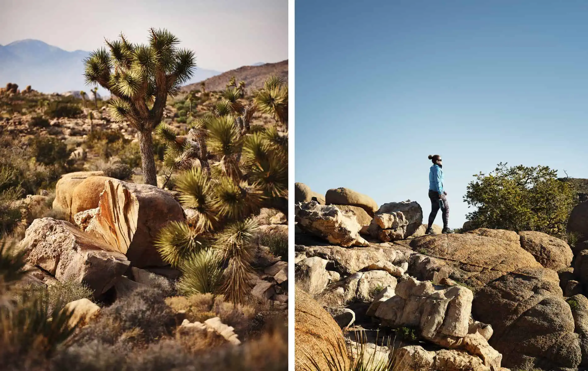
All Joshua Tree National Park, California
Day 7 & 8 – Drive from San Jacinto State Park to Joshua Tree National Park
Roughly 60 miles of driving will get you from the Palm Springs Aerial Tramway into the National Park.We have already written a specific guide to Joshua Tree, which you can check outhere,so we won’t go into too much detail. There’s plenty to see and do here which is why we’ve given this two days in our itinerary.In terms of accommodation, there’s plenty of options here: you could feasibly stay in Palm Springs, camp in the park or look for accommodation in Twentynine Palms – the town right on the edge of the park.
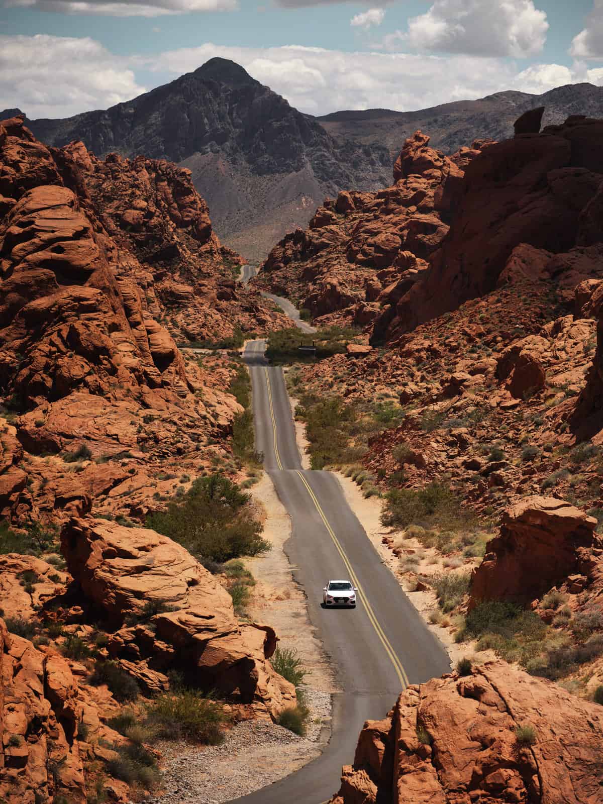
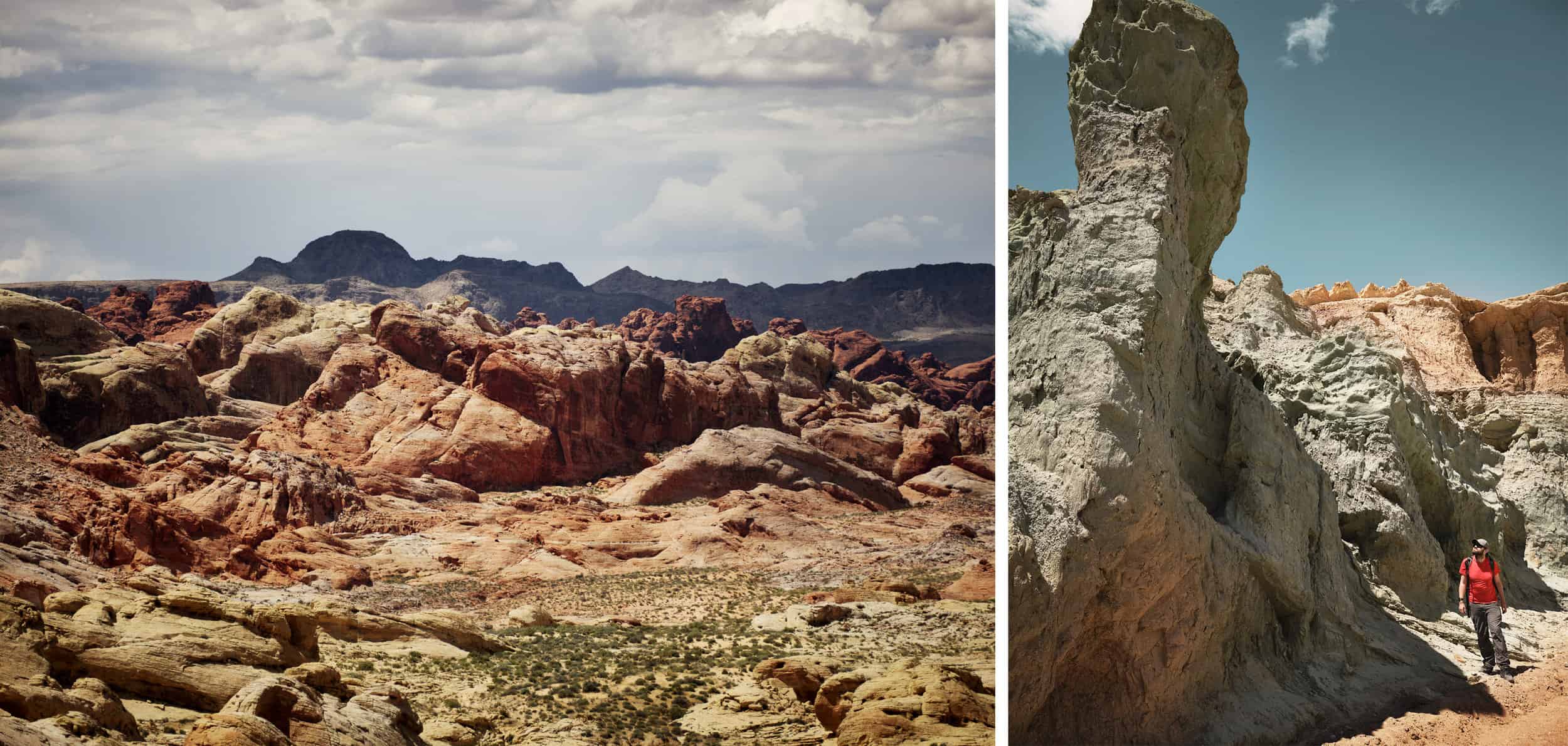
Valley of Fire State Park, Nevada
Day 9 – Drive from Joshua Tree National Park to Las Vegas
For the next part of our trip we’re going to be relocating to Southern Utah.There’s a whole host of interesting stuff along the way, so you could certainly add in a few more stops.On the flip side, you could absolutely do all of today and tomorrow’s drive in one long day behind the wheel if you wanted to gain an extra day.
We’ve decided to split the driving into two days and spend the night in Las Vegas.This is just under 200 miles and proximately 3hrs from Joshua Tree.If you want to add a bit of time exploring the landscape around Las Vegas, be sure to check out our Alternative Las Vegas Guide. The hiking options around Las Vegas are plentiful and if you have the space, be sure to spend a few hours in Valley of Fire State Park. You’ll find much more information about our favourite hikes and what to check out in ourAlternate Las Vegas Guide.
Grand Staircase Escalante National Monument
Day 10 – Drive from Las Vegas to Kanab taking in Red Cliffs National Conservation Area
From Las Vegas, we are going to drive on to Kanab in the south of Utah – it’s just over the state line with Arizona.This is another drive of approximately 200 miles and should take around 3hrs – but you do cross into another time zone, so this will mess with your ETA!Kanab is a great base from which to explore the surrounding National Parks and Monuments: Zion, Bryce and Grand Staircase.We’ll be staying here for the next four nights.Kanab itself is a great town – there’s plenty of good accommodation available along with a range of restaurants.The town was a popular filming base for Western Movies and the town museum has plenty of information on this if it is your thing!
Along the way, we suggest you take a detour to visit the Red Cliffs National Conservation area.This is around 120 miles along the i15 from Las Vegas.This is a spectacular area.When we visited, we had the trail completely to ourselves and also were fortunate to see a very large tortoise!Be aware, though, that you are in the deep desert here, and temperatures can soar!So, bring plenty of sun block and water and avoid hiking here in daytime sun during the hotter months of the year.
Los Angeles, California
Day 11 – Drive from Kabab to Zion National Park
From Kanab, the main park entrance is a 30-mile drive.Following this, there’s a scenic drive of around 12 miles through the park to the town of Springdale on the other side (your park entry allows you to leave and re-enter and Springdale is a great place to grab some lunch).There are plenty of scenic viewpoints along the main drive, but many visitors will want to park up and take the free shuttle bus up Zion Canyon (the road is closed to regular traffic).This bus route takes you to the trailheads for iconic hikes such as Angel’s Landing, Observation Point and the Narrows.
Looking on a map you’ll see that Zion National Park is enormous and only a relatively small part of it is easily accessible.There is a second entrance to the park at Kolob Canyon – this is 38 miles from Springdale – and you can use the same entrance ticket for both parts of the park.This area is quite different to the main part of the park.You gain height on the scenic drive rapidly and will soon find yourself winding through pine forests with spectacular overlooks.
Left: Zion National Park, Right: Bryce Canyon National Park
Day 12 – Drive from Kanab to Cedar Breaks through Dixie National Forest
This is a fantastic scenic drive, taking in a distance of roughly 65 miles one way.You start off driving through the desert, but as soon as you turn off the 89 onto Route 14, things start to change: you rapidly gain height and will soon find yourself in pine forests.Keep your eyes open and you will notice that the forest is growing on a lava flow from ancient eruptions.In Winter and Spring, you can expect to encounter snow along this route and after heavy snowfall, parts of the road can be closed.There’s plenty of spectacular scenery along here, but one of our favourite stopping points is the overlook of Navajo Lake.
Left: Death Valley National Park, Right: San Gabriel Mountains
Day 13, 14 – Drive from Kanab to Grand Staircase-Escalante National Monument, Vermillion Cliffs and the Glen Canyon
Kanab is right on the edge of the Grand Staircase Escalante National Monument and heading east on the 89 towards Page in Arizona, you will soon see some spectacular panoramic vistas that seem to be straight out of a Western Movie.South of here, lies the Vermillion Cliffs National Monument and, as you get closer to Page, you will pass into the Glen Canyon National Recreation area.
This whole area is a geologist’s paradise, and the multi coloured layers of rock that form the cliffs is surely one of the key reasons why Grand Staircase and Vermillion Cliffs have been designated National Monuments.
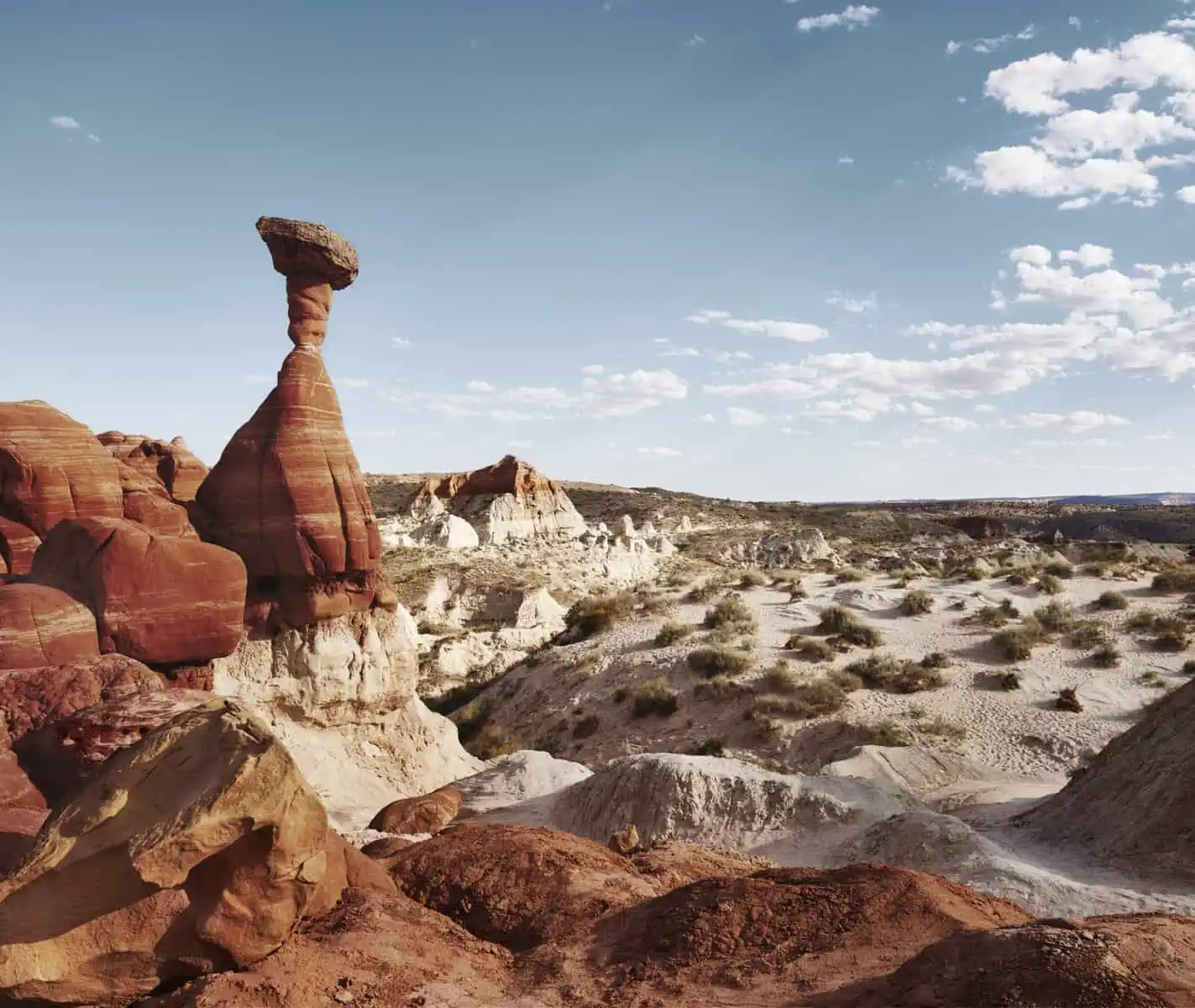
There is plenty to see around here!The two most iconic sites are no doubt Horseshoe Bend and Antelope Canyon (the Antelope Canyon Navajo Tribal Park lies just outside of Glen Canyon).You can expect massive crowds at both, but there are plenty more opportunities for quieter hikes.The tourist information centre in Kanab has free guides to the various trails, but amongst our favourites are the Toadstools, where you can see the naturally formed rock mushroom structures known as ‘Hoodoos’ and the Paria Township trail that takes you to a genuine Wild West ghost town.
The centrepiece of Glen Canyon is Lake Powell.There is a fee to get access to some of the marinas, but the America The Beautiful interagency pass is valid here.There’s the chance to take boats trips and participate in water sports on the lake along with some great hiking and scenic drives on the shore.
Turning our attention to Vermillion Cliffs, there are several spectacular locations including White Pocket, Paw Hole and perhaps most famous of all ‘The Wave’ that require specialised off road vehicles to access – either high clearance 4x4s or ATVs.It is possible to arrange guided tours to these locations from Kanab, and they are all well worth a visit. You’ll also need a permit from the visitor centre to do some of the areas in Coyote Buttes – its best to go speak with the visitor centre about your plans and they can advise you on what you’ll need.
As you can see, there’s a lot going on in this part of the world!We have put aside two days here, but you could easily spend a week or more exploring here (or a few months).
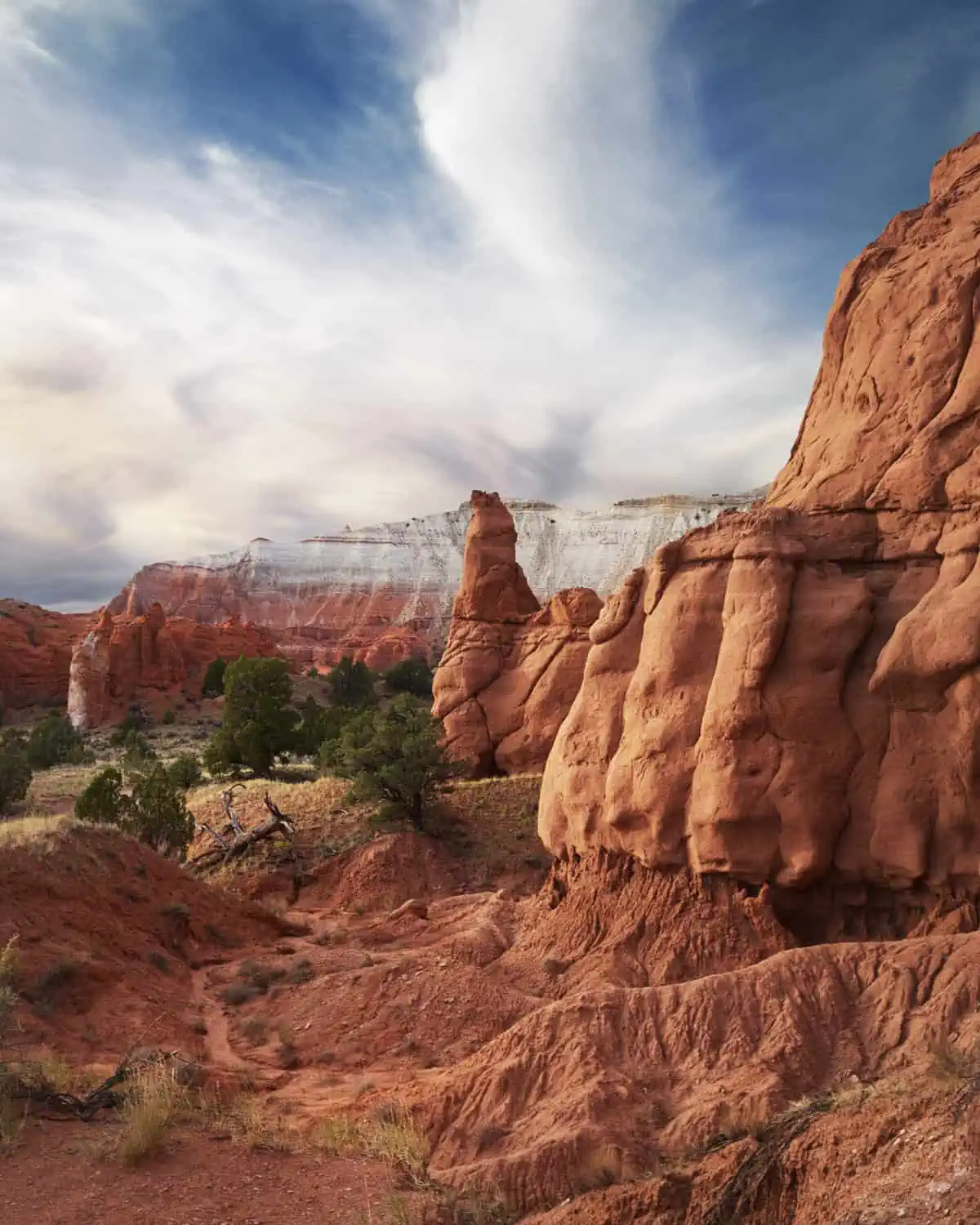
Kodachrome Basin State Park, Utah
Day 15 – Drive from Kanab to Bryce Canyon National Park
The entrance to the park is 77 miles and approximately 90 minutes from Kanab.In a similar way to Zion, the park is built around a scenic drive with a number of pull-in points.Bryce is a great place to visit if there are members of your group who can’t walk too far or have trouble with difficult terrain.It’s possible to see some really amazing things without having to go far from your parked car.For those who want to venture a bit further, there are trails of varying length within the park.Bryce Canyon is a deservedly popular destination and you can expect to encounter large crowds here.
In the Winter, Bryce can receive substantial snow fall which sometimes leads to some of the trails being closed off, so it is worth checking in advance to ensure everything is open before travelling to visit.
It would be possible to stay based in Kanab for the next two nights, but for our itinerary, we’ve decided to relocate closer to Bryce.There are plenty of options around here ranging from camping to cabins to hotels.
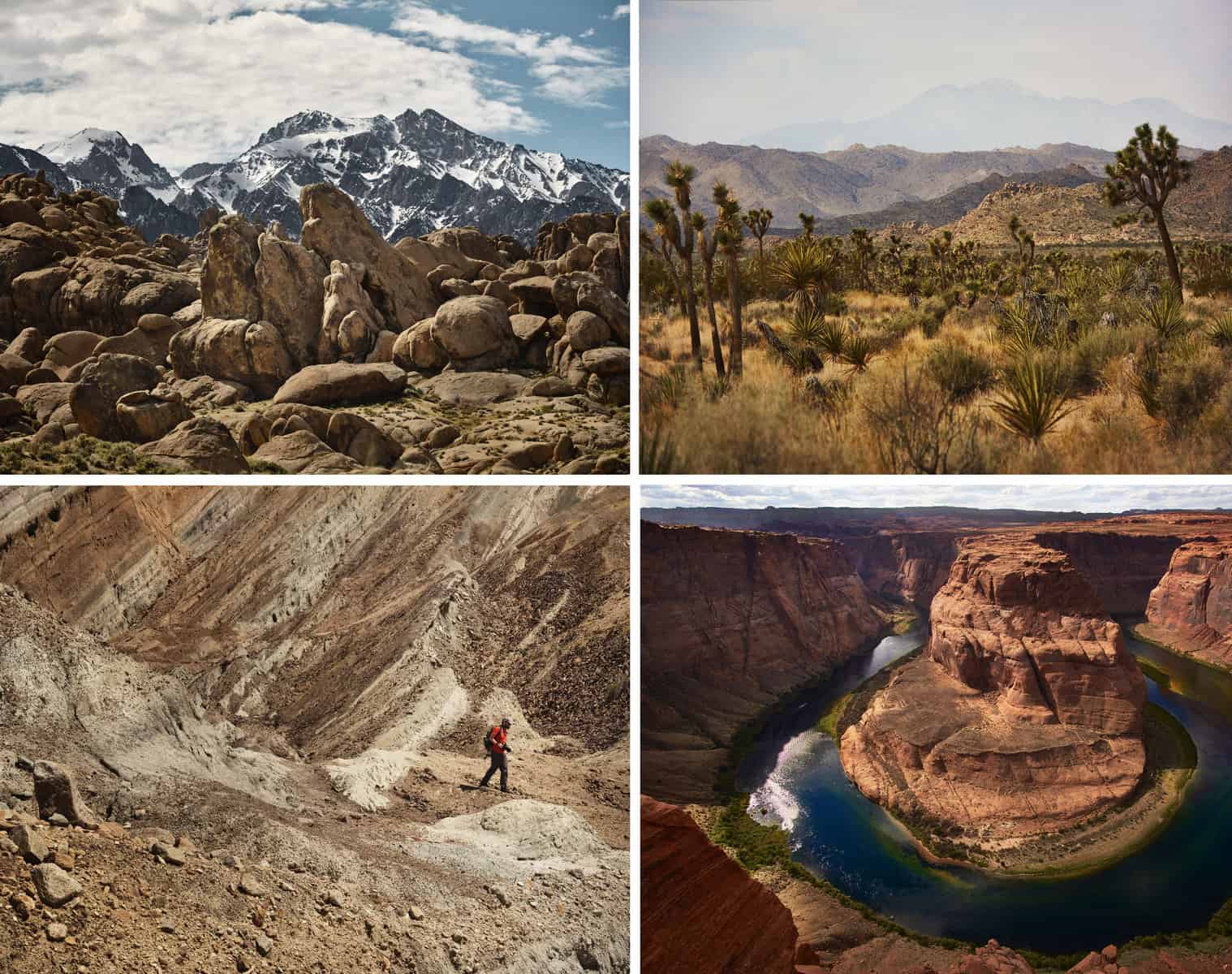
Clockwise from left: 1. Alabama Hills, California 2. Joshua Tree National Park, California, 3. Horseshoe Bend, Arizona, 4. Rainbow Basin, California
Day 16 – Drive from Bryce to Red Canyon and Kodachrome Basin State Park
There’s no doubt that the National Parks in Utah are spectacular, but it is a great shame that many visitors concentrate solely on the National Parks and miss out on some of the less well known but equally spectacular National Monuments and State Parks that are nearby.
First off is Red Canyon – which you most likely will have already driven through on the way to Bryce (the Red Canyon Visitor Centre is 13 miles West of the main entrance to Bryce Canyon on the 12).The rock formations in Red Canyon – including natural arches and more of the mushroom-like hoodoos – are jaw dropping and this is made even more so on a fine day when you see the vivid red of the rock against a deep blue sky.
The visitors centre serves as the starting point for most of the trails – many of which are suitable for mountain biking as well as hiking.The rangers at the visitor’s centre recommended we start off with the Pink Ledges Trail which joins up with the Hoodoo Loop Trail.Together, these two come in at well under a mile and are very easy going.None the less, they are a great way to see some spectacular rock formations very quickly.We would normally disregard such short trails, but we were certainly glad we followed the Ranger’s advice here!We also hiked the much longer Thunder Mountain Trail which starts in pine forests before climbing into the hills.There are some beautiful sections crossing red rock ridges and we would strongly recommend this trail.It’s primarily a mountain biking trail, so keep your eyes and ears open for bikers!
Head around 30 miles east back past Bryce on the 12 and you will find Kodachrome Basin State Park.As it’s a State Park, any interagency pass you have will not be accepted here.However, the entry fee is well worth it!As photographers, we were intrigued by the name – Kodachrome was a famous early colour film manufactured by Kodak.Had Kodak sponsored the park?Speaking with the always knowledgeable Rangers, we discovered this was not the case – the name apparently came from National Geographic photographers in the 1940 and related to how photogenic they thought it was!We visited this park towards the end of the day and found the light and colour absolutely spectacular – whoever named the park certainly had a point!Relatively speaking, Kodachrome Basin is quite small, but there are a number of longer circular trails that will still allow you to have a good hike. A map of these will be provided to you upon entry to the park, and with signposting makes for an easy to follow afternoon.
Left: Red Canyon, Utah Right: Sand to Snow National Monument, California
Day 17, 18 – Drive from Bryce Canyon National Park to Death Valley National Park
For the next part of our journey, we are heading back West towards Death Valley.This is a long drive – close to 400 miles and approximately 6hrs – so even if you set off early, you won’t have a full day available when you arrive.With this in mind, we’ve added a second full day to our itinerary for Death Valley.
It’s hard to get an understanding of the enormity of Death Valley until you begin your drive through; it is absolutely huge! What we love about Death Valley, aside from its beauty, is that there is the real opportunity to head into the backcountry into the high mountains. Whilst the basin is incredibly hot, the higher mountains provide a cool respite (and incredible views). If you only have a day to check out Death Valley, we’d really recommend taking in some of the points on the map provided at the visitor centre. Some of these are observation points, whilst some involve relatively short hikes. Our favourite places to check out would be Zabriskies Point, Artists Palette and The Devils Golf Course. If you want to take in a few more, we’d suggest Mesquite Flat Sand Dunes, Gower Gulch Loop and Ubehebe Crater Rim.
There are plenty of options for accommodation in and around Death Valley ranging from camping to luxury hotels.It is worth bearing in mind that Death Valley got its name for a reason and during the summer months it gets exceptionally hot – even at night it can be over 100F! With this in mind, you should choose your accommodation carefully.
San Gabriel Mountains, California
Day 19 – Drive from Death Valley to Lone Pine and Alabama Hills
The spectacular drive to Lone Pine takes just under 2hrs and 97 miles.Lone Pine is a small town with a huge reputation.It sits on the edge of Alabama Hills – an area of dessert with spectacular rock formations that is overlooked by the High Sierra mountains.As you saw in the Sand to Snow National Monument earlier in this trip, this is a place where you can stand in open dessert and, depending on the time of year, look up to snow-capped peaks.At 14,505ft, Mt Whitney is the tallest peak you will see here and indeed it is the tallest mountain in the Lower 48 States.Alabama Hills is famous as a filming location and as you explore off the main road – called ‘Movie Road’ – you will find places with names like ‘Lone Ranger Canyon’.
It is certainly possible to head into the mountains for some hiking, but this is challenging, high altitude terrain. Many of the trails and campsites here require permits which can often be reserved in advance – so if you do want to head into the back country, be sure to research this in advance.You’ll also be entering Bear country and there are strict guidelines issued by the Park Services on how food must be stored when hiking and camping in the back country.
Mt. Whitney itself is a challenging high altitude hike with significant elevation gain, which attracts many experienced hikers and those travelling with professional guides.
Even if you don’t head into the mountains, they still provide an incredible backdrop to Alabama hills and there are plenty of hiking opportunities here too.
Accommodation is not problem in Lone Pine.Alabama Hills is BLM land and camping here is free and on a first come, first served basis– but be warned, the pitches fill up quickly!Lone Pine itself has plenty of motels and restaurants if that is what you’d prefer.
Indian Canyon, Palm Desert, California
Day 20 – Drive from Lone Pine to Rainbow Basin and then back to Los Angeles
For your final day, you will drive back to LA via Rainbow Basin – this a journey of approximately 160 miles and 3hrs.
At pretty much the mid-way point between Las Vegas and Los Angeles, the Rainbow Basin Natural Area is really worth the trip. The name really explains it all, as you’ll be amazed by the beautiful rock formations that look like they’ve been dusted with powder paint. You’ll be stepping into a geological paradise here. The scenic road, which doubles as a hiking trail allows you to veer off and explore the rocks and canyons all around. You can spend the whole day doing this alone, but we’d also recommend Owl Canyon Trail also if you have the time. This linear trail can be found from Owl Canyon campground, which is well signposted from the Scenic road. You will not be disappointed with a visit here – it is truly stunning with amazing photography opportunities minute by minute.
From Rainbow Canyon, there just remains the 145-mile journey back to LA – a beautiful drive in its own right, back through the desert and, depending on the route you choose, either through or around the mountains.
Left: Valley of Fire State Park, Nevada, Right: Rainbow Basin, California
We really hope you have enjoyed reading through our itinerary and it has given you some inspiration to plan your own road trip.We think the real beauty of travelling around America is just how vast it is.In writing up this article, we’ve had to make some tough choices on what to include and what not to.There’s just so much to see! A detour to the North Rim of the Grand Canyon could easily be added from Kanab, for instance!We’d invite you, when planning your road trip, not to be so rigid with your plans: look at the maps online and image searches and if you see somewhere that looks interesting, then why not make a detour to see it.We said at the start of this article that we think the best thing about a road trip is that you can truly make it your own. Using a major car hire supplier such as Enterprise gives you the flexibility to collect and drop off your vehicle at different locations. This means your road trip does not have to be a round trip, but can easily be a linear journey, allowing you to explore more than you may ordinarily do.We hope the suggestions we have made here can help you start with your own adventure and, if you have any suggestions for places to visit that we might have missed along the way, then be sure to let us know in the comments!
Griffith Park, Los Angeles, California